It's hard to get an early start for a hike in Grand Gulch, as you have to pick up your permit at the Kane Gulch Ranger Station, which opens at 8:00 AM and closes at noon. In addition you have to watch an instructional video about Grand Gulch before venturing out.
After watching the video, Fred, Cindy, and Shelby took off on the required car shuttle so that we would have a vehicle when we exited the canyon at the Government Trailhead. In the meantime, Mike, Madison, and I got the gear sorted out into piles and got our packs ready to go.
When Shelby and the rest returned, we got all the gear packed and we headed out. Day one is very scenic and interesting. You start out on the mesa top and gradually drop into Kane Gulch. After reaching the junction with the main canyon, there seems to be ruins at every turn.
We made our camp at the mouth of Todie Canyon, which is about 7.2 miles from the ranger station. I did a couple of miles more as I headed back up Kane Gulch by mistake instead of heading down canyon. All in all it was a good day.
Note photo takers are given in the titles under the thumbnails.
Kickass Trekkers on this trip were: Bill Mooseker, Shelby Stong, Mike Stong, Madison Stong, Fred Stong, and Cindy Stong.
The descriptions under the photo thumbnails in the album sometimes contain links to maps or additional information. These are identified by "Blue” text for links. I've also inserted links to Google Maps to show where certain photos in the album were taken or to locate features shown in the photos. Click on the link, close the sidebar, and choose satellite view. Basically, you can then zoom in and out using the mouse wheel or drag the map by clicking and holding.
For panoramic photos, I would recommend clicking on the thumbnail photo to enlarge. View at original size for most detail. The thumbnails do not do justice to petroglyphs and pictographs, so I would recommend enlarging them as well. Please take the time to view the many videos to better experience what it was like to be there.
Troop 24 Kickass Trekkers Backpacking Trip
-Cascade Bill Mooseker
Date(s): May 8, 2016. Album by Cascade Bill. 1 - 175 of 175 Total. 9982 Visits.
enlarge 521KB, 1024x1022 1 pic&vids
To get the plugin just Google "videolan" or CLICK HERE FOR DOWNLOAD for Windows. There is a MAC version as well. Disable the Quicktime plugin if you use Videolan.
If you want to save photos to your computer, click the box under the thumbnails of the photos you want to download. Then click the "Download" button at the top of the album. Pick the size you'd like to download (Original is best)and the photos will be downloaded to a folder of your choice.
enlarge 89KB, 1024x768 2 2016 ut -cindy IMG 8958
After packing up our camp on Todie Flats, we drove over to the Kane Gulch Ranger station, arriving about 7:45. Fred and Cindy were already there, even though they had a longer drive. We got our permit and watched the compulsory 15 minute film.
enlarge 79KB, 1024x768 3 2016-05-08 06-41-50 - cindy IMG 8959 Since we had to do a car shuttle, Fred and Cindy followed Shelby out to the Government Trail trailhead where we would be coming out, while Mike, Bill, and Madison remained at the ranger station and got the troop gear and food organized.
enlarge 116KB, 1024x768 4 2016-05-08 06-53-44 - cindy IMG 8966 This is the road out to the Gov't Trail.
enlarge 138KB, 1024x768 5 2016-05-08 06-55-06 - cindy IMG 8967 You can see Shelby's truck up ahead.
enlarge 170KB, 1024x768 6 2016-05-08 06-57-28 - cindy IMG 8969 When dry, this road is not bad. In 2005, there had been an accumulation of snow that had melted, making the road impassable. I tried getting my Corolla down the road and got stuck in the mud about 200' from the paved road. And had to be ignominiously pushed back to the pavement.
enlarge 132KB, 1024x768 7 2016-05-08 06-58-38 - cindy IMG 8973 In 2005, Shelby was driving a big finned 1960's era Cadillac, which Shelby despite the muddy condition and its 2WD managed to get it up and down the road twice to the trailhead. It was the most harrowing ride I have ever experienced.
enlarge 143KB, 1024x768 9 2016-05-08 07-09-10 - cindy IMG 8980 Leaving the truck at the trailhead.
enlarge 161KB, 1024x768 10 2016-05-08 07-09-38 - cindy IMG 8981 There is a shallow stockpond at the trailhead, which seems a little out of place in this desert like setting.
enlarge 234KB, 1024x768 11 2016-05-08 07-11-14 - cindy IMG 8982 At the Government Trailhead. You can see the box at the right in which you deposit your fee for a daily permit.
enlarge 111KB, 1024x768 12 2016-05-08 07-15-18 - mike DSCF4233 Meanwhile back at the ranger station, we take in the various exhibits. When we first came to Grand Gulch in 2000 an old trailer served as the ranger station and instead of the mandatory film, the ranger would give you a short talk.
enlarge 153KB, 1024x768 13 2016-05-08 07-18-02 - mike DSCF4226 This display is outside the station.
enlarge 182KB, 1152x647 14 2016-05-08 08-33-48 - bill DSC01316 Fred and Shelby getting Fred's pack ready.
enlarge 190KB, 1152x647 15 2016-05-08 08-34-52 - bill DSC01317 Getting the lawn chair adjusted in its proper position.
enlarge 178.00MB, 1152x648 16 2016 ut whm may 8 001.mp4 VIDEO - Click Photo to View. Getting Fred's pack ready to travel.
enlarge 204KB, 1024x768 17 2016-05-08 08-36-30 - cindy IMG 8985 It was a cold morning and pretty breezy. The chalkboard at the RS indicated that the overnight temperature had been in the 20's.
enlarge 218KB, 1024x879 18 2016-05-08 08-40-48 - cindy IMG 8987 Bill is ready to go and Shelby is executing the "Lost Ranger Flippy" See HERE
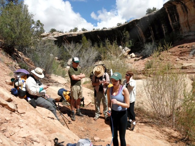
enlarge 188KB, 1024x768 20 2016-05-08 08-44-10 - cindy IMG 8989 Mike, Madison, and Shelby ready to go.
enlarge 173KB, 1024x768 21 2016-05-08 08-45-32 - bill DSC01318 Fred, Cindy, Shelby, Madison, and Mike.
enlarge 175KB, 1024x768 22 2016-05-08 08-46-12 - bill DSC01320 Cindy, Fred, Shelby, Madison, and Bill ready to start from the Kane Ranger Station. The trail starts right across the road from the ranger station. Click Here for Map
enlarge 305KB, 768x1024 24 2016-05-08 09-14-16 - cindy IMG 8991 Following the trail from the ranger station, we enter the wash and follow it through a few twists and turns. Here the trail skirts the northern edge of the canyon.
enlarge 200KB, 768x1024 25 2016-05-08 09-14-36 - cindy IMG 8992 The trail enters a notch where a large block has fallen away from the canyon wall
enlarge 181KB, 768x1024 26 2016-05-08 09-15-06 - cindy IMG 8993 Fred in the notch which is located HERE
enlarge 187KB, 768x1024 27 2016-05-08 09-15-16 - cindy IMG 8995 Exit end of the notch.
enlarge 210KB, 1024x768 28 2016-05-08 09-15-44 - cindy IMG 8996 Kane Gulch is not very deep at the beginning of the hike.
enlarge 187KB, 1024x768 32 2016-05-08 09-21-58 - bill DSC01322 The wash winds its way through some large boulders.
enlarge 217KB, 1024x768 33 2016-05-08 09-23-44 - cindy IMG 9004 There was quite a lot of water in the upper reaches of the canyon. Note the large evergreen as it serves as a landmark for the next few pictures.
enlarge 236KB, 1024x768 34 2016-05-08 09-26-02 - cindy IMG 9006 The stream carving its way down through the sandstone.
enlarge 185KB, 1024x768 35 2016-05-08 09-26-32 - bill DSC01323 Just downstream of the previous photo. The cone shaped evergreen is located HERE
enlarge 196KB, 768x1024 36 2016-05-08 09-28-02 - cindy IMG 9007 A little bit downstream is this small pouroff. You can find it HERE
enlarge 209KB, 768x1024 37 2016-05-08 09-28-06 - cindy IMG 9008 Fred making his way around a pool.
enlarge 212KB, 768x1024 38 2016-05-08 09-29-46 - cindy IMG 9010 Shelby and Bill - the pouroff is just around the corner behind them.
enlarge 179KB, 1024x768 39 2016-05-08 09-29-54 - cindy IMG 9011 The Old Man is on the Trail again.
enlarge 230KB, 1152x647 40 2016-05-08 09-30-44 - bill DSC01324 Mike and Madison rounding the bend.
enlarge 231KB, 1152x647 41 2016-05-08 09-31-06 - bill DSC01325 Mike and Madison
enlarge 152.52MB, 1152x648 42 2016 ut whm may 8 002.mp4 VIDEO - Click Photo to View. Taking a break about 45 minutes from the ranger station.
enlarge 320KB, 768x1024 44 2016-05-08 09-55-54 - cindy IMG 9013 Making our way down canyon.
enlarge 301KB, 768x1024 45 2016-05-08 09-55-56 - cindy IMG 9014 Fred pausing in the shade - this is the same tree as in the previous photo.
enlarge 266KB, 1024x768 46 2016-05-08 09-56-12 - bill DSC01326 Working our way down the wash.
enlarge 224KB, 1024x768 47 2016-05-08 09-56-44 - bill DSC01327 You can see the "trail" leave the wash at the left side of the photo, just to the right of the large boulders - I think that this spot is HERE
enlarge 209KB, 1024x768 48 2016-05-08 10-03-10 - bill DSC01328 Avoiding the large boulders in the wash, the trail stays high - you can see Fred making his way along the route to the right of the photo.
enlarge 248KB, 1024x768 49 2016-05-08 10-04-24 - mike DSCF4237 Madison making her way back down to the wash.
enlarge 237KB, 1024x768 50 2016-05-08 10-04-34 - mike DSCF4238 Madison - not cairns pointing out the way.
enlarge 179KB, 1024x768 52 2016-05-08 10-04-48 - mike DSCF4239 Mike & Madison.
enlarge 291KB, 768x1024 53 2016-05-08 10-05-20 - cindy IMG 9017 Madison going around the switchback to head back down canyon - note the rectangular stone block to the left.
enlarge 294KB, 768x1024 54 2016-05-08 10-05-22 - cindy IMG 9018 If you enlarge the photo, through the branches, you can see Fred making his way down the slope (note the rectangular stone noted in the previous photo)
enlarge 310KB, 1024x768 55 2016-05-08 10-06-00 - cindy IMG 9019 Fred picking his way down.
enlarge 212KB, 1024x768 56 2016-05-08 10-06-12 - cindy IMG 9020 Mike, Shelby, and Madison picking their way down the wash. Note the Large boulders on the cliff above Mike, which are clearly seen at the map location HERE
enlarge 264KB, 1024x768 57 2016-05-08 10-06-18 - cindy IMG 9021 Madison hopping across the creek.
enlarge 270KB, 768x1024 58 2016-05-08 10-09-16 - cindy IMG 9023 A little further down.
enlarge 217KB, 768x1024 59 2016-05-08 10-09-30 - cindy IMG 9025 Mike & Madison are now just opposite the large Boulders at the cliff top shown on the map link a few photos ago.
enlarge 230KB, 1024x768 63 2016-05-08 10-13-46 - bill DSC01329 The trail stays high through this section to avoid a large Pouroff located HERE. Note the prominent rock feature on the opposite side of the canyon that looks like a WWII flat top jutting from the canyon rim.
enlarge 159KB, 1024x768 64 2016-05-08 10-19-22 - mike DSCF4241 Madison making her way over slickrock down to the wash.
enlarge 151KB, 768x1024 65 2016-05-08 10-19-38 - mike DSCF4244 Madison and Fred - back down in the wash.
enlarge 138KB, 768x1024 66 2016-05-08 10-20-02 - mike DSCF4246 Interesting Boulder along the way - Note the "Flat top" on the canyon rim.
enlarge 204KB, 1024x768 67 2016-05-08 10-20-20 - cindy IMG 9029 Fred and Mike go around the boulder.
enlarge 181KB, 768x1024 68 2016-05-08 10-20-32 - cindy IMG 9030 Could THIS be the boulder?
enlarge 235KB, 768x1024 69 2016-05-08 10-21-12 - cindy IMG 9031 A little further down - you can see Madison's pack on the left edge of the photo as she goes around the boulder to avoid wet feet.
enlarge 173KB, 1024x768 70 2016-05-08 10-30-00 - cindy IMG 9033 Looking back at the "Flat top".
enlarge 180KB, 768x1024 71 2016-05-08 10-36-04 - bill DSC01330 The trail then stays high on the north side of the canyon to avoid an impassable boulder jam in the wash. The canyon walls of Kane Gulch are now about 500' above the bottom and are quite impressive.
enlarge 196KB, 1024x768 72 2016-05-08 10-37-30 - cindy IMG 9034 The trail stays high and eventually finds it's way back to this pouroff, where we take a long break.
enlarge 205KB, 1024x768 73 2016-05-08 10-39-46 - cindy IMG 9035 The bends in the canyon up to now have been fairly minor. Although we are not far from the junction of Kane with the main Grand Gulch, the canyon's twists and turns greatly increase the distance we'll have to travel.
enlarge 161KB, 768x1024 74 2016-05-08 10-42-10 - madison IMG 6430 Madison
enlarge 239KB, 768x1024 75 2016-05-08 10-42-20 - madison IMG 6431 Looking across the canyon.
enlarge 190KB, 1024x768 76 2016-05-08 10-44-26 - bill DSC01331 The location of the pouroff where we took our break is HERE as shown on Google Maps. If you look at the map location you can see there is a trail going up canyon, but this is a false trail and you will end up in the impassible boulder jam.
enlarge 166KB, 768x1024 77 2016-05-08 11-01-14 - mike DSCF4247 Fred
enlarge 197KB, 1024x768 78 2016-05-08 11-03-04 - cindy IMG 9036 Shelby & Madison enjoying the break. Note the CAIRN to the left of the photo. This shows where you go to go up canyon. After coming up the canyon on the south side, you go around the pouroff and head down canyon again for a short way and go between the cairn and the bank in the background to regain the trail.
enlarge 275KB, 768x1024 79 2016-05-08 11-19-46 - cindy IMG 9038 Leaving the pouroff on the south side of the canyon, we go round a bend heading south and then another coming to this straight stretch seeing the next bend ahead.
enlarge 252KB, 768x1024 80 2016-05-08 11-22-06 cindy IMG 9039 Mike bushwhacking through brush.
enlarge 206KB, 768x1024 81 2016-05-08 11-36-06 - cindy IMG 9040 Going around the bend made by this promontory on the south side of the canyon. HERE
enlarge 287KB, 1024x1024 82 2016-05-08 11-36-10 - cindy IMG 9041 Lower Kane Gulch is very pleasant, with evergreens and cottonwoods.
enlarge 351KB, 768x1024 83 2016-05-08 11-39-16 - cindy IMG 9042 Continuing on towards the junction.
enlarge 255KB, 768x1024 84 2016-05-08 11-39-40 - cindy IMG 9043 The hoodoos ahead mark the Junction with the main canyon.
enlarge 237KB, 1024x768 85 2016-05-08 11-42-04 cindy IMG 9044 The canyon rim is far above us.
enlarge 214KB, 1024x768 86 2016-05-08 11-42-08 - cindy IMG 9045 The last bend before the junction.
enlarge 332KB, 1024x768 87 2016-05-08 11-44-48 - cindy IMG 9046 Some Utah Sweet Pea flowers(??).
enlarge 221KB, 1024x768 88 2016-05-08 11-45-54 - cindy IMG 9047 In the main Grand Gulch at the junction with Kane Gulch.
enlarge 147KB, 1024x768 89 2016-05-08 11-46-50 - cindy IMG 9048 Peekaboo view of the upper level Junction Ruins.
enlarge 214KB, 768x1024 92 2016-05-08 11-53-04 - mike DSCF4254 Upper Level Junction Ruins - you can see they are located up a serious cliff.
enlarge 106KB, 1024x768 93 2016-05-08 11-52-50 - mike DSCF4253 View of Upper Level Junction Ruins - ruin with vertical posts.
enlarge 295KB, 1024x768 94 2016-05-08 11-51-00 - cindy IMG 9051 Looking back towards Kane Gulch.
enlarge 249KB, 1024x768 95 2016-05-08 11-53-38 - mike DSCF4255 Taking a break at the Junction - we stayed at this camp in 2005. I was the last one to leave and I took off down a "trail" on the opposite side of this camp. After hiking around several bends in the canyon, I saw some running water that was going the wrong way. I suddenly realized that I had inadvertently gone quite a ways back up Kane Gulch.
enlarge 151KB, 1024x768 96 2016-05-08 12-39-06 - mike DSCF4256 We were supposed to meet at the Turkey Pen Ruin, but mistakenly thought that this alcove was it.
enlarge 114KB, 1024x768 97 2016-05-08 12-39-18 - mike DSCF4257 Madison in alcove.
enlarge 278KB, 1024x768 100 2016-05-08 12-40-36 - mike DSCF4259 Heading down Grand Gulch.
enlarge 189KB, 1024x768 101 2016-05-08 12-49-04 - mike DSCF4261 Upper Turkey Pen Ruins - if you see this view, you've gone too far and have missed the turn off to see the ruins (if you are going down canyon).
enlarge 113KB, 1024x768 102 2016-05-08 12-49-14 - mike DSCF4262 Close up of one of the Upper Turkey Pen Ruins - this one is unusual because of the many logs supporting the roof.
enlarge 160KB, 1024x768 104 2016-05-08 12-51-56 - cindy IMG 9055 Stimper Arch through canyon wall - not visible from the other side.
enlarge 212KB, 1024x768 105 2016-05-08 12-53-14 - cindy IMG 9058 View of the Stimper Arch from the wash. The arch is located HERE
enlarge 157KB, 1024x768 106 2016-05-08 12-53-18 - mike DSCF4263 Stimper Arch - About 5 miles from the Kane Ranger Station.
enlarge 154KB, 768x1024 107 2016-05-08 12-53-30 - mike DSCF4264 Cindy - wash near the Stimper Arch.
enlarge 243KB, 1024x768 108 2016-05-08 12-54-14 - cindy IMG 9059 Pool in the wash by large Rock located HERE.
enlarge 274KB, 1024x768 109 2016-05-08 12-54-18 - cindy IMG 9060 Looking for a break spot, wondering where Bill got to.
enlarge 250KB, 768x1024 110 2016-05-08 12-55-08 - cindy IMG 9062 Cottonwoods and Canyon walls - what a day!
enlarge 275KB, 1024x776 111 2016-05-08 12-55-12 - cindy IMG 9063 A lot of bends in this stretch of the Gulch.
enlarge 171KB, 1152x605 112 2016-05-08 13-05-08 - bill DSC01338 This is a group of ruins at the base of an alcove, with a lot of pictographs on the alcove wall, including the famed "Antelope on a Bike".
enlarge 177KB, 1024x768 113 2016-05-08 13-06-28 - bill DSC01339 Large ruin - Since my last trip through here in 2005, they have added a lot of fencing (not a physical barrier) to keep you out of the area near the ruins. In 2005 you could go up to most of the pictographs.
enlarge 165KB, 1024x768 114 2016 ut -bill DSC01340 The large roof of this ruin appears to have collapsed - I wonder if it was a kiva.
enlarge 160KB, 1024x768 115 2016 ut -bill DSC01341 Another view - not the different constructions of the wall in the ruin behind.
enlarge 136KB, 1024x768 116 2016-05-08 13-07-14 - mike DSCF4280 view of the construction on the right side of the ruin in the previous photo - mud applied over the rock wall.
enlarge 154KB, 768x1024 117 2016-05-08 13-30-28 - mike DSCF4277 Completely different type of construction on the left side of the ruin.
enlarge 100KB, 1024x768 118 2016-05-08 13-08-04 - bill DSC01335 Pictographs on the wall adjacent to the ruin.
enlarge 104KB, 1024x768 119 2016-05-08 13-08-14 - mike DSCF4266 Another view - enlarge to original size to view details.
enlarge 103KB, 1024x768 120 2016-05-08 13-08-52 - bill DSC01337 Distinctive antelope on wheels.
enlarge 75KB, 1024x768 121 2016-05-08 13-08-56 - mike DSCF4267 Telephoto - note abstract figures to the left.
enlarge 96KB, 1024x768 122 2016-05-08 13-28-56 - mike DSCF4279 Combination petraglyph and pictograph figures.
enlarge 146KB, 1024x768 123 2016-05-08 13-31-50 - bill DSC01342 Moving down you can see the "chain" fencing keeping you away from the ruins.
enlarge 198KB, 1024x768 124 2016-05-08 13-31-52 - bill DSC01343 These ruins are in bad shape.
enlarge 190KB, 1024x768 125 2016-05-08 13-32-02 - mike DSCF4274 Roof has collapsed here.
enlarge 220KB, 1024x768 126 2016-05-08 13-32-10 - cindy IMG 9065 view of the roof and wall construction.
enlarge 210KB, 1024x768 127 2016-05-08 13-32-27 - cindy IMG 9066 You can see the builders took a shortcut here by using large flat blocks to form the base of the wall (one has toppled over).
enlarge 119KB, 1024x768 128 2016-05-08 13-32-30 - cindy IMG 9067 Handprints - looks like erosion has taken its toll on some of them.
enlarge 147KB, 1024x768 129 2016-05-08 13-32-30 - mike DSCF4283 Petroglyph
enlarge 140KB, 1024x768 130 2016-05-08 13-32-50 - mike DSCF4282 Petroglyph
enlarge 250KB, 768x1024 142 2016-05-08 13-43-56 - madison IMG 6438
enlarge 238KB, 768x1024 143 2016-05-08 13-44-00 - madison IMG 6439
enlarge 224KB, 768x1024 144 2016-05-08 14-28-12 - mike DSCF4288 On the trail again after a long break due to my wild goose chase back up Kane Gulch.
enlarge 163KB, 1024x768 145 2016-05-08 14-42-38 - cindy IMG 9075 Distinctive hoodoo at head of side canyon.
enlarge 93KB, 1024x768 146 2016-05-08 14-46-40 - mike DSCF4289 Another view of hoodoo - location is HERE
enlarge 164KB, 1024x768 147 2016-05-08 14-46-52 - mike DSCF4290 Cindy & Fred
enlarge 174KB, 1024x768 148 2016-05-08 14-46-56 - mike DSCF4291 This section of the Gulch is fairly easy going. (Note wall opposite is location of isolated hoodoo shown on previous photos.
enlarge 146KB, 1024x768 149 2016-05-08 14-58-04 - cindy IMG 9076 Up ahead is a pair of hoodoos - Gulch is now in shadow for the most part.
enlarge 168KB, 768x1024 151 2016-05-08 14-58-24 - mike DSCF4292 Telephoto view of hoodoo twins, which are located HERE On the other side of the Canyon wall opposite these hoodoos is Todie Canyon, which is our destination for today, so we are getting close.
enlarge 196KB, 1024x768 152 2016-05-08 14-58-40 - mike DSCF4294 Cindy taking a photo of the twin hoodoos.
enlarge 252KB, 1024x768 153 2016-05-08 14-58-58 - cindy IMG 9078 Mike taking a photo of Cindy taking a photo of the twin hoodoos.
enlarge 131KB, 1024x768 154 2016-05-08 15-15-12 - 2016 ut -bill DSC01345 Looking down canyon from about same spot that the photo of the side canyon hoodoo was taken. Looks like I'm about 30 min behind the rest of the group - it's been a long day.
enlarge 175KB, 1024x768 155 2016-05-08 15-15-20 - bill DSC01347 Looking back up canyon from the spot of the previous photo. The side canyon hoodoo is off the left side of the photo.
enlarge 248KB, 1024x768 156 2016-05-08 15-40-40 - cindy IMG 9079 I think everyone was tired when we made it to camp (me considerably behind the others). It had been a long day. Here Fred is setting up his new tent in our campsite at the mouth of Todie Canyon.
enlarge 210KB, 1024x768 157 2016-05-08 15-49-12 - cindy IMG 9080 Mike and Madison's tent.
enlarge 263KB, 768x1024 158 2016-05-08 16-13-04 - cindy IMG 9081 The cottonwoods provide a good place to hang your gear.
enlarge 208KB, 768x1024 159 2016-05-08 16-16-14 - mike DSCF4301 There was clear running water coming down from Todie Canyon. A welcome sound not usually found in the desert.
enlarge 235KB, 1024x768 160 2016-05-08 16-14-24 - mike DSCF4296 Madison, Fred, and Shelby getting water for our camp.
enlarge 228KB, 1024x768 161 2016-05-08 16-14-36 - mike DSCF4298 You can see from the coats that it has gotten colder since the sun went down behind the canyon wall.
enlarge 194KB, 768x1024 162 2016-05-08 16-15-16 - mike DSCF4300 One of our easier water collections of the trip.
enlarge 213KB, 1024x768 163 2016-05-08 16-20-46 - mike DSCF4303 We use our coffee pot to fill two 5 gallon Reliance collapsible jugs.
enlarge 84.18MB, 1152x648 164 2016 ut gp may 8 002a.mp4 VIDEO - Click Photo to View. Mike introduces our group as Shelby and Cindy prepare supper.
enlarge 198KB, 1024x768 165 2016-05-08 16-41-42 - mike DSCF4306 Both MSR Dragonflies are going strong.
enlarge 196KB, 1024x768 166 2016-05-08 16-42-06 - mike DSCF4308 Bill getting his gear sorted out.
enlarge 200KB, 1024x768 167 2016-05-08 17-02-04 - mike DSCF4309 Mike went exploring up Todie and got this shot of our camp.
enlarge 214KB, 1024x768 168 2016-05-08 17-02-12 - mike DSCF4310 Our camp way below from the south side of Todie Canyon.
enlarge 150KB, 1024x768 169 2016-05-08 17-06-44 - mike DSCF4311 Looking up Todie, a boulder is precariously perched.
enlarge 197KB, 1024x768 170 2016-05-08 17-15-04 - cindy IMG 9083 Shelby having some spiced tea.
enlarge 258KB, 1024x768 171 2016-05-08 17-15-16 - cindy IMG 9084 Bill and Fred - Shelby's yellow tent and Bill's green one. Shelby's is a 2004 Sierra Designs Light Year (Pack wt 95oz) and was the lightest one man tent available at the time. Mine is a Six Moon Design Skyscape Trekker (Pack wt 30oz), showing the technology gain over the years. Having used a Light Year for many years, I was amazed at the extra room in my new Trekker.
enlarge 259KB, 1024x768 172 2016-05-08 17-45-30 - cindy IMG 9085 Shelby, Mike, and Madison - "Campfire" time.
enlarge 270KB, 1024x768 173 2016-05-08 18-20-32 - cindy IMG 9087 All in all a great camp. This area was not so appealing in 2005 as there had been a fire caused by a hiker burning his toilet paper. 2005 photo of this area is shown HERE.
enlarge 172KB, 1024x768 174 2016-05-08 18-32-26 - cindy IMG 9088 You can see that the food has been hung to keep critters out.
enlarge 593KB, 1152x576 175 next 2.png CLICK HERE for Previous Album CLICK HERE for Next Album (Day 2) CLICK HERE Back to Grand Gulch 2016 Folder