 enlarge 64KB, 640x480 enlarge 64KB, 640x480
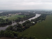
This is the road on the south side of the Kankakee River, west side of Momence.
|  enlarge 75KB, 720x405 enlarge 75KB, 720x405
|  enlarge 64KB, 640x480 enlarge 64KB, 640x480
|  enlarge 94KB, 640x481 enlarge 94KB, 640x481
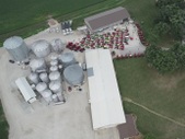
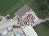
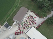
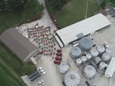
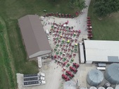
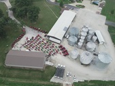
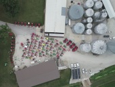
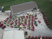
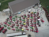
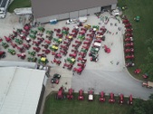
The following aerial photos were taken at the Darrell Stauffenberg farm, east of Kankakee.
|  enlarge 98KB, 640x481 enlarge 98KB, 640x481
|  enlarge 105KB, 640x480 enlarge 105KB, 640x480
|  enlarge 109KB, 640x479 enlarge 109KB, 640x479
|  enlarge 107KB, 640x479 enlarge 107KB, 640x479
|  enlarge 109KB, 640x480 enlarge 109KB, 640x480
|  enlarge 104KB, 640x480 enlarge 104KB, 640x480
|  enlarge 100KB, 640x480 enlarge 100KB, 640x480
|  enlarge 100KB, 640x481 enlarge 100KB, 640x481
|  enlarge 110KB, 640x480 enlarge 110KB, 640x480
|  enlarge 107KB, 640x481 enlarge 107KB, 640x481
|  enlarge 114KB, 640x480 enlarge 114KB, 640x480
|  enlarge 127KB, 720x405 enlarge 127KB, 720x405
|  enlarge 110KB, 640x480 enlarge 110KB, 640x480
|  enlarge 88KB, 640x480 enlarge 88KB, 640x480
|  enlarge 77KB, 640x480 enlarge 77KB, 640x480
|  enlarge 69KB, 640x479 enlarge 69KB, 640x479
|  enlarge 82KB, 640x479 enlarge 82KB, 640x479
|  enlarge 94KB, 640x479 enlarge 94KB, 640x479
|  enlarge 75KB, 640x478 enlarge 75KB, 640x478
|  enlarge 76KB, 640x478 enlarge 76KB, 640x478
|  enlarge 79KB, 640x479 enlarge 79KB, 640x479
|  enlarge 105KB, 640x478 enlarge 105KB, 640x478
|  enlarge 77KB, 640x477 enlarge 77KB, 640x477
|  enlarge 64KB, 640x477 enlarge 64KB, 640x477
|  enlarge 47KB, 640x476 enlarge 47KB, 640x476
|  enlarge 91KB, 640x426 enlarge 91KB, 640x426
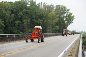
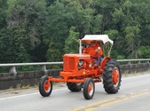
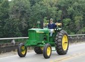
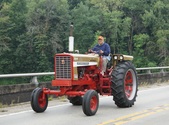
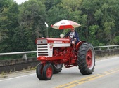
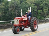
The following group of 98 photos was taken crossing the Iroquois River with the tractors going northbound on the Sugar Island bridge.
|  enlarge 110KB, 640x475 enlarge 110KB, 640x475
|  enlarge 110KB, 640x475 enlarge 110KB, 640x475
|  enlarge 111KB, 640x474 enlarge 111KB, 640x474
|  enlarge 108KB, 640x473 enlarge 108KB, 640x473
|  enlarge 110KB, 640x474 enlarge 110KB, 640x474
|  enlarge 112KB, 640x474 enlarge 112KB, 640x474
|  enlarge 110KB, 640x480 enlarge 110KB, 640x480
|  enlarge 107KB, 640x480 enlarge 107KB, 640x480
|  enlarge 101KB, 640x479 enlarge 101KB, 640x479
|  enlarge 102KB, 640x478 enlarge 102KB, 640x478
|
|
|
