
| ||||||||||
1 pics 1 If you want to save photos to your computer, click the box under the thumbnails of the photos you want to download. Then click the "Download" button at the top of the album. Pick the size you'd like to download (Original is best)and the photos will be downloaded to a folder of your choice. | 2 Utah 2011-001j On our 2nd day of hard driving, we usually stop in Hanksville UT for lunch at Blondies. This is the gas station adjacent, which features a minimart carved out of the rock. |
3 Utah 2011-002j Another view - It's hard to believe but the gas was cheaper here than in Lynnwood, which is saying something since Hanksville is about as far as you can get off the beaten path. We passed through here in 1965 on our way to California, when we had to replace one of our "retread" tires on our "new" Chevy II. The cost was $55 which would be over 400 in today's dollars. | 4 Utah 2011-003j Heading out of Hanksville on UT95 is this view of the Henry Mountains. |
5 Utah 2011-004j We turned off UT 95 a little ways out of Hanksville onto a sandy road with the view here. | 6 Utah 2011-005j At the trailhead - as you can see my low clearance Corolla made it. Kelsey's guidebook warns about a couple of sandy spots in the road that you have to worry about. The first one caught me by surprise and I got bogged down (wrong metaphor for a sandy spot) and Joel and Shelby had to push me out. I was able to carry enough speed to get through the 2nd one, although the bottom of the car was complaining at the "sandblasting". |
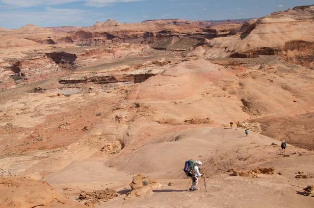
7 Utah 2011-006j Getting our gear together - Fred met us at Blondies in Hanksville, having driven up from Arizona. | 8 Utah 2011-008j View of trailhead and Henrys Mountains to the west. Satellite view of TH - click HERE |
9 Utah 2011-007j Looking down into the Dirty Devil Canyon from the rim at the trailhead. | 10 Utah 2011-009j The Troop 24 Kickass Trekkers at the start of the hike: Fred, Bill, Maria, Amanda, Shelby, and Joel. |
11 Utah 2011-010j Starting out. | 12 Utah 2011-011j Another view. (Note Joel has a new camera and is giving it a workout) |
13 Utah 2011-012j There is a well graded trail at the top. | 14 Utah 2011-013j We still can't see the river. |
15 Utah 2011-014j Shelby must see a lizard or something! | 16 Utah 2011-015j Really a great day to start out. |
17 Utah 2011-016j Almost out of the green sediments into the red. We can see the cliffs cut by the Dirty Devil in the distance. | 18 Utah 2011-017j |
19 Utah 2011-018j Just following the trail - we have no idea which way it goes. | 20 Utah 2011-019j |
21 Utah 2011-020j Bill, Shelby, and Fred. | 22 Utah 2011-021j At last we can see the river as we wind through the hills. |
23 Utah 2011-022j The path winds around this rocky promontory. | 24 Utah 2011-023j Climbing down from the point, the path becomes much rockier and steeper. You can see Angel Cove cutting into the rock (dark area). For location click HERE |
25 Utah 2011-024j After threading down the rocky point, we come to a slickrock saddle, and the way is now marked with cairns. | 26 Utah 2011-025j Fred, Shelby, Amanda, and Maria pick their way through the "Moonscape". |
27 Utah 2011-026j Down a little "Valley". | 28 Utah 2011-027j Cairns lead the way. |
29 Utah 2011-028j Almost to the end of the valley - where do we go from here? | 30 Utah 2011-029j |
31 Utah 2011-031j Textures in the rock along the trail. | 32 Utah 2011-030j As usual, I'm lagging behind. If you enlarge the photo (original size), you can see the trail far below just to the left of my pack. Note the rock Shelby is standing on to the left of center. |
33 Utah 2011-032j Climbing down - That is Beaver Canyon straight ahead. Joel's telephoto lens makes the canyon appear much closer than it is. The rock point at the left is the one with Shelby on it in the previous photo. | 34 Utah 2011-033j |
35 Utah 2011-034j Our group makes its way down a steep slickrock ridge. You can see the mouth of Beaver Canyon (Yes there are beavers in the desert) as it meets the main Dirty Devil. I'm about where Amanda was in the previous photo. | 36 Utah 2011-035j Bill pausing a minute to take in the view. |
37 Utah 2011-036j Winding our way down. | 38 Utah 2011-037j After descending the slickrock we traverse along a ledge toward the bit of path we saw from above. |
39 Utah 2011-038j Shelby on the bit of path as we go around another point above Beaver Canyon. Note that the topo map incorrectly shows the trail going down into Beaver Canyon, whereas it goes around this point and then turns north. | 40 Utah 2011-039j Shelby and Fred going around the point. You can see the southermost Henry Mountains far in the distance. |
41 Utah 2011-040j Back on the slickrock again - going around the point just above the cliff walled Beaver Canyon. | 42 Utah 2011-041j Shelby and Fred. |
43 Utah 2011-042j Crossing over a ridge opposite Beaver Canyon. For location: Click Here | 44 Utah 2011-043j Shelby taking a break. |
45 Utah 2011-044j Shelby and Bill. | 46 Utah 2011-045j Heading down. |
47 Utah 2011-046j Following the cairns down towards Beaver Canyon. | 48 Utah 2011-047j Patterns in the slickrock. |
49 Utah 2011-048j Looking back up Beaver Canyon. | 50 Utah 2011-049j Bill descending steep slickrock as the cairns are now leading us north away from Beaver Canyon. Note the rounded knoll from previous photos. |
51 Utah 2011-050j Yucca Plant along the way. | 52 Utah 2011-051j Taking a break after we hit the relatively flat area above the river. We lost a little time in this area as there were conflicting trails. We were looking for a way down to the river, but there were none. Eventually, we found a trail headed north across the flat area. (Note that the trail shown on the topo map is not correct). |
53 Utah 2011-052j Wildflower - similar to Sego Lily but has 4 petals instead of 3. | 54 Utah 2011-053j Another desert flower - we've seen these in Grand Gulch as well. |
55 Utah 2011-054j | 56 Utah 2011-055j At the end of the long flat area we follow the cairns up another slickrock climb. |
57 Utah 2011-056j Up to the next bench. | 58 Utah 2011-057j |
59 Utah 2011-058j Bill going up the bench. | 60 Utah 2011-059j It's a steep one. |
61 Utah 2011-060j Fred following a ledge. Wind erosion has made some interesting holes in the sandstone. | 62 Utah 2011-061j Close up of the effects of wind erosion. |
63 Utah 2011-062j Traversing along the ledge. | 64 Utah 2011-063j As we traversed we came upon these interesting holes sculpted into the side of the hill. |
65 Utah 2011-064j Maria, Shelby, and Fred. | 66 Utah 2011-065j This is the life! |
67 Utah 2011-066j Joel tries the natural version of the Egg chair. | 68 Utah 2011-067j |
69 Utah 2011-068j | 70 Utah 2011-069j Packs on after our short stop - the sun is getting lower. |
71 Utah 2011-070j | 72 Utah 2011-071j Soon we were off the slickrock and on to a sandy bench. The last drop off the slickrock was very near the edge of the cliff and was a little nerve racking. Here we are heading down off the bench and have almost dropped down to the river level. |
73 Utah 2011-072j Shelby inspecting some petroglyphs along the trail. | 74 Utah 2011-073j Petroglypths. |
75 Utah 2011-074b Wavy lines carved into the rock. | 76 Utah 2011-076j Figure with exaggerated hands. |
77 Utah 2011-077b another view. | 78 Utah 2011-078b Two more figures. |
79 Utah 2011-079j At the Petroglyph panel. | 80 Utah 2011-080j A small side canyon. |
81 Utah 2011-081j close up. | 82 Utah 2011-082j Finally we've gotten down to the river level. We could see the mouth of Robber's Roost Canyon just across the way. I wanted to cross at this point but Shelby said that the trail kept on going. The rest of the crew decided to follow the trail, but I made the fateful decision to cross here. |
83 Utah 2011-083j Shelby investigating another Petroglyph panel. | 84 Utah 2011-084j These figures seem much different that the other panel we saw. |
85 Utah 2011-085j More figures. | 86 Utah 2011-086j Here I am getting ready to cross the Dirty Devil. |
87 Utah 2011-087j Refusing to follow the trail, I decided to cross the Dirty Devil at this spot. I didn't get very far when suddenly, I was stuck in Dirty Devil Quicksand - It's hard to describe, you'd put your foot down and it would feel solid and then it would slowly keep sinking in. I'd put my poles in and they would just keep going in. Finally I fell over and had to crawl out, with help from Joel and Shelby who had run back to help me when seeing my predicament. | 88 Utah 2011-088j Our Camp near the mouth of Robber's Roost Canyon. Note Fred's commemorative 1973 blue tent. Figured I'd give it one more use before it goes away. |
89 Utah 2011-091b The Oatmeal water is boiling and Joel is pumping water. (7:34) | 90 Utah 2011-089j Cooking breakfast. I also learned another valuable lesson that morning: "Don't use cheapo Fred Meyer ziploc bags". I found that my gorp bag had about 2 inches of water in it. To top things off, I found out the hard way that my mouthwash was not Listerene but was Dawn dish soap! |
91 Utah 2011-090j 7:41pt - At least all my wet stuff (excluding gorp) dried overnight. | 92 Utah 2011-097b This is just below the mouth of the South Fork of R.R Canyon. (9:55pt) For location Click Here |
93 Utah 2011-098b We took a break here just east of the mouth of the South Fork. Thats the side canyon shown on the map. (10:46pt) For Location Click Here | 94 Utah 2011-099b Maria and Shelby - looking down canyon from previous photo. (10:46pt) |
95 Utah 2011-092j Somewhere above the mouth of the SF of RR canyon. (11:14pt) | 96 Utah 2011-093j Another view. |
97 Utah 2011-100b Fred following the tread. Shelby, Maria, Amanda, and Joel are already around the bend. (11:26pt) I think this is the location: Click Here | 98 Utah 2011-094j This is the long straight stretch that is shown in the next photo - you can recognize the desert varnish on the wall at the center of the photo (11:29) |
99 Utah 2011-101b Looking back down canyon. (11:42pt) Approximate Location: Click Here | 100 Utah 2011-095j Approaching a prominent headland jutting out from small side canyon - the view is obscured by the wash. (11:45) |
101 Utah 2011-096j Rounding the headland shown in the previous photo. (11:48) This point is located: Here | 102 Utah 2011-103j Breaking for lunch - Joel climbed a large Rock and got this view looking up canyon. Shelby, Maria, and Amanda are at the lower right. Bill and Fred are still down canyon. (11:50) |
103 Utah 2011-102j From his vantage point atop the rock, this is the view to the north showing a small side canyon. | 104 Utah 2011-105j Another view from the rock - a telephoto view looking up canyon. |
105 Utah 2011-107j A telephoto view looking down canyon from Joel's rock, you can see the view from the previous photos. If you view the photo at original size, I think I'm the light colored shape to the left of the tree at the foot of the left canyon wall to the left of center. | 106 Utah 2011-108j A view of the distinctive rock formation across the canyon. |
107 Utah 2011-104b Fred arriving. (11:52) | 108 Utah 2011-106b Having our bagels, summer sausage, and cheese lunch - view is looking down canyon.(12:35) Location for lunch: Click Here |
109 Utah 2011-109j Rocks in the area of our lunch spot. | 110 Utah 2011-110b Fred heading up canyon after lunch - a nice pool in the wash. (12:55) For location: Click Here |
111 Utah 2011-111b Looking Down Canyon. If you enlarge the photo you can see the Henry Mtns in the far distance (13:07) | 112 Utah 2011-112j After hiking up the canyon a ways we took a break, and discovered we had passed the Robber's Roost Arch. While Fred and I waited, Joel, Shelby, Maria, and Amanda hiked back to see the bridge (14:02) |
113 Utah 2011-113j Shelby with a tumbleweed. | 114 Utah 2011-114j Shelby approaching the Arch. |
115 Utah 2011-115j Shelby hiking along a ledge below the arch. | 116 Utah 2011-116j Looks like a little climb is necessary to get up into the arch. |
117 Utah 2011-117j Maria climbing up. | 118 Utah 2011-118j Almost there. |
119 Utah 2011-119j Maria his just come through the arch, which is to the left. This was used as a cattle trail from the canyon up to the rim. | 120 Utah 2011-120j Shelby and Amanda join Maria. Notice the man made rock wall above Shelby (?) |
121 Utah 2011-121j Joel took this photo looking up canyon from the top of the arch. If you enlarge this photo to original size you can spot me near a tree near the center of the photo. For the location of the Arch: Click Here | 122 Utah 2011-122j Looking along the top of the arch. |
123 Utah 2011-123j Shelby being Shelby! | 124 Utah 2011-124j Fred will not like the looks of this! |
125 Utah 2011-125j I should note that Blue John Canyon, where John Ralston (127 Hours) got his hand trapped is the next canyon over. | 126 Utah 2011-126j Shelby taking it to the edge. |
127 Utah 2011-127j You can see the trail leading up to the arch. | 128 Utah 2011-128j The down canyon side of the arch. |
129 Utah 2011-129j Looking across the canyon from the top of the arch. | 130 Utah 2011-130j Looking down canyo from the top of the arch. |
131 Utah 2011-131j Another shot looking down canyon. | 132 Utah 2011-132j Looking up canyon across the top of the arch. |
133 Utah 2011-133j Looking down through the arch. | 134 Utah 2011-134j Shelby off on another adventure. |
135 Utah 2011-135j It's only a couple of hundred feet drop, but it would sure make a great photo if I sat on that rock! | 136 Utah 2011-136j See, nothing to it! |
137 Utah 2011-137j Another view. | 138 Utah 2011-138j Looking south from the top of the rim. |
139 Utah 2011-139j The top ledge under the arch - this must be where the cattle came up. | 140 Utah 2011-140j Desert flower. |
141 Utah 2011-141j Back on the trail. (15:04) | 142 Utah 2011-142b This is just below the mouth of White Roost Canyon, where we wanted to camp. When I got there the rest of the group had forged ahead and had missed the spot. Luckilly, I was able to get their attention and have them hike back. (15:05) For location: Click Here |
143 Utah 2011-143j Day 3: Day hike up White Roost Canyon - I stayed in camp because of blistered feet. (10:16) | 144 Utah 2011-144j A lovely pool in White Roost Canyon. |
145 Utah 2011-145j Another view. | 146 Utah 2011-146j Continuing up White Roost. (10:20) |
147 Utah 2011-147j | 148 Utah 2011-148j |
149 Utah 2011-149j Looking down canyon. | 150 Utah 2011-150j 10:22 |
151 Utah 2011-151j | 152 Utah 2011-152j Taking a break before heading up an old cattle trail to the rim. (10:38) For Location: Click Here |
153 Utah 2011-153j Heading up a side canyon that used to be used as a stock trail from the canyon to the rim. (10:43) | 154 Utah 2011-154j A little further up. |
155 Utah 2011-155j Shelby on the rim. (10:46) | 156 Utah 2011-156j Looking down into White Roost from the rim. (10:41) |
157 Utah 2011-157s Joel taking the previous photo (10:41) | 158 Utah 2011-158s Joel |
159 Utah 2011-159s Maria (10:41) | 160 Utah 2011-160s A rim dweller. (10:43) |
161 Utah 2011-161j Shelby & Maria. | 162 Utah 2011-162j Shelby. |
163 Utah 2011-163j Heading back down (10:43) | 164 Utah 2011-164j Across the slickrock. |
165 Utah 2011-165j Shelby doing a little climbing (10:58) | 166 Utah 2011-166j Back in White Roost (11:23) |
167 Utah 2011-167j Heading up White Roost. (11:43) | 168 Utah 2011-168j Another view. |
169 Utah 2011-169j Canyon walls are closing in. (11:45) | 170 Utah 2011-170j Heading up the wash. (11:45) |
171 Utah 2011-171j (11:47) | 172 Utah 2011-172j Yucca. (11:47) |
173 Utah 2011-173j (11:50) | 174 Utah 2011-174j Headed for the slot. |
175 Utah 2011-175j | 176 Utah 2011-176j 11:59 |
177 Utah 2011-177j Fred going through a tilted slot. | 178 Utah 2011-178j Looks pretty tricky to get through. |
179 Utah 2011-179s Maria and Joel working their way along the narrow slot. | 180 Utah 2011-180s Headlights on for this stretch. (12:08) |
181 Utah 2011-181s Joel and Maria in the shadows. | 182 Utah 2011-182s Another view. (12:09) |
183 Utah 2011-183s Joel making a supreme effort to get over this chockstone blocking the way. (12:23) | 184 Utah 2011-184s Made it! |
185 Utah 2011-185s Shelby's turn to get over. (12:25) | 186 Utah 2011-186s Joel making his way to the next slot section. (12:31) |
187 Utah 2011-187s Self portrait, Shelby. (12:45) | 188 Utah 2011-188s A tough place to get through. (12:47) |
189 Utah 2011-189s Made it. | 190 Utah 2011-190j Shelby. (12:48) |
191 Utah 2011-191s White Roost slot. | 192 Utah 2011-192j Shelby in slot. |
193 Utah 2011-193j (12:51) | 194 Utah 2011-194s Joel loking for a way through. (12:53) |
195 Utah 2011-195s Looks like the end. | 196 Utah 2011-196s Back at our camp (18:29) |
197 Utah 2011-197s Moon rising over the canyon. | 198 Utah 2011-198s View of our camp. For location Click Here |
199 Utah 2011-199j Joel's shot of the moon from our camp. | 200 Utah 2011-200j A side canyon across from our camp. |
201 Utah 2011-201b Day 4: Getting ready to leave camp. (08:27) | 202 Utah 2011-202b A look back up canyon before we head out. |
203 Utah 2011-203b Looking back to the headwall between White Roost and the main Robber's Roost Canyon. | 204 Utah 2011-204b The group catching up to me. (08:42) |
205 Utah 2011-205b Looking down canyon. (8:46) | 206 Utah 2011-206b A nice pool along the way (8:49)that is located Here |
207 Utah 2011-212j (9:04) | 208 Utah 2011-213j |
209 Utah 2011-207b Fred nearing the Robber's Roost Arch (9:40) | 210 Utah 2011-208b Shelby passing by the arch. You can see the access trail clearly heading when you're heading down canyon. (9:43) |
211 Utah 2011-209b Another view. | 212 Utah 2011-210b Close up of the arch. (9:45) |
213 Utah 2011-211b Down canyon from our lunch spot on Day 2 - see photo 101b (10:51) | 214 Utah 2011-215b Fred at mouth of the South Fork of Robber's Roost. (11:23) We met a large Morman youth group near here that was having lunch - they had rappelled down into the S.Fork and were headed out via the Angel trail. |
215 Utah 2011-214j Nearing the mouth of the canyon. (11:37) | 216 Utah 2011-216b Fred just a short way from the mouth of the canyon and the Dirty Devil River. (11:50) |
217 Utah 2011-217b Shelby and Amanda crossing the Dirty Devil (13:16) | 218 Utah 2011-218b Amanda and Maria crossing. |
219 Utah 2011-219b Fred (13:20) | 220 Utah 2011-220b Fred & Shelby. |
221 Utah 2011-221b Joel enjoying the water. | 222 Utah 2011-223b Shelby showing that standing in same spot results in sinking into the muck. |
223 Utah 2011-224j Bill making his way across the Dirty Devil. (13:37) | 224 Utah 2011-225j Bill |
225 Utah 2011-226j | 226 Utah 2011-227j Looking down river. |
227 Utah 2011-228b In the shade of the canyon walls, looking back at the mouth of Robber's Roost. (14:04) | 228 Utah 2011-229b We camped on a dry ledge above the river for our final night. (15:15) |
229 Utah 2011-230b A telephoto view looking down the river. If you enlarge to "original size", you can see some people wading just above the shadow line - I'm thinking that they were the group we saw earlier that day. | 230 Utah 2011-231b Joel (15:17) |
231 Utah 2011-232b Our camp. For Location: Click Here | 232 Utah 2011-233j (17:13) |
233 Utah 2011-234j Fred setting up his old tent (retired after this trip) that he got in the 70's when he was in college. | 234 Utah 2011-235j |
235 Utah 2011-236j View from our camp as the sun sets. | 236 Utah 2011-237j Dinner time. (17:19) |
237 Utah 2011-238j Bill dishing out dinner, while Amanda and Maria wait. Notice the orange dish that Bill is spooning the dinner into - that is Joel's collapsible dish that was a good idea in theory but not in practice. | 238 Utah 2011-239j The sun is almost down. And the last of Fred's ol'-blue. |
239 Utah 2011-240j Another moonrise. | 240 Utah 2011-241j 18:40 |
241 Utah 2011-242j Looking for rocks around camp. | 242 Utah 2011-243j Officially the sun is down. |
243 Utah 2011-244j Day 5: Sunrise is imminent (5:57) | 244 Utah 2011-245j |
245 Utah 2011-246j Making final preparations to leave camp. | 246 Utah 2011-247j Just about everything is stowed away. The cairned trail comes down onto a narrow ledge just feet away from the cliff. We decided not to go back this way but climb up a hill to the right of our camp. (5:58) |
247 Utah 2011-248j Shelby traversing the slick rock shortly after we left camp. (6:16) | 248 Utah 2011-249j Shelby - you can see we are back on the cairned "trail". |
249 Utah 2011-250j Looking back at Fred coming around the bend. (6:19) | 250 Utah 2011-251j Out of the Slickrock (6:26) |
251 Utah 2011-252j Shelby (6:27) | 252 Utah 2011-253j |
253 Utah 2011-254j Bill coming over the hill. | 254 Utah 2011-255j |
255 Utah 2011-256j Joel waited for me to catch up - that first hill out of camp was hard for me to get up. (6:31) | 256 Utah 2011-257j You can see the cairns showing the way. (6:31) |
257 Utah 2011-258j Another one of those purple flowers. (6:36) | 258 Utah 2011-259b After crossing the flat, we took a break before heading up the slickrock for our climb to the canyon rim. Shelby strapped my pack on top of his pack for the climb. (6:58) |
259 Utah 2011-260b Looking back up Beaver Canyon. (7:00) | 260 Utah 2011-261b Shelby heading up the hill. |
261 Utah 2011-262b Fred is near the top of the hill. Shelby has just passed Maria and Amanda. Joel is already over the hill. (This is the same hill we were going down in picture 34j on Day 1.)(7:11) | 262 Utah 2011-263b Looking back at the river. You van see our campsite far in the distance (the green bench above the last cliff visible on this side of the river) (7:16) |
263 Utah 2011-264b Telephoto view. (7:17) | 264 Utah 2011-265b Still climbing. This was the last picture I took as Shelby's battery was running out. (7:32) |