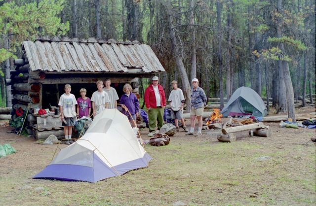
Adults on this trip:
"Cascade" Bill Mooseker, Greg Phillips, Steve Goodwin
Scouts on this trip:
Jason Smith, Adam Phillips, Jon Younger, Danny Stallings, Peter Goodwin, Andrew Mooseker, Kyle Meissner
Our big backpacking trip for the summer of 1996 was the Pasayten Crazyman. This was a very strenous 8 day trip in the Pasayten Wilderness covering 60 miles with almost 13000 feet of elevation gain.
This trip would probably not be feasible today as large portions of the route were ravaged by forest fires in 2003.
The descriptions under the photo thumbnails in the album sometimes contain links to maps or additional information. These are identified by "Blue” text for links.
Maps are best viewed at "Original" size. To view at "Original" size, click on Thumbnail to enlarge the map, then click again to access the original resolution. Move the cursor to the point on the map that you want to enlarge and then click the cursor to zoom in or out.
An explanation of how I have derived the distances and elevation gain/losses can be found HERE.
Troop 24 "The High Adventure Troop"
-Cascade Bill Mooseker
Date(s): August 1996. Album by Cascade Bill. 1 - 122 of 122 Total. 4462 Visits.
enlarge 354KB, 1024x702 1 pics 1
To enlarge photos, click on the thumbnail - the photo will pop up enlarged to 1024 pixels max (height or width). To view at Original size (best for maps, etc.), Ctrl-Click on the Photo, and finally a 3rd click to enlarge to the original resolution. Click again to reduce back to fit the screen again.
If you want to save photos to your computer, click the box under the thumbnails of all the photos you want to download (or check the "select all" box at the bottom of the album). Then click the "Download" button at the top of the album. Pick the size you'd like to download (Original is best)and the photos will be downloaded as a zip file to the folder of your choice.
enlarge 385KB, 662x1024 2 crazy96a Day 1: Lake Creek Trailhead to "A Good Half Hour Camp"
It's a long drive from Lynnwood over the North Cascades highway. Then with a lunch stop in Winthrop and another long drive up Chewack River Road and on the the Lake Creek Trailhead, you're not getting an early start.
The first part of the trail is an easy valley pound up the valley to long and thing Black Lake.
Numbers on map correspond to Trail Log waypoints.
enlarge 377KB, 662x1024 3 crazy96b
leaving Black Lake, it was a relentless valley pound. After a while the guys were asking me when we would be getting to a campsite. I told them "about a good half hour or so".
The Lake Creek Trail above Black Lake has been abandoned due to the hundreds of downed trees across the trail due to the 2003 Fawn Peak fires.
enlarge 379KB, 1024x662 4 crazy96c
The "good half hour or so" camp never materialized and after about another three hours we came to the junction with the Diamond Jack Trail.
A short way down the trail we found a widening in the trail with an old fire ring, that we dubbed "A Good Half Hour Camp". A long day - 9.2 miles with a little over 2400' of climbing.
enlarge 98KB, 791x1024 5 CRAZY96-d1 Trail Log Waypoints: Day 1
See Map for location of waypoints.
enlarge 439KB, 1024x673 6 96-02-276-002 Taking a break along the trail to Black Lake: Andrew, Pete, Steve, Jason, Greg, Adam, Jon, Danny, and Kyle.
This part of the trail was burned over in 2003. The trail to Black Lake is maintained - a fairly current photo of the trail to Black Lake can be found HERE and you can see it has changed since our trip in 1996.
enlarge 357KB, 1024x663 7 96-01-276-001
Soon the lower end of Black lake is reached, about 4 miles from the trailhead. If you enlarge the photo, you can see the guys traversing the talus to the right of the picture (Steve's red pack stands out prominently.)
enlarge 483KB, 1024x670 8 96-03-276-003 Taking a break at the upper end of the lake: Adam, Danny, Jason, Pete, Kyle, and Andrew, and Steve.
enlarge 425KB, 1024x673 9 96-04-276-004
Greg at our break. Due to the slope of the hill along the trail there aren't many campsites, and those that were there were occupied as shown here - just a few feet off the trail.
enlarge 451KB, 1024x672 10 96-05-276-005
View looking down the lake from our break spot. In hindsight, It probably would have been a good time to start looking for a campsite, but there was still plenty of daylight left so we picked up our packs and headed up the trail.
enlarge 379KB, 1024x662 11 crazy96c Day 2 was a short day - from "A Good Half Hour Camp" to Lower Fox Lake. Day 2: 3.1 miles & 1523 ft climbed.
enlarge 72KB, 791x1024 12 CRAZY96-d2 Trail Log Waypoints: Day 2 For location of waypoints see Map.
enlarge 234KB, 1024x665 13 96-06-275-009 Andrew & Peter greet the new day at "A Good Half Hour Camp".
enlarge 400KB, 1024x665 14 96-07-275-010 Jason
enlarge 371KB, 1024x665 15 96-08-275-011 Greg and Kyle.
enlarge 507KB, 1024x665 16 96-09-275-012 Tent locations were sparse so we had to jam them together to get enough room.
enlarge 439KB, 1024x665 17 96-10-275-013
After breakfast we headed up the Diamond Jack trail. After hiking about three miles and climbing about 1300 feet, the trail came to this camp in a meadowed basin.
The Diamond Jack Trail continues switchbacking up to Diamond Jack Pass, but we took a break here before heading off cross country to Lower Fox Lake.
enlarge 363KB, 665x1024 18 96-11-275-014 Peter climbing up steep slope.
There was a sort of a way trail going very steeply up the slope, which we named "Hell Hill".
enlarge 409KB, 673x1024 19 96-12-276-006 Andrew making his way up "Hell Hill".
enlarge 428KB, 1024x673 20 96-13-276-007 The top of "Hell Hill" Jason, (Peter behind Jason), Jon, and Danny (in the trees).
enlarge 394KB, 1024x676 21 96-14-276-008 Andrew near the top.
enlarge 362KB, 673x1024 22 96-15-276-009 Kyle making his way up - Steve further down
We went down "Hell Hill" in 2001 (See HERE) and Greg fell on the way down. A little while later someone noticed that Greg had a big piece of wood stuck in his leg!
enlarge 466KB, 679x1024 24 96-17-96-crzy-112 Steve coming up - I doubt that this route is possible now due to the fires.
enlarge 386KB, 695x1024 25 96-19-96-crzy-111 Greg, Jason, and Steve.
After making camp at the Lower Fox Lake, several of us made a day hike up to the upper Fox Lake, shown here at the camp at the upper lake.
enlarge 454KB, 1024x671 26 96-20-03-276-011 Upper Fox Lake - Jason, Steve, Bill, & Pete.
enlarge 489KB, 676x1024 27 96-21-276-012 Greg and Steve - Looking back at Upper Fox Lake.
enlarge 443KB, 1024x671 28 96-22-276-013 Camp at Lower Fox Lake
This is the ceremonial "Burning of the Underwear" by which Greg Phillips underwear and socks are burned.
Pete (previously named "Bucketfoot" on the 1997 Chelan Summit Hike) lived up to his name as he was trying to throw a frog into the lake and slipped on the mud and ended up on his keister.
enlarge 379KB, 1024x662 29 crazy96c Day 3-Map 1: Lower Fox Lake to Larch Pass
Cross country from Lower Fox Lake via Upper Fox Lake & upper basin. Climbing to shoulder of Peak 7553 and traversing to ridge to descent to Diamond Jack Pass. Proceed up Ridge along Tr 532 (Diamond Jack Sheep Drive - not really a trail, some vague tread in places but more of a high route).
enlarge 400KB, 1024x662 30 crazy96d Day 3- Map 2: 6 miles & 2049' climbed
Route follows Diamond Jack Sheep Drive over saddle above Diamond Creek to descend to the Larch Creek Trail. Follow trail to Larch Pass. Camp 3 is in meadows south of Larch Pass.
enlarge 98KB, 791x1024 31 CRAZY96-d3 Trail Waypoints Log: Day 3
For waypoint locations see Maps.
enlarge 306KB, 1024x676 32 96-23-276-014
Kyle & Andrew leaving Lower Fox Lake. Peaks in back are the summits of Fool Hen peaks: pt 8082', 8168', & 8107'.
enlarge 308KB, 1024x673 33 96-24-276-015 Another shot of Kyle & Andrew.
Fortunately the area around the lake was not touched by the Fawn Peak Fires - If you look at Google Earth there is a thin green band extending around the lower Fox Lake outlet marking the limit of the fire. The upper basin and the upper lake also escaped the fire.
enlarge 371KB, 667x1024 34 96-25-275-015 Diamond Point from shoulder of Peak 7553.
enlarge 380KB, 674x1024 35 96-26-276-016
Andrew - following vague tread along the meadows of Diamond Point. Looking back at the Fool Hen peaks.
enlarge 359KB, 1024x671 36 96-27-276-017 Steve & Greg along the route above Diamond Jack Pass.
enlarge 315KB, 1024x673 37 96-28-276-018
Steve - Point 7553' is to the left of the picture. We had traversed across the shoulder of this peak to get to Diamond Jack Pass. The Fox Lakes are behind and below this point.
enlarge 333KB, 1024x667 38 96-29-276-019
Traversing along the slopes of Diamond Jack (this is near waypoint 3 - see Map). We had our raingear on as there were some showers.
enlarge 375KB, 1024x674 39 96-30-276-020
Looking down at the pass we would go over to reach the Larch Creek Trail. Larch Pass is the low point beyond.
enlarge 518KB, 1024x672 40 96-31-276-021 A deer we saw in the meadows near Diamond Creek.
enlarge 318KB, 1024x668 41 96-32-96-crzy007 Kyle & Andrew taking a break at an old sheep herder's camp near Diamond Creek.
enlarge 403KB, 1024x668 42 96-33-96-crzy008 Jason, Peter, Danny, Jon, and Greg taking a break.
enlarge 621KB, 1024x674 43 96-34-275-016 Finally on the Larch Creek Trail.
We had a nice camp at Larch Pass. The guys saw a 2-man saw in a horse packer's tent near our camp and they borrowed it to saw out a number of camp stools (more than enough for everyone). When we camped there again in 1998 many of the stools were still there.
enlarge 385KB, 662x1024 44 crazy96e Day 4: Larch Pass to Quartz Lake- Total of 6 miles & 933' climbed.
This was a fairly easy day - about the same distance as day 3 but less than half the climb, and all on trail. The only down note was the weather, which was overcast with occasional showers.
enlarge 122KB, 791x1024 45 CRAZY96-d4 Day 4: Trail Waypoint log
See map for location of waypoints.
enlarge 358KB, 1024x658 46 96-35-275-017 Heading north a short way from Larch Pass, yo can see Whistlers Pass (Notch) come into view.
enlarge 309KB, 1024x665 47 96-36-275-018 Rolling meadows of McCall Gulch.
enlarge 360KB, 1024x665 48 96-37-275-019
Leaving the Larch Creek Trail, we started up the trail to Whistler's Pass. This trail is not shown on the map.
enlarge 347KB, 1024x665 49 96-38-275-020 Going up the slopes above McCall Gulch on the Whistler's Pass trail.
enlarge 497KB, 1024x662 50 96-39-275-021
Whistler's Notch - the guys climbed up to the top of the ridge and took this photo. If you enlarge it, you can see Bill, Greg, and Steve taking a break at the pass.
enlarge 361KB, 1024x663 51 96-40-275-022
Looking back towards Larch Pass, with the back side of Fool Hen Peak in the distance seemingly sitting in the saddle of Larch Pass.
enlarge 321KB, 1024x672 52 96-41-275-023 View down into Whistler Basin.
enlarge 335KB, 1024x675 53 96-43-276-023 Getting ready to head out - Steve, Adam, Danny, Jason, and Peter.
enlarge 307KB, 1024x665 54 96-42-276-022 Steve getting ready to head out - standing in Whistler's Notch with Larch Pass behind him.
enlarge 256KB, 1024x661 55 96-44-275-024 As we followed the trail through Whistler's Basin, the clouds lowered and it began to rain.
enlarge 377KB, 1024x664 56 96-45-275-025 We took our lunch break at this old sheepherder's camp near Waypoint 10 on the Day 4 Map.
enlarge 281KB, 1024x660 57 96-46-275-026 This photo was taken near waypoint 15.
Almost to the Boundary Trail - Greg and Danny looking back along the west side of Sand Ridge - you can see the trail as it traverses the ridge. At this point, our camp at Quartz Lake was a little less than 1.5 miles away.
enlarge 395KB, 1024x662 58 crazy96f Day 5 Map: Quartz Lake to Ashnola Shelter - Total of 6.8 miles and 925' climbed.
It was a fairly easy day, and one of the most scenic as the trail stays high in the meadows with sweeping views for most of the way.
enlarge 92KB, 791x1024 59 CRAZY96-d5 Day 5: Trail Waypoint log
See map for location of waypoints.
enlarge 444KB, 1024x676 60 96-47-276-024 Camp at Quartz Lake - Adam, Peter, Danny, Jon, and Kyle getting their packs ready to go.
This was one of the coldest nights I have experienced while backpacking. We stayed in bed late as we didn't want to get up when it was so cold.
For breakfast, I remember that we had a freeze dried omelet. I remember that because it was the last time we ever had an omelet on the trail. I used to have them every 5 years or so, and would forget that after an omelet breakfast, you would be belching up eggs all day.
enlarge 522KB, 1024x676 61 96-48-96-crzy-113 On the scenic Boundary Trail. This is near Waypoint 5.
enlarge 221KB, 1024x661 62 96-50-96-crzy002 Looking back at the east side of Sand Ridge.
enlarge 227KB, 1024x672 63 96-51-96-crzy003 View towards Cathedral Peak.
enlarge 247KB, 1024x657 64 96-52-96-crzy004 Wide angle view towards Cathedral Peak - Bald Mountain is to the right.
enlarge 361KB, 1024x663 65 96-49-96-crzy001 Taking a break at near Waypoint 10 - you can see the distinctive Cathedral Peak in the distance.
enlarge 453KB, 1024x665 66 96-53-275-031 Greg & Adam have a little wrestling match - Looks like Greg has the upper hand here.
enlarge 452KB, 1024x673 67 96-54-275-032 The remains of the Barker Brown Cabin from the trail.
enlarge 317KB, 1024x673 68 96-55-96-crzy-114
Having traversed the meadows of Sheep Mountain, we are beginning the descent to the Ashnola River.
enlarge 497KB, 1024x673 69 96-56-96-crzy-115 Jon crossing the Ashnola on a precarious log bridge.
enlarge 473KB, 680x1024 70 96-57-96-crzy-116 Greg making his way across.
Dinner time - I first camped at the Ashnola Shelter in 1981 (See photo album Here)
When I stay here, it seems as if I've entered a time warp, and I'm in Boonesborough back in the 1700's. There is a little meadow near the shelter; you have hiked for days getting here far from any vestige of civilization; and the river is flowing north.
enlarge 367KB, 1024x667 73 96-60-276-033
The nice thing about the shelter is that there is a table that you can do your food preparation on.
enlarge 339KB, 1024x662 74 crazy96g
Day 6: Ashnola Shelter to Remmel Lake - Total of 8.5 miles and 2864' climbed.
After a couple of fairly easy days, day 6 was going to be pretty tough with a long climb out of the Ashnola valley and up and over Bald Mountain. Note that the trail has been relocated from what is shown on the Topo map.
enlarge 342KB, 662x1024 75 crazy96h Day 6 Map 2
enlarge 111KB, 791x1024 76 CRAZY96-d6 Day 6: Trail Waypoint log
See map for location of waypoints.
enlarge 345KB, 1024x665 77 96-61-275-033 Looking across Spanish Creek Valley from the trail up Bald Mountain.
While most of the trail goes through seemingly endless lodgepole pine, there is one short stretch that has a stand of aspens making you wonder how they got theres.
enlarge 310KB, 1024x665 78 96-62-275-034
It's a long climb but you eventually break out of the scrub forest into the broad meadows of Bald Mountain.
enlarge 283KB, 1024x662 79 96-63-275-035 Looking South (more or less) from the meadows of Bald Mountain.
enlarge 311KB, 1024x673 80 96-64-276-036 Summit of Bald Mountain - the topo map shows the trail going much closer to the summit.
Back in June 1981, we were going west on the Boundary trail and the Green Trails map that we had showed the trail going right over the top of Bald Mtn, which was covered in snow at the time. We opted to go via the Spanish Creek trail, which was one of the muddiest awful slogs ever. Later on a day hike up Bald Mtn from the Ashnola Shelter, we found that the actual trail was snow free.
enlarge 320KB, 1024x670 81 96-65-275-036 Another view
enlarge 352KB, 1024x671 82 96-66-276-035 Looking back over the Ashnola valley towards Sheep Mtn (partially obscured by trees).
enlarge 309KB, 1024x662 83 96-67-275-037 Andrew and Bill
enlarge 279KB, 1024x940 84 96-67-275-037a
Close up of Andrew and Bill - See Here for photo of Bill & Greg near the same spot in 1981.
enlarge 360KB, 1024x748 85 96-69-278-001
Our Group - Bill, Andrew, Jon, Kyle, Danny, Peter, Steve, Adam, Greg, and Jason.
enlarge 327KB, 1024x685 86 96-70-278-003 Another shot - Cathedral Peak as a backdrop.
enlarge 376KB, 1024x659 87 96-71-278-002
This is the spot where the trail dips down over the side of Bald Mtn, which you can see just to the right of center.
enlarge 343KB, 1024x656 88 96-72-277-002 On the trail towards Remmel Lake.
enlarge 338KB, 1024x652 89 96-73-277-001 Jon & Bill on trail to Remmel Leke.
enlarge 360KB, 854x1024 90 96-74-crazy-005 Andrew, Adam, Peter, & Kyle at the Spanish Creek Guard station.
enlarge 368KB, 1024x677 91 96-75-crazy-006 Remmel Mountain is to the right of the photo.
enlarge 389KB, 1024x667 92 96-76-278-004
Looking for a camp site on the north side of Remmel Lake - seemed like every spot was taken, so we hiked back to look on the south side of the lake.
enlarge 376KB, 1024x673 93 96-77-278-005 Another view from the north side of Remmel Lake.
enlarge 297KB, 679x1024 94 96-78-278-006
View from our camp on the south side of Remmel lake, with the alpenglow on Amphitheater Mountain.
One of the memorable moments from this camp was that Jon was dishing out the chow, he managed to spill half of it on the ground. After that, whenever anyone spilled the food, it was called "Doing a Jon".
At night, the horse campers across the lake having brought ample supplies of alcoholic beverages, we in fine spirits whooping and riding horses up and down. Finally after we were able to get to sleep, in the middle of the night we heard a horse go galloping on the trail just south of our camp. As we were preparing breakfast, a cowboy came through asking if anyone had seen a horse. That horse was probably back at the thirty mile trailhead by then.
enlarge 76.03MB, 1024x682 Download MPEG4 95 Doing a Jon.mp4 VIDEO - Click Photo to View
Jon describing our dinner at Remmel Lake and the origin of the term, "Doing a Jon". (From the 2010 Troop 24 Reunion)
enlarge 342KB, 662x1024 96 crazy96h
Day 7: Remmel Lake to the Basin east of Peepsight Pass - Total of 8.3 miles and 2401' climbed.
On Day 7 we backtracked to the Spanish Creek Guard Station and then turned south on the Andrew's Creek Trail. At Andrew's Pass we turned off on the Crazyman Pass Trail and followed it our camp in the Basin below Peepsight Pass.
enlarge 362KB, 662x1024 97 crazy96i Continuation of Day 7 Map.
enlarge 143KB, 791x1024 98 CRAZY96-d7 Day 7: Trail Waypoint log
See map for location of waypoints.
enlarge 353KB, 1024x663 99 96-79-277-003
It was pretty boring backtracking to Spanish Cr Guard Station and following the Andrew's Creek Trail to Andrew's pass so I didn't have any pictures. However, climbing on the Crazyman Pass Trail we soon got some views. This is looking towards the west side of Remmel Mountain.
enlarge 337KB, 665x1024 100 96-80-277-004 Bill Climbing on the Crazyman Pass Trail.
enlarge 541KB, 679x1024 101 96-81-278-007 The trail is pretty sketchy - Steve and Greg making their way.
enlarge 423KB, 1024x662 102 96-82-277-005
Here the trail disappears in a meadow. The guys are looking to see where the trail goes.
enlarge 387KB, 1024x680 103 96-83-crazy-010
Climbing up we get a good view of Andrew's Mountain to the left and Remmel to the right.
enlarge 458KB, 1024x676 104 96-84-278-008 Another view a little further on.
enlarge 363KB, 1024x670 105 96-85-278-009
Looking down Glory Creek from near the top of Crazyman Pass - I think the mountain to the right of center is Bald Mtn.
enlarge 477KB, 1024x666 106 96-86-277-006 Andrew & Greg coming up to the top of Crazyman Pass.
enlarge 366KB, 1024x664 107 96-87-277-007 Bill & Steve from the top of Crazyman Pass.
enlarge 283KB, 1024x663 108 96-88-277-008
Looking south from the top of Crazyman Pass - Andrew, Adam, Jason, Kyle, Danny, Jon, Peter, Greg, Steve, & Bill
enlarge 365KB, 1024x769 109 96-89-crazy-009
Getting ready to head out. Unfortunately most of this valley was burned over in the 2003 fires. The trail descends these meadows into the forest to the right. We took a break along the trail and as we were sitting there, we heard a radio squawking and a Forest Ranger soon came around the switchback. He was really surprised when he looked up and saw all of us sitting there watching him. I asked him where he was going and he said Peepsight Lake. I told him that he was going the wrong way and pointed him in the right direction.
As he put his pack back on he flipped it over his head and slid his arms into the straps - which became what we called the "Lost Ranger Flippy" method of putting on your pack.
enlarge 174.76MB, 1024x682 Download MPEG4 110 Lost Ranger.mp4 VIDEO - Click Photo to View.
Video from the 2010 Troop 24 Kickass Trekker's Reunion with Bill telling the tale of the "Lost Ranger of Crazyman Pass". (Note: I mistakenly had the year as 1995 instead of 1996 and "Pinnacle" instead of "Peepsight" Lake.)
enlarge 272KB, 1024x693 111 96-90-crazy-011 The sun setting on Peepsight Peak - photo taken from our camp.
enlarge 332KB, 669x1024 112 96-91-277-011 Our camp in the basin below Peepsight Pass.
enlarge 507KB, 1024x665 113 96-92-277-012 Kyle with his mosquito netting on.
enlarge 410KB, 1024x665 114 96-93-277-014 Twilight at out last night on the trail.
enlarge 362KB, 662x1024 115 crazy96i Day 8: Basin Below Peepsight Pass to the Andrew's Creek Trailhead Total was 12.4 miles and 808' climbed.
enlarge 372KB, 662x1024 116 crazy96j Continuation of Map for Day 8.
enlarge 392KB, 662x1024 117 crazy96k Continuation of Map for Day 8.
enlarge 121KB, 791x1024 118 CRAZY96-d8 Day 8: Trail Waypoint log
See map for location of waypoints.
enlarge 376KB, 1024x658 119 96-94-277-015 Peepsight Mountain from our camp.
enlarge 457KB, 1024x735 120 96-95-crazy-008
What Bear? - Enlarge the picture to original size and then click on the center of the photo to see the bear we came upon as we went down the Andrew's Creek Trail.
Near the end of the trail at the footbridge over Little Andrew's Creek. Following troop tradition, we changed into our uniforms for our trip home.
enlarge 435KB, 1024x715 122 96-97-crazy-007 Another shot.
When we got to the trailhead, there were two Forest Rangers asking everyone who came out if they had seen a Forest Ranger, who had gone missing and had not been in radio contact. We reported that we had seen the "Lost Ranger" and that he was headed to Peepsight Lake the last we saw of him.
When we got to my car, the battery in the Silver Bullet (aka the Grey Ghost)was dead. I had the guys push me down the road, and I popped the clutch to get it started (Whooo H00!). Then after picking up the other cars from our starting trailhead, we headed back to Winthrop for a Pasayten Burger and the long drive home.
