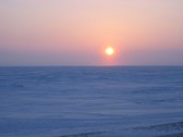
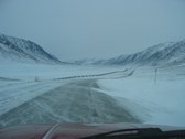
1
Mile post ZERO
This is the pipeline leaving Pump Station One heading south
| 
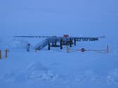
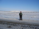
2
Pump Station One
-25F and as always a 20 knot wind
| 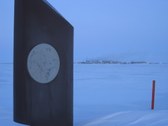
3
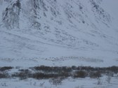
Demarcation line
This marker is the demarcation between the British Petroleum and ARCO now Phillips Petroleum side of the oil field. Its shaped like a wing to keep snow from drifting behind it and across the spine road. That is Pump One in the background
| 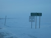
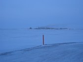
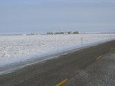
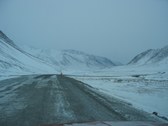
4
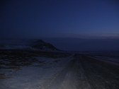
Heading south
This sign is down the road a spell from Deadhorse.
|
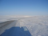
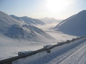
5
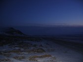
ANWR
Looking east across the Sag river and onto ANWR. Its a "thing of beauty" eh? This is the "pristine" wilderness the environmentalists dont want to "destroy". Belive me the caribou would'nt miss the few acres needed for a oil production facility. Caribou actually use gravel roads and runways to get away from mosquitos in the summer. I have seen times in summer when caribou have been herded off of a runway so an airplane could land.
| 
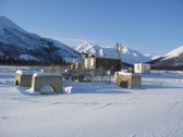
6
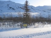
PS 2
Now shut down and in standby. Thru the use of drag reducing agent aka DRA, five of the original pump stations have been shut down and the pipeline is still able to thruput a million barrels a day---possibly more.
| 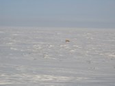
7
Red Fox
They survive on lemmings and birds.
| 
8
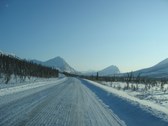
Looking North
Between PS3 and PS2. It seems to go on forever----
|
9
Lori Creek
Paul Eckman at Lori Creek. Named for Lori Howard in the days before the pipeline. She still works for Alyeska Pipeline Service Co., the operator of the pipeline
| 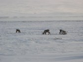
10
Caribou
Digging for lichen
| 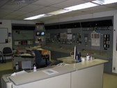
11
Pump Station Control Room
Each PS has three mainline pumps driven by Rolls Royce turbines. Pump Stations One, Three and Four are fed by a gas line from the Prudhoe Bay field. The rest are fired by turbine fuel. The whole Pipeline is controlled from OCC (Operations Control Center) in Valdez by microwave and fiberoptic cable. It truely is an engineering marvel!
| 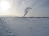
12
PS 3 @ -30F
Shes plenty cold by the signs left by vapor
|
13
Caribou
They are hardy animals that never leave the North Slope
| 
14
s4000012
| 
15
Slope Mountain
Day break with PS 3 lights at center
| 
16
PS 4
This Pump Station has the job of getting the oil over Atigun Pass, the high point in the Brooks Range. From here its 301 miles to the next pumps at PS 7.
|
17
North to PS 4
| 
18
Atigun River drainage
It was blowing pretty good and building. They declared a "Category three" condition at PS 4 when we arrived and couldnt go on that day.
| 
19
Atigun Pass in the Brooks Range
Heading south on the north slope side. This is the continental divide. The pipeline is all barried and encased in concrete for several miles here.
| 
20
Atigun Pass in the Brooks Range
Over the top and looking down on the headwaters of the Dietrich and Chandalar Rivers
|
21
The Farthest North Tree
After dropping off of the Chandalar shelf. Its the first "tree" as we head south, over Atigun Pass. Vandals have ringed the tree so we'll have to pick another soon. Everything north of this is brush.
| 
22
Remote Gate Valve
There are approximately 60 RGV's on the pipeline. These are basically a battery, motor control and communications for the valve. The battery charger in these remote units is powered by propane and are twin 252 volt minature three phase AC generators that is rectified to DC as the valve motor is 250 Volts DC. The units closer to town and commercial power have a propane generator and a AC to DC battery charger
| 
23
Wiehl and Poss Mountains
| 
24
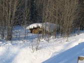
Gold Creek
My Dad spent some time in this cabin while prospecting for gold in the Wiseman mining district in 1947,long before anyone thought of a road or oil. Now its right beside the haul road.
|
