
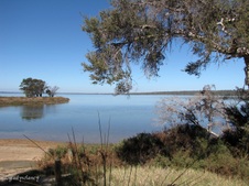
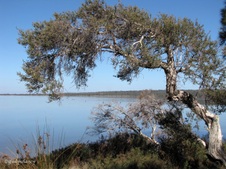
1
Approaching Lake Clifton
Situated within Yalgorup National Park, Lake Clifton is very salty, long and narrow and abounds with a variety of bird life.
| 
2
Lake Clifton in Yalgorup National Park
The lake provides a temporary home to hundreds of migrating birds, many of which travel great distances to breed.
| 
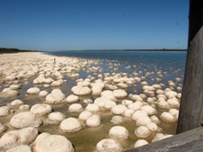
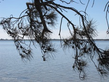
3
Blue Waters of Lake Clifton
Lake Clifton supports a thrombolite reef over 6km long and up to 120m wide, possibly the largest living thrombolite reef in the southern hemisphere.
|

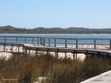
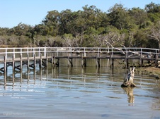
4
Boardwalk
A board walk leads out over the lake for easy viewing of the thrombolites.
| 
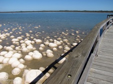
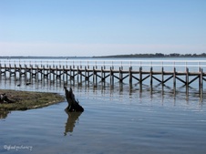
5
Boardwalk over Thrombolites
On 28 January 2010, the thrombolites in Lake Clifton were declared endangered under the Environment Protection and Biodiversity Act.
| 
6
Thrombolites at Lake Clifton
Thrombolites, 'living rocks', are the most common form of microbialites, which are rock-like structures built by micro-organisms.
|

7
Thrombolites along the eastern bank of Lake Clifton
One of the few places in the world where the thrombolites grow is at Lake Clifton in Western Australia's Yalgorup National Park which is located 32 kilometres south of Mandurah.
| 
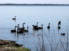
8
Thrombolites viewed from the Boardwalk
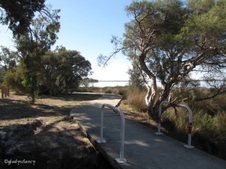
The lake is also one of only two sites known where microbialites occur in water less salty than sea water.
| 
9
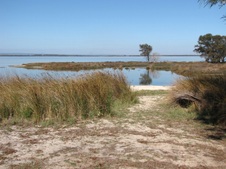
Looking down on the Thrombolites
The lake contains the largest lake-bound microbialite reef in the southern hemisphere which is over 6kms long and widens in parts to 120m.
|

10
Thrombolites large and small
The thrombolite structures reach heights of up to 1.3m.
| 
11
More Thrombolites
Stromatolites and thrombolites are created by algae and represent the earliest record of life on earth.
| 
12
Thrombolites below the Boardwalk
Thrombolites are formed when the micro-organisms photosynthesise.
|

13
Visitors at the end of the Boardwalk
During this processs they are able to precipitate calcium carbonate from the waters of the lime-enriched lake to form the rock-like structures.
| 
14
Eastern Bank of Lake Clifton
Luckily Lake Clifton has an abundance of fresh ground water which is high in calcium carbonate providing the perfect environment.
| 
15
Lake Clifton's Thrombolites
Thrombolites have an internally clotted texture and are formed by blue-green bacteria trapping sediment particles.
|

16
The Boardwalk
Thrombolites and stromatolites were the only known form of life on Earth some 350 to 650 million years ago.
| 
17
Edge of the Boardwalk
Microbes found in both thrombolite and stromatolite formations are believed to be responsible for oxygen production which allowed life to exist on the planet.
| 
18
Thrombolite Reflections
Thrombolites are the most common form of microbialites and are formed by a variety of micro-organisms. They grow at an average of 1mm a year.
|

19
Molly enjoying a day out in the sunshine
| 
20
Inland view from Boardwalk
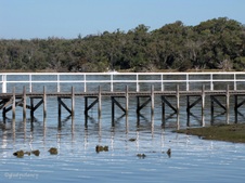
The water has receeded leaving these Thrombolites high and dry.
| 
21
Shallows of Lake Clifton
|

22
Boardwalk over Thrombolites
| 
23
Yalogorup National Park
The name Yalgorup is a composite of the Aboriginal words ‘yalgor’ (swamp or lake) and ‘up’ (a place).
| 
24
View across Lake Clifton
|

25
The Bend in the Boardwalk
| 
26
Another view of the Thrombolites
| 
27
Rushes beside the Boardwalk
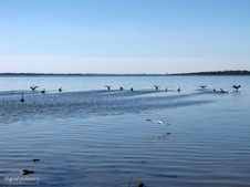
|

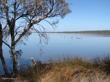
28
Black Swan on Lake Clifton
Indigenous birds that come to Yalgorup every year to feed and breed include:- Black Swans, Australian Shelducks, Banded Stilts, Red-capped plovers, Crakes, Australian Crakes, Australian Reed-Warblers, Pacific Black Ducks and Hooded Plovers.
| 
29
Lake Clifton through the Trees
The Ramsar wetlands of the Yalgorup Lakes System are also the breeding, moulting and feeding grounds for thousands of endemic and migratory birds each year.
| 
30
Walking back to the Car Park
Yalgorup is a 12,888 hectare national park situated between Mandurah and Bunbury - a narrow coastal strip of land that includes Lake Clifton and Lake Preston and seven other minor lakes.
|

31
Looking back along track to Thrombolites
Thrombolites are 100 m from the Car Park.
| 
32
Natural Vegetation of Yalgorup National Park
Flora includes coastal heaths, tuart woodlands, paperbark swamps, mixed eucalypt woodlands and sedge swamps.
| 
33
Leaving the Car Park
Fauna within the park includes Grey Kangaroo, Brush Wallaby, emus, Whistling Kite, Horny Grebe, Black Swan, Rock Parrot, Sacred Kingfisher, Red Kneed Dotterel, Red Capped Dotterel and Hooded Dotterel.
|

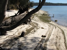
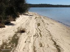
34
Island Point Reserve
A short drive to a lovely picnic spot at Island Point Reserve on the Peel Estuary.
| 
35
Peel-Yalgorup System, Wetlands of International Importance
The Convention on Wetlands of International Importance, called the Ramsar Convention, is an intergovernmental treaty that provides the framework for national action and international cooperation for the conservation and wise use of wetlands and their resources.
| 
36
Tranquil Scene on Harvey Estuary
Peel-Harvey has traditionally been seen as one estuary. However, the Water and Rivers Commission of WA has now classified it as two separate estuaries (Peel Inlet and Harvey Estuary) so that each one is linked to the River Basin from which it drains.
|

37
Track around the Point
| 
38
Small Islands in Harvey Estuary
| 
39
Black Swans on the Estuary
|

40
Zoomed to Black Swans and House on the Hill
| 
41
Molly looking for Fish
| 
42
Vegetation at the Water's Edge
|

43
White Egret in the Water
| 
44
Another White Egret flew by
| 
45
And Landed in the Tree!
|

46
Reflections
| 
47
Foreshore Stabilisation
The Council's Foreshore Rehabilitation Officer co-ordinated construction and installation of foreshore stabilisation Island Point with the help of Green Corp’s. 85 metres of coir logs have been installed along the northern tip of Island Point with the help of Green Corp’s and the Council's bushland maintenance crew.
| 
48
Trees on the Island
|
49
Sheoak Branch overhangs the Water
Seed capsules indicate it is a female tree.
| 
50
Base of the Sheoak grips the Sand
| 
51
Tidal marks at Water's Edge
|
52
Patterns on the Sand
| 
53
A Place to Rest
| 
54
Sandy Bank
|

55
Harvey Estuary
Point Grey on the horizon.
| 
56
Popular Spot for Crabbing
| 
57
Framed by Trees
|

58
Northerly view of Harvey Estuary
| 
59
Looking towards Peel Inlet
| 
60
Black Swans (Cygnus atratus)
|
61
Scenic View from Island Point Reserve
| 
62
Melaleuca near Water's Edge
| 
63
Shady Picnic Spot
Island Point Reserve.
|

64
Southerly view from Island Point Reserve
| 
65
Upright view
| 
66
Framed by Melaleuca
|

67
Easterly View from Island Point Reserve
| 
68
Rushes provide habitat for Waterbirds
| 
69
Ball of Mistletoe
|

70
Stabilisation Logs around Tree
| 
71
Seat with a View
| 
72
Twisted Melaleuca and Reeds
|

73
Time to continue the Journey
| 
74
Cycleway along Estuary Road Dawesville
| 
75
Shady Parking at Dawesville Picnic Place
|

76
Startled Black Swans
| 
77
Black Swans skimming the water
| 
78
Dawesville Jetty
|
79
Jetty at Dawesville
| 
80
Seagulls on the Jetty
| 
81
Vegetation to Water's Edge
|

82
Curved Dawesville Jetty
| 
83
Jetty Reflections
| 
84
Dawesville Jetty Landing
|

85
Looking into the Water of Harvey Estuary
| 
86
Catamaran on the Water
| 
87
Zoomed to House and Private Jetty
|

88
Melaleucas grow to Water's Edge
| 
89
Stump in the Water
| 
90
That Stump from another angle
|
91
A Fallen Melaleuca
| 
92
Reflections
| 
93
Tidal Bank of Harvey Estuary
|
94
Dawesville Jetty on Harvey Estuary
The Peel Inlet is beyond the long land mass of Point Grey.
| 
95
Algae on the Rocks
The major problem in the rivers and estuary is an excess of phosphorus from rural and urban land use practices entering from the catchment and feeding the growth of algae. Urban areas currently account for only 6% of the catchment, but contribute more than 20% of phosphorus. Unsewered urban areas have a big impact, contributing 17% of phosphorus in winter.
| 
96
Scenic View
|

97
View from the Bank
| 
98
The Water's Edge
| 
99
Rushes in the Foreground
|

100
Framed by Vegetation
| 
101
The Black Swans have returned
Note the Seagull having a bath!
| 
102
Bathing Seagull surrounded by Black Swans
|

103
Swans watch as the Seagull bathes
| 
104
That Seagull is not finished yet!
| 
105
Black Swans are loosing interest
|

106
Two Seagulls on the Jetty Railing
| 
107
That Seagull is still enjoying his bath
| 
108
Harvey Estuary from the Cycleway
|

109
Estuary beyond the Trees
| 
110
Eucalyptus Trees on the other side of the road
| 
111
Public Barbeques for a Picnic
|

112
Heading back to the Car
| 
113
Shadows over the cycleway
Time to head home after a lovely day enjoying the natural beauty of this section of the Peel-Yalgorup System.
| |
