Adults on this trip:
Cascade Bill Mooseker, Charlie Walker
Scouts on this trip:
Jason Smith, Adam Phillips, Matt Perry, Carl Douglass, Cary "Chip" Walker, Eric Walkingshaw, Bobby Hinnencamp
I planned this trip to do the "Golden Loop" as featured in the 101 Hikes Guidebook. Unfortunately, the snow had not completely melted over the Angel Staircase part of the trail so I decided not to risk it. Instead I decided to do an out and back trip to Cub Lake over Horsehead Pass on the Chelan Summit via the Eagle Lakes Trail, visiting Lower Eagle Lake going in and Upper Eagle Lake on the way out.
The descriptions under the photo thumbnails in the album sometimes contain links to maps or additional information. These are identified by "Blue” text for links.
Note: I have added map images for each day of the hike from online CalTopo maps. Links to the online Caltopo Maps can be found in the description under the map image thumbnails. CalTopo gives the option of viewing the online map using several different base layers. Use the right sidebar "Layer" entry to choose the layer displayed as follows: CalTopo Mapbuilder (T), Hybrid (H), Imagery (I), Scanned Topos (U), and Forest Service Maps. (values in parentheses are keyboard shortcuts for those layers). If you are a Caltopo suscriber, you may also view the map using current Google Satellite Maps. This can be problematic as the satellite image may show the area covered with snow. In that case, use the Imagery layer or the method described below.
The routes and waypoints shown on the Caltopo online maps can be exported to KML (Google Earth) and GPX formats (edit with notebook+ to replace "><" with ">\n<" to properly format text). These can be imported into Google Earth. With "historical imagery" checked in the "View" menu, you can usually find an non snow covered image of the area.
I have also added a table for miles traveled, elevation gains. and losses for each day of the hike as well as cumulative gains and losses for the trip. An explanation of how I have derived the distances and elevation gain/losses can be found HERE.
Map images are best viewed at "Original" size. To view at "Original" size, click on Thumbnail to enlarge the map, then click again to access the original resolution. Move the cursor to the point on the map that you want to enlarge and then click the cursor to zoom in or out.
Troop 24 "The High Adventure Troop"
-Cascade Bill Mooseker
Date(s): July 1996. Album by Cascade Bill. 1 - 35 of 35 Total. 79 Visits.
enlarge 354KB, 1024x702 1 pics 1
To enlarge photos, click on the thumbnail - the photo will pop up enlarged to 1024 pixels max (height or width). To view at Original size (best for maps, etc.), Ctrl-Click on the Photo, and finally a 3rd click to enlarge to the original resolution. Click again to reduce back to fit the screen again.
If you want to save photos to your computer, click the box under the thumbnails of all the photos you want to download (or check the "select all" box at the bottom of the album). Then click the "Download" button at the top of the album. Pick the size you'd like to download (Original is best)and the photos will be downloaded as a zip file to the folder of your choice.
enlarge 315KB, 1024x758 2 Chelan Bugout 1996 Day 1 Caltopo Map for Day 1 - Trailhead to Lower Eagle Lake Online map can be found HERE
It's a long drive to get to the Eagle Lakes trailhead whether you go the northern route over the North Cascades Highway or HWY 2 over Stevens Pass. The final climb up to the trailhead always taxes my 1985 Camry (The Gray Ghost aka The Silver Bullet) and to avoid overheating you have to turn on the heater, which becomes unbearable as the summer temperature along the drive is hot, hot, hot!
enlarge 196KB, 1024x827 3 96chelan day 41
Tabulation of miles and elevation gain/loss for Day 1 from the trailhead to Lower Eagle Lake. Note that the waypoints refer to those shown on the map.
Although fairly short in miles the heat and the nearly 2100 feet of elevation gain made for a long day while carrying the heaviest packs of the trip.
enlarge 337KB, 1024x666 4 96-270-013 At Eagle Lakes Trailhead Chip, Eric, Bobby, Adam, Jason, Matt, Charlie
enlarge 290KB, 1024x672 5 96-270-014 Carl, Charlie, and Bobby
I think this photo was taken at the waypoint "SWB 5720" on the Caltopo Map. Peak in background is Peak 8033.
enlarge 288KB, 1024x681 6 96-270-015 Charlie
This is on the old Lower Eagle Lake trail. In order to lessen impact on the lake by motorcycles the old trail, which first went to Lower Eagle, was replaced by a new superhighway that goes to Upper Eagle first. This is easily circumvented by hikers if they find where debris was placed on the old trail to disguise it. These obstacles can be climbed over with little effort and the old trail followed down to the lake.
enlarge 342KB, 1024x758 7 Chelan Bugout 1996 Day 2 Caltopo Map for Day 2 - Lower Eagle Lake to Cub Lake Online map can be found HERE
After the relentless climbing of the previous day, Day 2 although a little longer had about one half of the elevation gain while it passed through some of the most scenic portions of the Chelan Summit Trails.
enlarge 269KB, 1024x1006 8 96chelan day 42
Tabulation of miles and elevation gain/loss for Day 2 from Lower Eagle Lake to Cub Lake
The camp a Lower Eagle Lake features a large camp table made of stone as seen here.
enlarge 262KB, 1024x676 10 96-270-017 Cary, Eric, Jason, Adam, Bill, Matt, and Bobby (Carl in foreground)
The guys here are laughing as I'm giving Adam a hug after telling a joke at his expense
enlarge 255KB, 1024x676 11 96-270-018 Getting ready to leave camp
enlarge 263KB, 1024x676 12 96-270-019 Carl checking his pack - you can see the lake from our camp
enlarge 215KB, 1024x670 13 91-191-032 Lower Eagle Lake
enlarge 254KB, 690x1024 14 96-270-020 View of Horsehead Pass from Lower Eagle Lake
enlarge 271KB, 1024x677 15 96-270-021 Guys on the trail above Lower Eagle Lake with Horsehead Pass above
The old trail out of Lower Eagle Lake winds around the north side of the lake and then climbs steeply to meet the main trail about .3 mi beyond the cutoff trail to Upper Eagle lake. This is a scenic stretch and one which Andrew and I will never forget as we saw a dead horse by the side of the trail on here in 1991
enlarge 326KB, 1024x676 16 96-270-022 Charlie on the Eagle Lakes Trail
After climbing the meadows above Lower Eagle Lake, the old trail joins the main Eagle Lake trail as it switchbacks up to Horsehead Pass
enlarge 234KB, 1024x682 17 96-270-023 Carl and Bobby
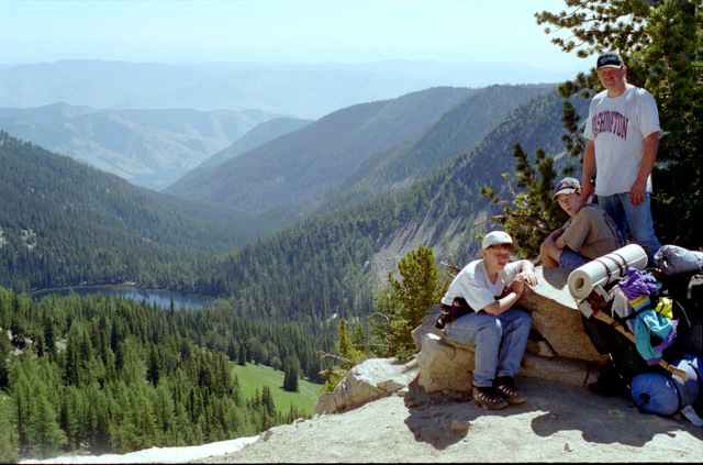
enlarge 225KB, 1024x673 18 96-270-024 Looking South from Horsehead Pass
enlarge 248KB, 1024x676 19 96-270-025 Bobby, Cary, and Charlie at Horsehead Pass. Below is Lower Eagle Lake.
enlarge 228KB, 1024x681 20 96-270-026 Looking North from Horsehead Pass
Eric and Jason climbed this peak (8180 ft) to peer down on Upper Eagle Lake, while the rest of us were content to soak up some rays and enjoy the scenery. This was about .4 of a mile up and back with about 640 feet of elevation gain.
enlarge 294KB, 681x1024 21 96-270-027 Carl, Bobby, & Charlie
Descending from Horsehead Pass with a couple of long switchbacks, the trail enters the larch covered basin that contains Boiling Lake seen here.
Boiling Lake with the spectacular ridge above. Having camped here before, I must say that the only thing "boiling" here are the mosquitoes.
enlarge 292KB, 1024x677 23 96-270-029 Charlie heading down the Cub Lake trail just past Junction Camp
After dropping down from Boiling Lake, the Eagle Lakes trail ends at the Junction with the Chelan Summit Trail at one of my favorite campsites (I call it the Junction Camp). I much prefer it to camping at Boiling lake as it has much fewer mosquitoes.
enlarge 264KB, 1024x678 24 91-191-023 On the way down you get this peekaboo view of Cub Lake way below
enlarge 340KB, 1024x758 25 Chelan Bugout 1996 Day 3 Caltopo Map for Day 3 - Cub Lake to Upper Eagle Lake Online map can be found HERE
Basically a repeat of Day 2, but in the opposite direction but continuing on to Upper Eagle Lake. It was a much rougher day as we would be ascending rather than descending from Horsehead Pass.
enlarge 251KB, 1024x963 26 96chelan day 43
Tabulation of miles and elevation gain/loss for Day 3 - from Cub Lake to Upper Eagle Lake
enlarge 259KB, 1024x682 27 96-270-030 Charlie, Carl, Jason, Chip, Adam, Matt, Eric, and Bobby Preparing to leave our camp at Cub Lake.
enlarge 221KB, 1024x677 28 96-270-031 Carl, Jason, Charlie, Matt, Bobby, Chip, and Eric
Taking a break at the Junction Camp after the long climb up from Cub Lake. The metal firepit here reminds the backpacker that his trail is a motorcycle route and is not wilderness area.
enlarge 360KB, 1024x679 29 96-270-032
Heading up one of the long switchbacks above Boiling Lake. If you enlarge the image, you can see the guys on the trail just to the left of center.
enlarge 317KB, 678x1024 30 Chelan Bugout 1996 Day 4 Eric, Bobby, & Charlie
This is near where the spur trail takes off for Upper Eagle Lake.
enlarge 318KB, 1024x758 31 Chelan Bugout 1996 Day 4 Caltopo Map for Day 4 - Upper Eagle Lake to the Trailhead Online map can be found HERE
enlarge 238KB, 1024x934 32 96chelan day 44 Tabulation of miles and elevation gain/loss for Day 4 - Upper Eagle Lake to Trailhead
It should have been an easy day to hike out to the cars, but somehow Eric, rather than continue down the main Eagle Lakes trail, went back to the Lower Eagle Lakes trail. We were almost to the end of the trail when we discovered he was missing. Several of us went back up the trail searching. Eventually, he found himself on the right trail. But Charlie and I as the adults were pretty upset when we found out he was missing.
enlarge 321KB, 1024x789 33 96-270-034 Camp at Upper Eagle lake Charlie and Adam pumping water for the day
enlarge 236KB, 1024x682 34 96-270-035 Matt, Carl, and Bobby getting ready to head out
enlarge 225KB, 1024x723 35 96-270-036 Adam getting his pack together (My pack in the background)