enlarge 64KB, 800x533 1 ut05-d3-001r Shelby - we spent our second night at the confluence of Bullet Canyon and Grand Gulch. Camps here are hard to come by because of the number of parties.
enlarge 74KB, 800x533 2 ut05-d3-002r Eric - you can see it was a cold morning. There was a rain shower just before we got up.
enlarge 66KB, 800x533 3 ut05-d3-003r Dan
enlarge 90KB, 800x533 4 ut05-d3-004r Dan & Bill
enlarge 76KB, 800x533 5 ut05-d3-005r Shelby
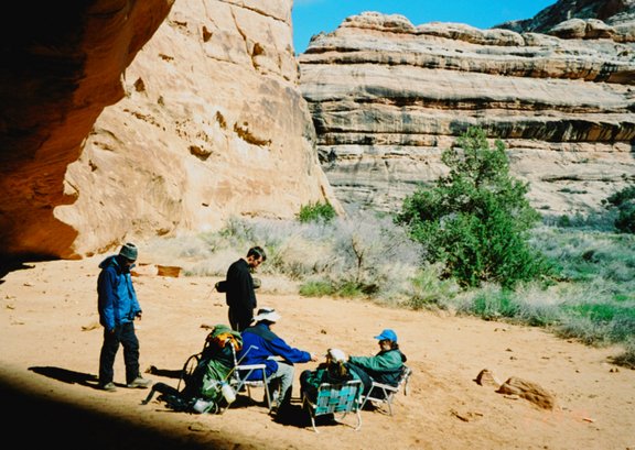
enlarge 121KB, 800x533 6 ut05-d3-006r A few laughs despite the cloudy skies and cold morning.
enlarge 65KB, 800x533 7 ut05-d3-007r Allison
enlarge 148KB, 800x533 8 ut05-d3-008r Drying the gear as much as we can before we head out.
enlarge 113KB, 800x533 9 ut05-d3-009r General mayhem of the camp - note the color of the water in the jugs.
enlarge 98KB, 800x533 10 ut05-d3-010r Feet - note the mud.
enlarge 75KB, 800x533 23 ut05-d3-020r More Branches - Roger.
enlarge 148KB, 800x533 24 ut05-d3-021r This is the confluence: Bullet on the Left and the Gulch on the right. Our camp was just to the left of the photo.
enlarge 82KB, 568x800 25 ut05-d3-022b Heading up GG above Bullet - I was following a trail (the wrong one apparently) when I stepped on a low branch that broke and before I knew it I was rolling down the bank and ended up in the creek. Luckilly, I was able to extricate myself from the mud with only wet clothes and bruised dignity.
enlarge 114KB, 800x598 26 ut05-d3-023a1 Eric - "Stairsteps" in the slickrock just below Green Mask Canyon.
enlarge 88KB, 800x598 27 ut05-d3-023a2 Eric
enlarge 99KB, 800x568 28 ut05-d3-023b This section of slick rock was the only place where there was no flow in the wash. This is a very scenic section just below Green Mask (Sheik's) Canyon.
enlarge 122KB, 568x800 29 ut05-d3-024b Allison and Eric: Nice wide spot in the canyon at the junction of Green Mask Canyon with GG. Several nice camp spots here (Water available at Green Mask Spring).
enlarge 127KB, 598x800 30 ut05-d3-025a2 Eric climbing up to view the Green Mask Panel
enlarge 120KB, 800x598 31 Green Mask Pictograph Panel Grand Gulch ut05-d3-025a3 Pictographs at Green Mask Panel
enlarge 126KB, 800x568 32 ut05-d3-025b Unusual style of figures at the Green Mask Panel - don't know what happened to the heads of these female figures.
enlarge 110KB, 800x568 33 ut05-d3-026b Note figure of woman giving birth at left.
enlarge 96KB, 800x568 34 ut05-d3-027b Eric at panel.
enlarge 101KB, 800x598 35 ut05-d3-028a1 Another view of Eric
enlarge 146KB, 800x598 36 ut05-d3-028a2 Allison at an unusual pictograph at fire blackened rock.
enlarge 137KB, 800x598 37 ut05-d3-028a3 Eric - looking up Shiek's Canyon.
enlarge 112KB, 800x598 38 ut05-d3-028a4 Bill - exploring Green Mask pictograph panel.
enlarge 103KB, 800x598 39 ut05-d3-028a5 View of old pictographs at the Green Mask panel - note that the rock face has fallen down after the panel figures were made.
enlarge 92KB, 800x568 40 ut05-d3-028b These very old pictographs are much less complicated than the later Basketmaker ones. Note that a large portion of the wall below these pictographs had collapsed after the pictographs were made. There is no way to access this rock face now as it is 25-30 feet above the canyon floor.
enlarge 113KB, 800x596 41 ut05-d3-029b These later figures are below those in the previous picture - note the stylish headdresses and turkeys - at this point I ran out of film (same as in 2002) and I didn't get a photo of the Green Mask for which this panel is named.
enlarge 73KB, 598x800 42 ut05-d3-030a1 Green Mask - Zoom in for best view. This pictograph is very high and not approachable.
enlarge 89KB, 800x568 43 ut05-d3-030b After the first couple of days, the travelling is much easier above the Bullet/GG junction - although there was still water in the wash, but for the most part the wider canyon and heavier traffic provided more developed foottrails which were much easier going.
enlarge 96KB, 800x533 52 ut05-d3-039r Roger's pack in full lawn chair extended mode.
enlarge 118KB, 800x533 53 ut05-d3-040r Another view.
enlarge 132KB, 587x800 54 ut05-d3-041b A small pouroff - the clouds were gathering.
enlarge 125KB, 800x568 55 ut05-d3-042b This is a very scenic stretch of the canyon.
enlarge 104KB, 800x598 56 ut05-d3-044a1 Alcove where we had lunch.
enlarge 120KB, 800x568 57 ut05-d3-044b The rain finally came and we donned our raingear and took shelter under this alcove for lunch. About five minutes after the heaviest of the rain the sun came out and the sky cleared. There was a small cascade of water running off the top of the alcove that made a beautiful rainbow as the drops broke up on their way down.
enlarge 134KB, 800x598 58 ut05-d3-045a1 Roger, Danny, and Eric playing cards at lunch.
enlarge 110KB, 568x800 59 ut05-d3-045b These ruins are on top of a large overhanging alcove. There didn't appear any way to access them.
enlarge 118KB, 568x800 60 ut05-d3-046b There was still water flowing in the wash - very beautiful scene.
enlarge 87KB, 568x800 61 ut05-d3-047b Another beautiful scene.
enlarge 121KB, 800x533 62 ut05-d3-048r Split Level Ruin - note ruins on upper ledge which looked completely inaccessible.
enlarge 110KB, 800x568 64 ut05-d3-050b View of ruins on upper ledge.
enlarge 152KB, 800x598 65 ut05-d3-051a1 Eric at Split Level Ruin.
enlarge 99KB, 800x533 66 ut05-d3-051r Small ruin part of Split Level complex.
enlarge 101KB, 800x598 67 ut05-d3-052a1 Allison at Split Level Ruin.
enlarge 65KB, 800x598 68 ut05-d3-052a2 Allison
enlarge 86KB, 800x533 69 ut05-d3-052r Interior view of small ruin.
enlarge 68KB, 800x533 70 ut05-d3-053r Another view of the floor of the small ruin.
enlarge 109KB, 800x533 71 ut05-d3-056r Another small ruin in the Split Level complex - note roof construction supporting upper masonry.
enlarge 118KB, 800x533 72 ut05-d3-057r Another Ruin - probably a granary- with stone for sealing opening.
enlarge 115KB, 800x533 73 ut05-d3-058r Main Split Level Ruin: notice floor construction as well as combination of stone masonry with stick and mud daubed over branch construction. This must have been an interior wall at one time.
enlarge 129KB, 800x533 74 ut05-d3-059r Close up of Split Level Ruin.
enlarge 129KB, 568x800 140 ut05-d4-014b These are the extensive ruins in this alcove. I met a group of young Native Americans from Arizona who were on a backpacking trip. They were waiting by the trail for their leader who was exploring the ruins.
enlarge 127KB, 800x568 141 ut05-d4-015b Close up of a ruin in this alcove - the roof has collapsed but you can get a good idea of the construction used.
enlarge 111KB, 533x800 142 ut05-d4-016r Natural Arch just down canyon from Turkey Pen Ruin.
enlarge 113KB, 533x800 143 ut05-d4-017r Shelby and Natural Arch.
enlarge 96KB, 800x580 144 ut05-d4-018b Close up of natural arch.
enlarge 135KB, 568x800 145 ut05-d4-019b Another view of Natural Arch.
enlarge 85KB, 800x533 146 ut05-d4-020r Extreme closeup of Natural Arch.
enlarge 134KB, 588x800 147 ut05-d4-021b After a bend at the Natural Arch and a squeeze through a narrow section, the Turkey Pen Ruin comes into view.
enlarge 95KB, 800x533 148 ut05-d4-022r Lower end of the Turkey Pen Complex - this is a huge alcove that ramps up around the bend in the canyon.
enlarge 114KB, 800x533 149 ut05-d4-024r View of floor/roof construction.
enlarge 108KB, 800x533 150 ut05-d4-025r Small ruin at the base of the Turkey Pen complex. Note fire blackened walls
enlarge 92KB, 800x568 151 ut05-d4-026b Another view of small ruin - note stones for sealing entrances.
enlarge 105KB, 800x533 152 ut05-d4-027r Detail of small ruin - structure to the left has been removed. Note difference in construction of inner and outer walls.
enlarge 104KB, 800x533 153 ut05-d4-028r Roof of small ruin.
enlarge 116KB, 800x533 154 ut05-d4-029r Roof of small ruin showing location of another interior wall.
enlarge 63KB, 800x533 155 ut05-d4-030r Inside view of small ruin showing interior wall.
enlarge 93KB, 533x800 156 ut05-d4-031r Another view inside small ruin showing another interior wall.
enlarge 82KB, 800x533 157 ut05-d4-032r More ruins as we go up the wide ramp of the ledge.
enlarge 90KB, 800x533 167 ut05-d4-043r This sign was not here in 2002 and climbing up to the upper level was permitted then. There was a register tablet in an ammo can where visitors could comment on their visit. One commenter stated that he had visited the area in the 1960's and that there used to be a lot of artifacts around the sites and there had been a lot of damage over the years.
enlarge 120KB, 800x568 168 ut05-d4-047b Structures on upper level - note entrance on right and "bridge" just to left of center.
enlarge 122KB, 800x568 169 ut05-d4-048b Close up of bridge - logs have been bound together with yucca rope.
enlarge 98KB, 800x533 170 ut05-d4-048r Above is the entrance opening for access to the upper level.
enlarge 123KB, 800x568 171 ut05-d4-049ab This close up of the entrance shows why the BLM have closed the upper area - the more people use the projecting timbers for handholds could lead to collapse of the wall.
enlarge 103KB, 568x800 172 ut05-d4-049b Ruin on the upper level of the Turkey Pen complex.
enlarge 96KB, 568x800 173 ut05-d4-050b View of the upper level ruin.
enlarge 106KB, 800x533 174 ut05-d4-050r Roger's close up of the upper level ruins.
enlarge 97KB, 800x533 175 ut05-d4-051r pottery shards and other remnants.
enlarge 133KB, 800x568 176 ut05-d4-052b Pictographs at Turkey Pen. The rock here had a lot of efflorescense so paintings were not as crisp as in other panels.
enlarge 113KB, 568x800 177 ut05-d4-053b More pictographs at Turkey Pen.
enlarge 126KB, 800x533 179 ut05-d4-055r Note mud daubs thrown on wall - some of these were way up on the wall.
enlarge 101KB, 800x533 180 ut05-d4-056r More pictographs.
enlarge 122KB, 800x533 181 ut05-d4-057r Another view of large pictograph panel.
enlarge 101KB, 800x533 182 ut05-d4-058r These figures have faded.
enlarge 99KB, 800x568 183 ut05-d4-059b These black hand prints were on the back wall of a structure. It looked like a bunch of people had been buried and were frantically clawing their way out. Note charcoal residue on ground.
enlarge 135KB, 800x533 184 ut05-d4-060r The "Turkey Pen". There is no evidence that it was in fact used as a "Turkey Pen" - it looks like a pen and there are turkey pictographs around; so naturally, it became the "Turkey Pen".
enlarge 141KB, 800x568 185 ut05-d4-061b Close up of the Turkey Pen construction. Note lashing of branches together. Not much of the mud "plaster" remains.
enlarge 103KB, 800x568 186 ut05-d4-062b Eric and Bill at the Turkey Pen.
enlarge 105KB, 800x598 189 ut05-d4-063a3 Eric's Turkey Impression or practicing "Friends, Romans, Countrymen - Lend me your ears!"
enlarge 106KB, 800x598 190 ut05-d4-063a4 Eric at the "Turkey Pen".
enlarge 140KB, 800x598 191 ut05-d4-063a5 Pictographs at Turkey Pen Alcove.
enlarge 126KB, 568x800 192 ut05-d4-063b View of the Gulch from the Turkey Pen alcove. Note that the wash still has water in it.
enlarge 158KB, 568x800 193 ut05-d4-064b Eric and Allison taking a break just up canyon from the Turkey Pen.
enlarge 121KB, 800x568 194 ut05-d4-065b The Junction Ruin - these are the upper level of a large ruin complex. It did not appear that this ledge was accessible without severe exposure.
enlarge 131KB, 800x568 195 ut05-d4-066b Another view of the upper ledge of the Junction Ruin. The term "Junction" refers to the fact that the ruins are opposite the mouth of Kane Canyon as it meets the main Gulch canyon.
enlarge 119KB, 800x568 196 ut05-d4-067b There are two large Kivas located on the lower ledge of the Junction alcove. The main support log for this one has been sawed off and placed in the kiva pit. The roof has been completely removed.
enlarge 120KB, 568x800 197 ut05-d4-068b This is the second kiva. The central support log is still in place.
enlarge 118KB, 800x568 198 ut05-d4-069b A granary at the northern edge of the lower ledge.
enlarge 140KB, 568x800 199 ut05-d4-070b looking up canyon from the Junction ruin ledge.
enlarge 122KB, 568x800 200 ut05-d4-071b I hiked up canyon and found this idyllic view. In 2002 we had to go way up the canyon from the Junction to find a stagnant pools with water but in 2005 the wash had flowing water in it.
enlarge 146KB, 800x598 201 ut05-d5-001a Getting ready to head out - Kane Gulch is to the right of photo.
enlarge 147KB, 800x598 202 ut05-d5-002a Eric - ready to break camp.
enlarge 183KB, 800x598 203 ut05-d5-003a Danny
enlarge 142KB, 800x598 204 ut05-d5-004a Heading up Kane Gulch.
enlarge 132KB, 800x598 205 ut05-d5-005a Water flow in Kane Gulch.
enlarge 125KB, 800x598 206 ut05-d5-006a Trail goes through this notch near the top of the Kane Gulch trail.
enlarge 130KB, 598x800 207 ut05-d5-007a Another view of notch.