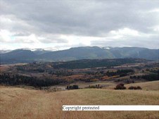
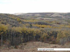
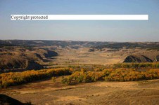
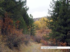
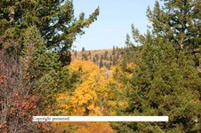
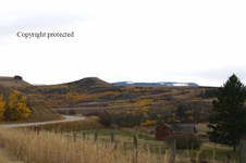
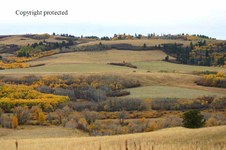
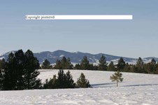
1
PA140007Xcopy
Cotton wood creek coming from Casino creek with Big Snowy Mtns in the back ground - Fall season
| 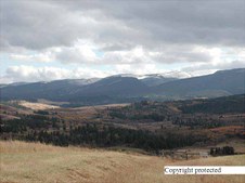
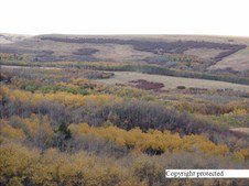
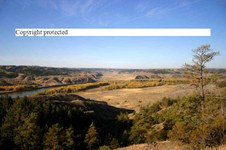
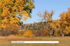
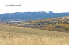
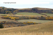
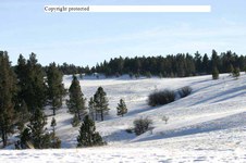
2
PA140008Xcopy
Another vies up cotton wood creek - fall season
| 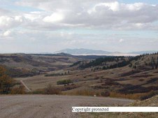
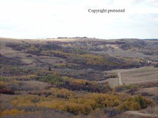
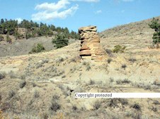
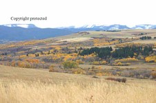
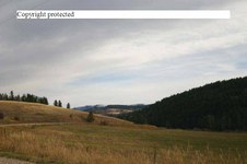
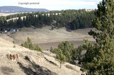
3
PA140009Xcopy
Looking down Castle Creek from the end of the public road
| 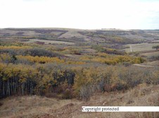
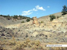
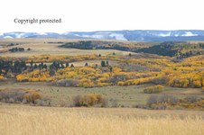
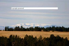
4
PA140010Xcopy
same area
|
5
PA140011Xcopy
same area
| 
6
PA140013Xcopy
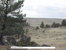
more of the same
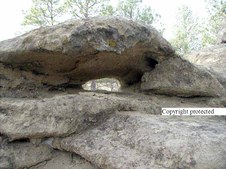
| 
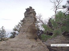
7
PA140014Xcopy
the road I came in on below...
| 
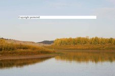
8
PA150001Xcopy
Missouri River bottom from top of hill going into Slipper Anne area
|
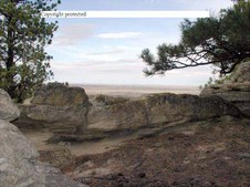
9
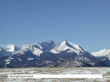
PA150005Xcopy
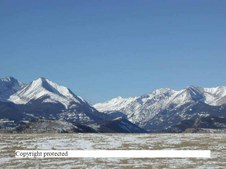
another view
| 
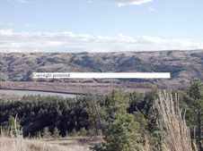
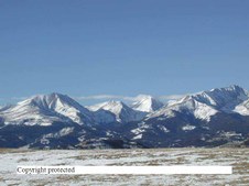
10
106 0661 RT8 copy
Same area
| 
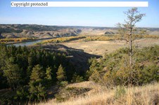
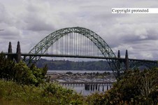
11
106 0662 RT8 copy
Same area
| 
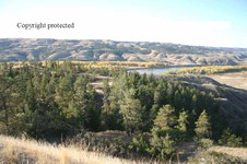
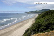
12
106 0667 RT8 copy
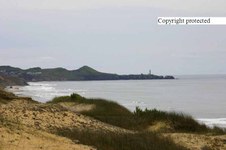
Same area
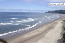
|
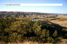
13
106 0668 RT8 copy
Same area
| 
14
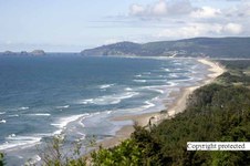
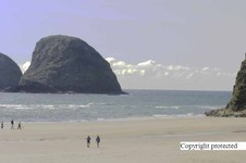
106 0670 RT8 copy
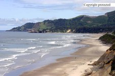
Same area
| 
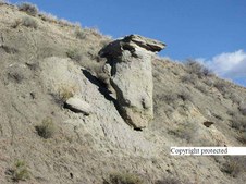
15
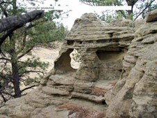
PA150006Xcopy
Close up of rock formation shown earlier
| 
16
PA150007Xcopy
Going into Slippery Anne from hi-way 191 on the Missour River
|
17
PA150009Xcopy
This rock formation looks like it is barely hanging on. This photo was taken Oct. 15, 2000. It's since disappeared. Must have broke up as it slid down the hill. There isn't a trace of it on that hill side. Not sure what happened to it but it's gone.
| 
18
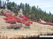
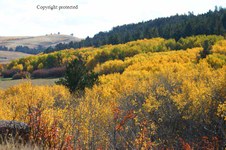
PA218444Xcopy
Nice fall color on a hillside up Casino Creek just out side of Lewistown, MT
| 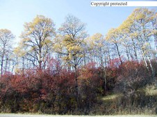
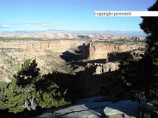
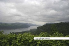
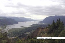
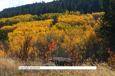
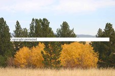
19
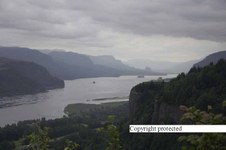
PA218513Xcopy
More Fall color, brush with Aspen/Quakies
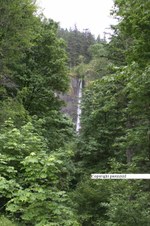
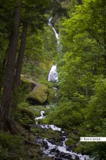
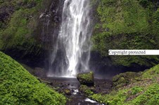
| 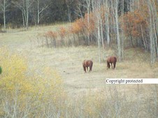
20
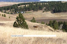
PA228535Xcopy
Two horses in a meadow in thet fall
|
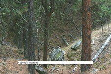
21
PA228548Xcopy
Lookng down a trail I walk up for exercise
| 
22
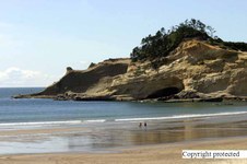
PA250002Xcopy
Bottom of a sand stone type plateau..
| 
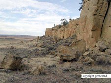
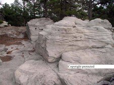
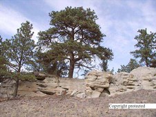
23
PA250032Xcopy
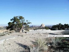
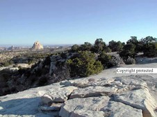
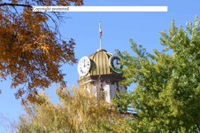
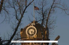
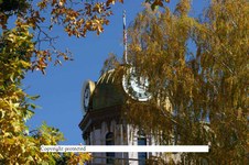
I call this Sand Stone Picture window. it's near Wennett, MT on that Plateau
| 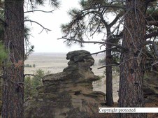
24
PA250046Xcopy
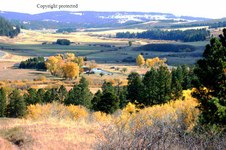
more sand stone formations
|
25
PA250033Xcopy
sand stone formations
| 
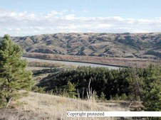
26
PA250051Xcopy
Holes in the sand stone
| 
27
PA250035Xcopy
Tree growing out of sand stone
| 
28
PA250062Xcopy
This tree has roots coming out of the rock below it
|
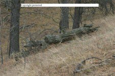
29
Pa250064 copy
Looking down a valley off a flat top butte south of Winnet, Montana a few miles.
| 
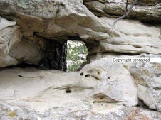
30
PA250077Xcopy
Hole in sand stone
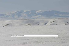
| 
31
PA250087Xcopy
More sand stone
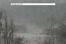
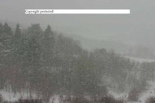
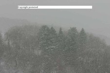
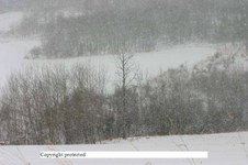
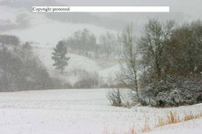
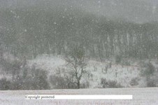
| 
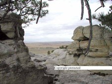
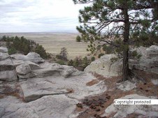
32
Pa250079 copy
Looking at the sand stone formations and onto the plains from the same butte.
|
33
Pa250083 copy
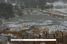
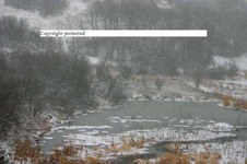
more of the butte
| 
34
PC109188Xcopy
Crazy Mountains by Big Timber, MT
| 
35
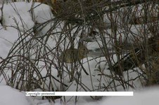
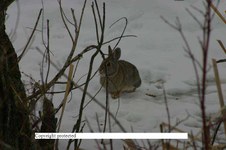
PC109189Xcopy
Crazy Mtns
| 
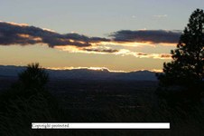
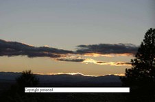
36
PC109190Xcopy
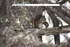
Crazy Mtns
|
37
PIC00086Xcopy
Along 1-70 in Eastern Utah
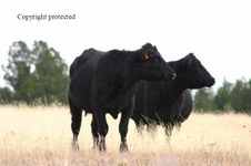
| 
38
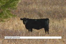
PIC00087Xcopy
Same early morning sun
| 
39
PIC00089Xcopy
same area
| 
40
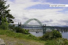
149 4950 RJ copy
Bridge at New Port, Oregon harbor
|
41
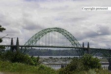
149 4951 RJ copy
| 
42
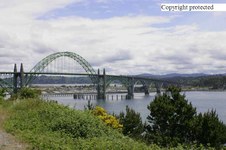
149 4953 RJ copy
| 
43
149 4955 RJ copy
| 
44
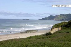
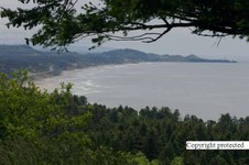
149 4962 RJ copy
Beach close by New Port
|
45
149 4963 RJ copy
Along that beach
| 
46
149 4964 RJ copy
Light House on right ......north of New Port
| 
47
149 4968 RJ copy
Another beach in the area
| 
48
149 4969 RJ copy
same
|
49
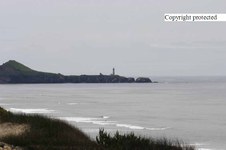
149 4972 RJ copy
Coming closer to the light house north of New Port Oregon
| 
50
149 4973 RJ copy
| 
51
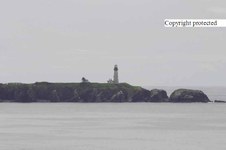
149 4977 RJ copy
The light house is on the right at the end of that finger of land in the distance
| 
52
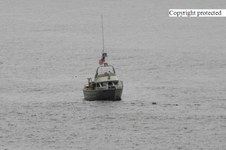
149 4983 RJ copy
Coast Guard boat anchored off shore
|
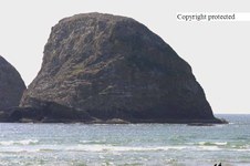
53
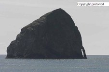
150 5001 RJ copy
Big Rock off shore at Oceanside, Oregon
| 
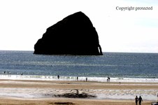
54
150 5003 RJ copy
Beach near the rock
| 
55
150 5006 RJ
Rock again
| 
56
150 5007 RJ copy
same beach
|
57
150 5012 RJXcopy
Parasail
| 
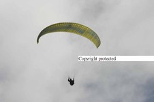
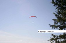
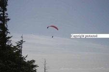
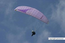
58
150 5013 RJXcopy
Purple one
| 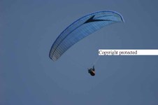
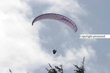
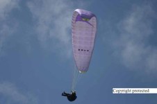
59
150 5014 RJXcopy
Blue Parasail
| 
60
150 5015 RJXcopy
Purple again - they go with the air flow close and over the beach
|
61
150 5016 RJXcopy
Red one
| 
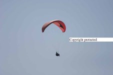
62
150 5019 RJ copy
This is south of Oceanside where they parasail a lot.
| 
63
150 5023 RJXcopy
Red again coming closer
| 
64
150 5024 RJXcopy
In the distance
|
65
150 5025 RJXcopy
headed away
| 
66
150 5026 RJ copy
And there is one now!!
| 
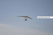
67
150 5027 RJ copy
he circles.....
| 
68
150 5035 RJXcopy
older style
|
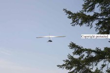
69
150 5036 RJXcopy
he was doing ok
| 
70
150 5044 RJ copy
Another big rock off shore
| 
71
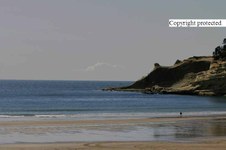
150 5049 RJ copy
There it is again......just off Oceanside, OR
| 
72
151 5137 RJXcopy
Looking up the Columbia River near Crown Point Look out
|
73
151 5142 RJXcopy
Crown Point on the right on top of that rock
| 
74
151 5144 RJXcopy
Past Crown point farther up the Columbian Gorge
| 
75
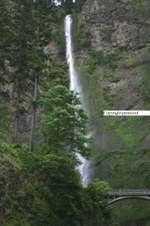
151 5150 RJXcopy
Water fall Before Multinomah Falls
| 
76
151 5151 RJXcopy
Closer look
|
77
151 5159 copy
| 
78
151 5160 copy
| 
79
151 5166 copy
| 
80
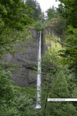
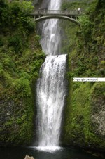
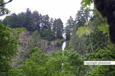
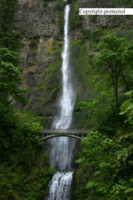
151 5171 RJXcopy
Upper and lower Multinomah Falls
|
81
151 5175 copy
| 
82
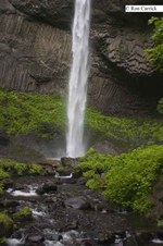
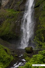
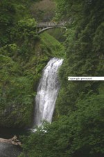
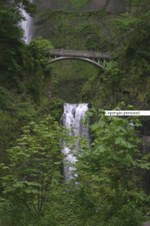
151 5177 RJXcopy
Looking down lower Multinomah Falls from the Bridge
| 
83
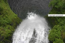
151 5179 RJXcopy
Bottom of upper again
| 
84
151 5181 RJXcopy
Top of Upper
|
85
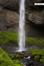
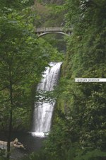
151 5182 RJXcopy
Another view of lower
| 
86
151 5183 RJXcopy
More folage
| 
87
151 5184 RJ.jpg.copy
Again
| 
88
151 5185 RJXcopy
lower with folage
|
89
151 5186 RJXcopy
Upper
| 
90
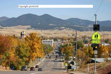
00592 RT8 copy
Looking at down town Lewistown, Montna from main steet hill
| 
91
00595 RT8 copy
Fergus County Court House in Lewistown
| 
92
124 2483 RT8 copy
Court house
|
93
00596 RT8 copy
Court House
| 
94
00576 RT8 copy
Looking up Spring Creek and towards East Fork... just south of Lewistown, MT
| 
95
00580 RT8 copy
Same area up Spring Creek
| 
96
00582 RT8 copy
Same area
|
97
00583 RT8 copy
Same area
| 
98
00584 RT8 copy
Same area
| 
99
00585 RT8 copy
Same area
| 
100
00587 RT8 copy
|
101
106 0694 RT8 copy
Just off Spring Creek S.E.of Lewistown
| 
102
104 0437 RT8 copy
Missour River at Slippery Ann on the Charls M. Russel Wild Life Refuge in North Central Montana
| 
103
110 1079 RT8 copy
Up Casino Creek Aprox. 5 miles south of Lewistown
| 
104
110 1080 RT8 copy
Looking at the Snow Mountains up Cotton Wood Creek ... over the hill and south of Casino Creek
|
105
110 1081 RT8 copy
same
| 
106
110 1082 RT8 copy
same
| 
107
110 1083 RT8 copy
same
| 
108
110 1086 RT8 copy
same
|
109
110 1087 RT8 copy
| 
110
110 1093 RT8 copy
Up Casino Creek again
| 
111
112 1293 RT8 copy
Mountain in the Big Belts from Upper Spring creek on State section.. it's probably 70-100 miles distance.
| 
112
112 1296 RT8 copy
Looking down into the Spring Creek valley from the State Section. South of Lewistwon 3 miles.
|
113
114 1451 RT8 copy
Wooden Cooley on the State section.
A gulley or draw in other places is called a cooley here.
| 
114
121 2183 RT8 copy
dead log
| 
115
127 2751 RT8 copy
| 
116
127 2758 RT8 copy
Judith Mountains from State Section up Spring Creek
|
117
127 2763 RT8 copy
Turn around and here is the state section
| 
118
121 2134 RT8 copy
Looking off State section into Upper Spring Creek
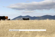
| 
119
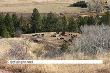
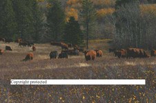
112 1297 RT8 copy
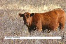
Looking down on Spring Creeek from up on top of the State school section at a herd of cattle below
| 
120
113 1308 RT8 copy
|
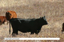
121
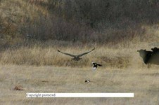
121 2199 RT8 copy
Golden Eagle taking off.
| 
122
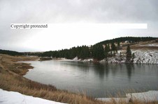
118 1835 RT8 copy
Ice covered Hansens Pond on Uppper Spring Creek, Lewistown, MT.
| 
123
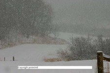
115 1552 RT8 copy
Castle Creek... S.E of Lewistown 10 miles or so ... it was snowing
| 
124
115 1555 RT8 copy
|
125
115 1560 RT8 copy
| 
126
115 1562 RT8 copy
| 
127
115 1570 RT8 copy
| 
128
115 1571 RT8 copy
|
129
115 1572 RT8 copy
| 
130
115 1576 RT8 copy
Beaver dam and lodge on Castle Creek
| 
131
115 1579 RT8 copy
| 
132
116 1617 RT8 copy
On road to Lime Kiln Canyon just a few miles north east of Lewistown. Those are the Judith Mountains
|
133
116 1618 RT8 copy
| 
134
116 1619 RT8 copy
| 
135
116 1624 RT8 copy
| 
136
127 2738 RT8 copy
Bald MT in the Big Belts of Central Montana
|
137
126 2669 RT8 copy
Bunny in the bush
| 
138
126 2672 RT8 copy
More of the bunny in the bush
| 
139
P7295471
Wells Fargo Sand sculpture at the Lewistwon Art center
| 
140
122 2254 RT8 copy
Sunset from the Rims in Billings, MT Dec 2003
|
141
122 2258 RT8 copy
Another shot
| 
142
123 2308 RT8 copy
Squirrel with a dry pine cone
| 
143
112 1298 RT8 copy
Sure hope you know what that is.
| 
144
1 CRW 1426 RT8 copy
|
145
113 1306 RT8 copy
| 
146
112 1299 RT8 copy
| 
147
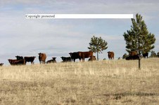
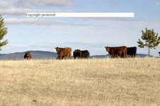
121 2127 RT8 copy
Cows on State section.. upper Spring Creek near Burleigh Fishing pull parking
| 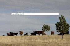
148
121 2128 RT8 copy
Same cows on State section
|
149
121 2129 RT8 copy
Lone cow with Judith Mtns back ground
| 
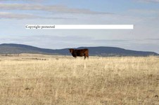
150
121 2130 RT8 copy
| 
151
121 2131 RT8 copy
| |
