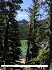
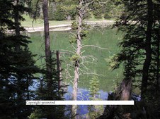
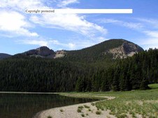
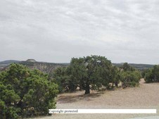
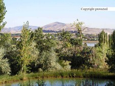
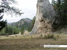
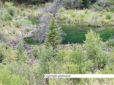
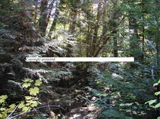
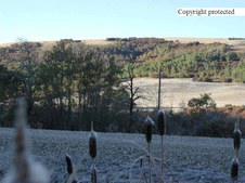
1
P7170009Xcopy
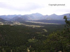
These photo's are around and of Crystal Lake which is 30 miles W.S. of Lewistwon, MT in the Snowy Mountains.
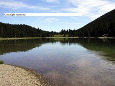
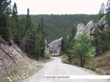
| 
2
1 P7170012x copy
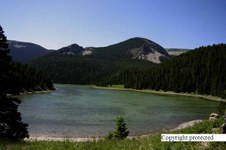
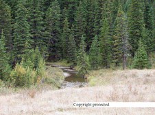
| 
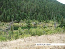
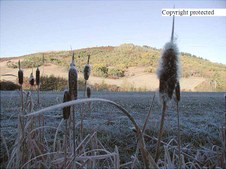
3
P7170013Xcopy
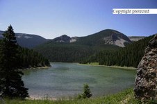
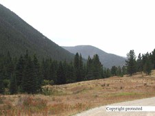
| 
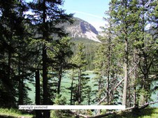
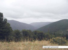
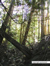
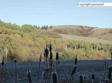
4
1 P7170025xcopy
|
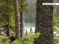
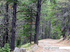
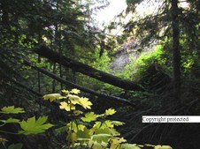
5
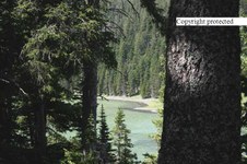
1 P7170588xcopy
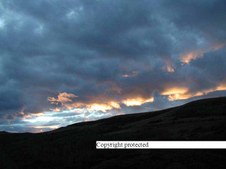
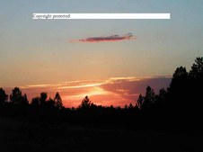
| 
6
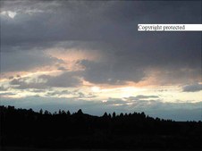
1 P7170027xcopy
| 
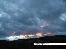
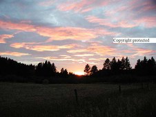
7
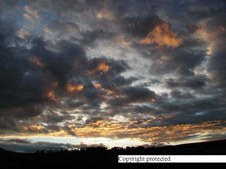
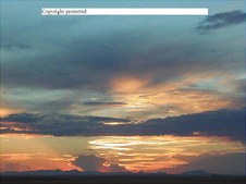
1 P7170589xcopy
| 
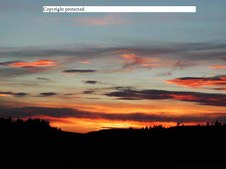
8
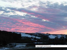
1 P7170591xcopy
This one won 1st place in it's catagory at a fair.
|
9
1 P7170592xcopy
| 
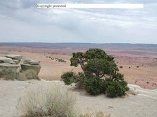
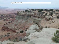
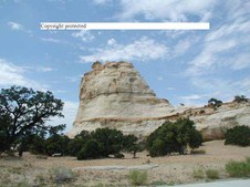
10
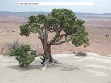
1 P7170593xcopy
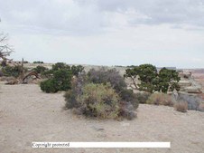
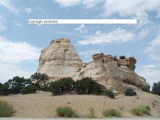
| 
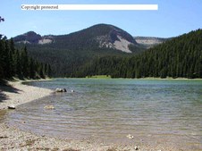
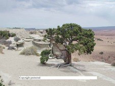
11
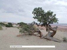
171_7153 RJXcopy
Crystal Lake at 6,000 ft elevation 20 miles SW of Lewistown, MT.
| 
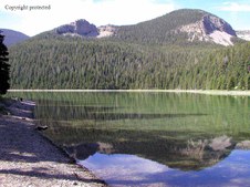
12
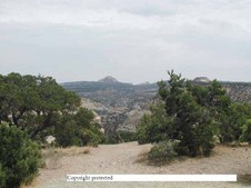
171_17156 RJXcopy
again
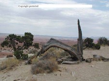
|
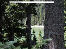
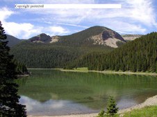
13
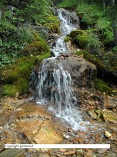
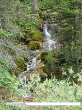
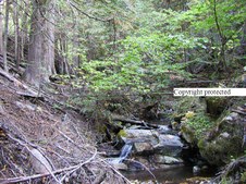
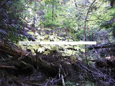
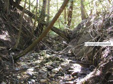
P6240036.CrystalXThroughXTheXFir
This photo was taken in 2000 with a 1.3 Mega Pixel 450 Digital.
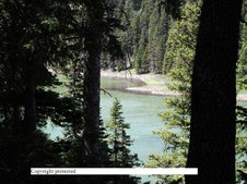
| 
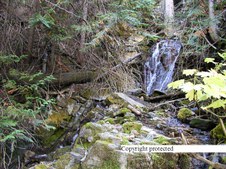
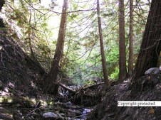
14
171_7148 RJXcopy
This is the same shot as 13. It's closer up and taken July 30, 2004. One tree on the left in the foreground has been cut down since 2000. The water line was lower and its a month and 4 years later. It was taken with a 6.3 Mega Pixel Canon 300D SLR.
| 
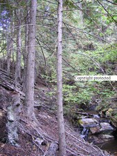
15
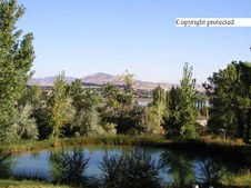
1 P8015672xcopy
Montana Sunset on spring creek
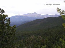
| 
16
1 P8015673xcopy
Another over Spring Creek
|
17
PB229043Xcopy
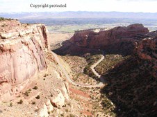
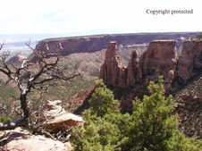
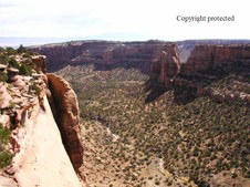
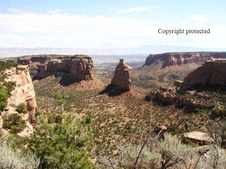
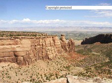
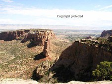
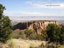
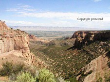
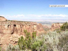
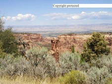
Castle Creek sunset.. near Lewistown
| 
18
PB229046Xcopy
| 
19
1 P9030056x copy
Spring Creek sunset
| 
20
PA138221Xcopy
Castle Valley flaming sunset
|
21
P8070115xcopy
Near Lewistown
| 
22
P9090074xcopy
September Sunset in the Judith Mountains going up to Maiden Canyon
| 
23
PIC00027Xcopy
Spring Creek winter sunset
| 
24
P7200026.Sunsetxcopy
Sunset west of Lewistown towards the Belt Mountains
|
25
P7215066xcopy
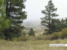
Castle Creek sunset
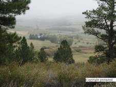
| 
26
P5212274Xcopy
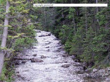
North of Lewistown
| 
27
P7074578Xcopy
Spring Creek sunset
| 
28
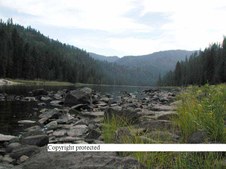
189 8996 copy
West from Lewistown towards the Belt Mountains.
|
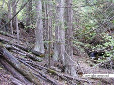
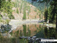
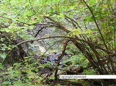
29
P7180533xcopy
Juniper in Easter Utah on I-70
| 
30
P7180535xcopy
Eastern Juniper off I-70 in Eastern Utah
| 
31
1 P7180536 copy
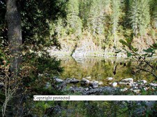
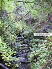
Same Juniper
| 
32
P7180537 copy
same area
|
33
P7180539 copy
same area
| 
34
P7180542 copy
Same area
| 
35
P7180546 copy
Same area
| 
36
P7180548 copy
same
|
37
P7180551 copy
near same area
| 
38
P7180556 copy
same area on I-70
| 
39
P7180563 copy
eastern Utah
| 
40
P7180565 copy
|
41
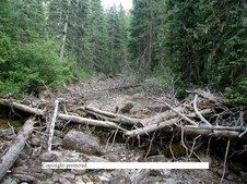
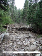
P8030018 copy
Dry stream bed near Crystal lake in MT. There was water flowing about 2-3 weeks before. I have pictures of it with the water flowing. The logs here make a small water fall.
| 
42
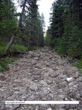
P8030020 copy
same
| 
43
P8030022 copy
| 
44
P8030023 copy
Same creek but a spring runs year around here
|
45
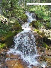
P6260027 copy
Little water fall near the sring
| 
46
P8030028 copy
The spring is just a little ways above the top of the photo. Have to walk up to see it.
| 
47
P8030032 copy
| 
48
P6163889 copy
This is the dry stream bed in early June with water in it.
|
49
P9010152 copy
Pond in a friends back yard near Loveland, Colorado...
| 
50
P9010153 copy
| 
51
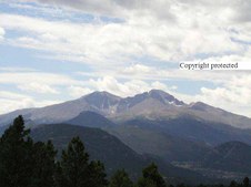
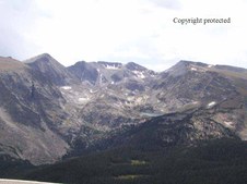
P9020160 copy
Left to right Meeker Peak at 13,000 feet and Longs Peak at 14,256 Near Estes Park,Co in Rockey Mtn. National Park
| 
52
P9020161 copy
|
53
P9020162 copy
| 
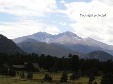
54
P9020163 copy
Back side of Longs Peak from the road going up to Trail Ridge.
| 
55
P9020164 copy
| 
56
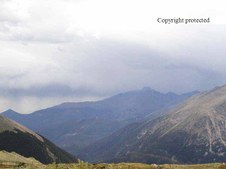
P9020168 copy
Looking S.W. off Trail Ridge Road at 12,000 ft. in Rockey Mtn National Pk.
|
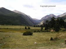
57
P9020169 copy
Looking at Longs Peak from the top of Trail Ridge Road
| 
58
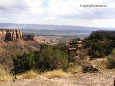
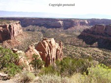
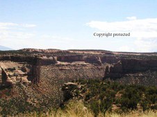
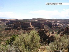
P9040171 copy
Fruit Canyon in Colorado National Monument in Western Colorado near Fruits, Co. Taken in September 3, 2003
| 
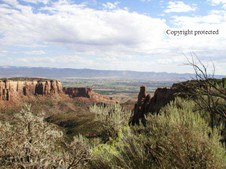
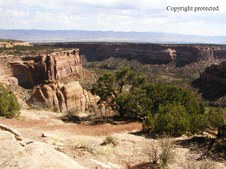
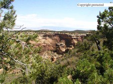
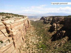
59
P9040172 copy
Colorado Natl Monument
| 
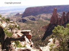
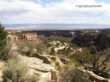
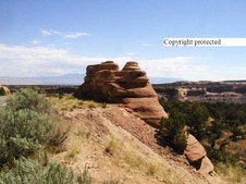
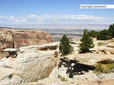
60
P9040176 copy
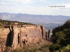
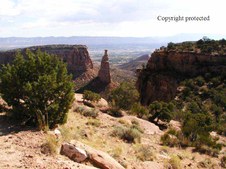
Independent Monument in Co National Monument
|
61
P9040177 copy
Independent Monument
| 
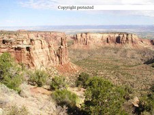
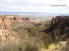
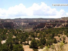
62
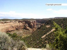
P9040178 copy
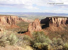
Canyon in the Monument
| 
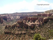
63
1 P9040180 copy
| 
64
1 P9040182 copy
|
65
1 P9040184 copy
| 
66
1 P9040191 copy
| 
67
1 P9040193 copy
| 
68
1 P9040196 copy
|
69
1 P9044182 copy
| 
70
1 P9044183xcopy
| 
71
1 P9044185 copy
| 
72
1 P9044189 copy
|
73
1 P9044191 copy
| 
74
1 P9044192 copy
| 
75
1 P9044193 copy
| 
76
1 P9044195 copy
|
77
1 P9044196 copy
| 
78
1 P9044197 copy
| 
79
1 P9044198 copy
| 
80
1 P9044199 copy
|
81
1 P9044200 copy
| 
82
1 P9044201 copy
| 
83
1 P9044202 copy
| 
84
1 P9044203xcopy
|
85
1 P9044205 copy
| 
86
1 P9044207 copy
| 
87
1 P9044208 copy
| 
88
1 P9044210 copy
This is the last of the 2003 Colorado National Monument Poto's
|
89
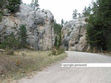
P9100004 copy
Headed for Tole Gate going to Yogo Canyon in the Belt Mtns. near Utica, MT in central MT. Taken Sept. 9, 2000
| 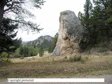
90
P9100005 copy
heading into Yogo Canyon
| 
91
1 P9100006 copy
| 
92
1 P9100015 copy
|
93
1 P9100018 copy
Yogo Creek just up stream from Tole Gate.
| 
94
1 P9100022 copy
| 
95
1 P9100041 copy
Moss in an old beaver pond on Yogo Creek.
| 
96
1 P9100043 copy
|
97
1 P9100053 copy
This was taken from a road from Yogo Creek over the top to Wolf Creek north of Yogo Creek. They have stopped maintaining the road so it is becoming harder to travel with a car. That road used to be shown on a map but now it's not shown. I imagine it can be driven with a 4 wheel drive but not a 2 wheel drive car by now. It might even be blocked off by now. You can get to the old town site of Yogo but after that the canyon narrows and goes off Yogo Creek. That may be the part that is not drivable now.
| 
98
1 P9100064 copy
This is part of the road that might be closed by now.
| 
99
1 P9100088 copy
I think it is almost impossible to get up or down this road without a 4 wheel drive at this time. (2010)This photo was taken in 2000.
| 
100
1 P9147022 copy
Lake Pend Oreille from Farragut State Park. Taken September 14,2001
|
101
1 P9147027 copy
Looking across Lake Pend Oreille from Farragut State Park.
| 
102
1 P9147028 copy
From Farragut State Parke again.
| 
103
1 P9244259xcopy
Near Kettle Falls, Idaho 3+ miles south along Potters Road. Taken in September 24,2003
| 
104
1 P9244264 copy
Taken same day. The trees are all Cedar, the yellow leaves closest is called Devils Claw The fallen tree bridges the small canyon they are in. It was dark because of the heavy over growth. It was a pretty place with steep sides.
|
105
1 P9244266 copy
| 
106
1 P9244273 copy
| 
107
1 P9244274 copy
Last of the Kettle Falls, Idaho photos
| 
108
1 P9247199 copy
This was taken in Idaho on high way 12 headed towards Lolo, Montana in Sept. of 2001
|
109
1 P9247214 copy
| 
110
1 P9247230 copy
| 
111
1 P9247231 copy
| 
112
1 P9247234 copy
More photos along highway 12 in Idaho yet.
|
113
1 P9254293 copy
These are more of the Potters Road creek photo's taken Sept. 24, 2003
| 
114
1 P9254295 copy
More of the same near Kettle Falls, ID
| 
115
1 P9254296 copy
More
| 
116
1 P9254298 copy
Cedars criss cross the creek as they grow in the canyon near Kettle Falls
|
117
1 P9254299 copy
Same
| 
118
1 P9254300 copy
Same
| 
119
1 P9254301 copy
More
| 
120
1 P9254302 copy
More
|
121
1 PA047936 copy
Upper Spring Creek with fog in the creek bottom. Oct. 4, 2001
| 
122
1 PA047941 copy
Same day.
| 
123
PA060004Xcopy
Taken on Castle Creek October 6, 2000
| 
124
PA060007Xcopy
Same place same day
|
125
PA060092Xcopy
Same place and day
| |
