
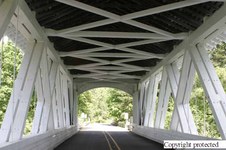
1
148 4849 RJ.up copy
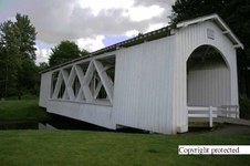
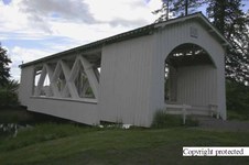
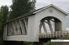
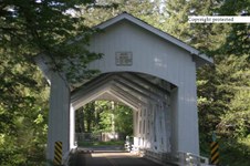
Crabtree Creek (Larwood) Covered Bridge
County: Linn - State Oregon
Stream: Crabtree Creek
Truss Type: Howe
Bridge Length (ft): 105
Year Built: 1939
| 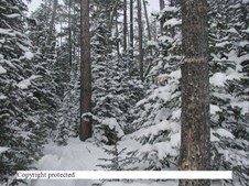
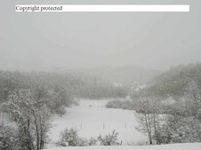
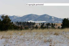
2
P2110012 copy
Deep woods as Show Down Ski Area.... Big Belts of central Montana
| 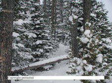
3
P2110011 copy
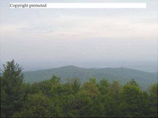
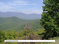
Still Show Down area
| 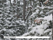
4
P2110013 copy
Lots of snow at Show Down
|

5
P2110025 copy
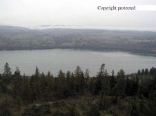
Dry weed with snow blossums
| 
6
P4050965 copy
Arizona on I-15 south of St. George, Utah
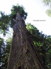
| 
7
P4050970 copy
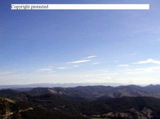
Same - it was raining
| 
8
P4171152 copy
Crazy Mountains near Big Timber, MT
|

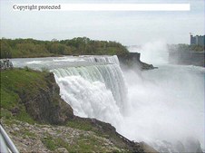
9
1 P5100959. American Falls from Canadian side copy
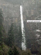
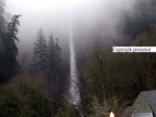
American Falls of Niagra Falls, NY
| 
10
P5100960
Canadian falls from Canadian side
| 
11
P5100961.
Tourist Boat below Canadian Falls
| 
12
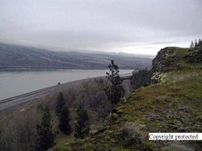
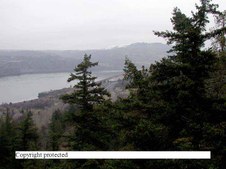
1 P5100962.JPG American Falls copy
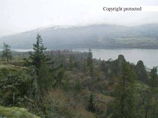
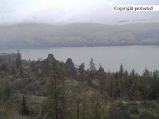
American Falls left... Canadian falls right in distance. Bout all you can see is spray
|
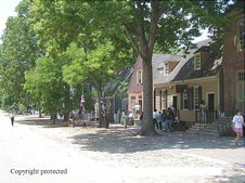
13
P5140974.Williamsburg copy
Old Williamsburh, VA
| 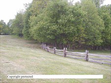
14
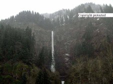
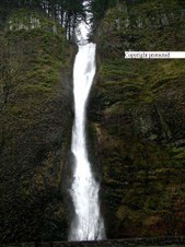
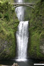
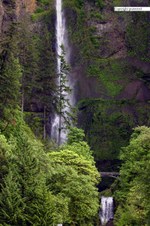
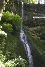
1 P5161007.Blue Ridge Fence copy
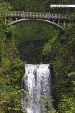
Rail fence on Blue Ridge Parkway in Virginia
| 
15
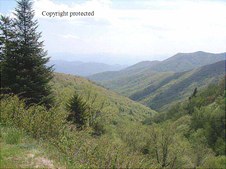
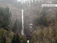
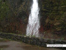
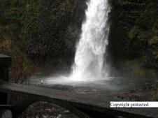
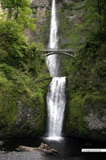
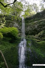
1 P5171012.Blue Ridge Pkwy copy
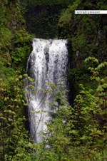
Great Smokey Mts. from Blue Ridge Park Way
| 
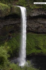
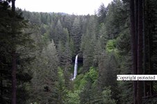
16
P5171018. - Blue Ridge Pkwy copy
same
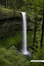
|
17
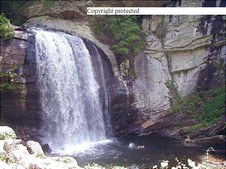
P5181029.Looking Glass falls.N
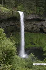
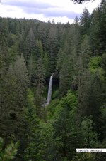
Looking Glass Falls in North Carolina (notice 1 swimmer and aonther person on the rock - lower right
| 
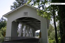
18
1 P5181031. - Smokey Mtns copy
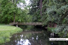
Smokey Mtns
| 
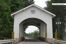
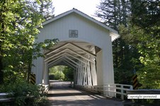
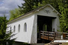
19
P5181036.JPG - Exposed tree roots . Smky Mtn Farm copy
Almost feel sorry for that tree... look at those roots and deformed brandes
| 
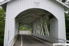
20
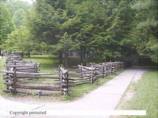
P5181038.JPG - Z fence at Smk. Mtn
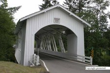
Rail fence leading to informantion building at east Smokey Mtn. Natl. Pk. entrance.
|
21
P5181043.Appalachian Trail - Marker copy
Appalachian Trail Marker - Proof of being there.
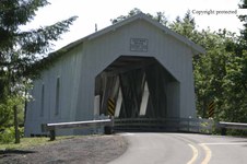
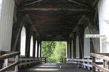
| 
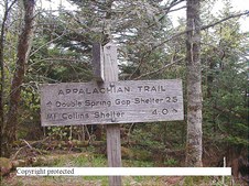
22
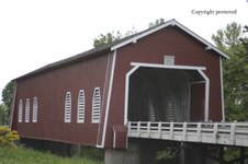
P5184204 copy
Up Castle Creek in a show storm. Near Lewistown,MT
| 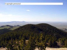
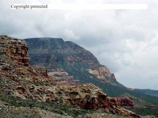
23
P5240005 copy
Judith Mtns. from where the Radar Domes were.
| 
24
1 P5240008 copy
Same
|

25
P5250001 copy
Sand Sculpture at Lewistown Art Center
| 
26
P5250006 copy
Ma and Pa? sand sculpture
| 
27
1 P6163795.Ladies slipper copy
Pink Lady slipper.... wild flower
| 
28
2 P7090654 copy
California Red Woods
|
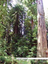
29
1 P7090658 copy
One big tall Redwood Tree
| 
30
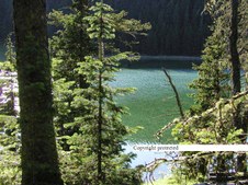
1 P7120539 copy
Crystal lake
| 
31
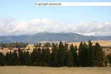
CRW 1262 RT8Xcopy
Judith Mtns from St Section upper Spring creek
| 
32
CRW 1268 RT8Xcopy
Nice view to right of last pic
|

33
CRW 1405 RT8Xcopy
Curious squirrel
| 
34
CRW 1401 RT8Xcopy
down we come....
| 
35
CRW 1420 RT8Xcopy
She thinks she's hid?
| 
36
CRW 1417 RT8Xcopy
She knows she's been seen.
|
37
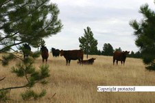
CRW 1423 RT8Xcopy
Cattle on School Section
| 
38
CRW 1637 RT8Xcopy
Judith Mtns from State school section, upper Spring Creek near Lewistown, MT
| 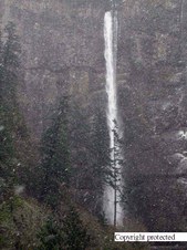
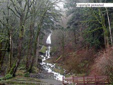
39
P1299869Xcopy
Multinomah Falls east of Portland, Oregon. Jan. 31, 2001
| 
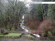
40
P1299871Xcopy
same time
|
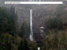
41
1 P1299874 copy
Same time
| 
42
P1299878Xcopy
Same time
| 
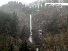
43
P1299879Xcopy
It was snowing. Same time
| 
44
P1299881Xcopy
See the snow? Jan. 31, 2002
|
45
P1299882Xcopy
Same day, same snow
| 
46
P1319907Xcopy
Is the water falling out of the cloud?
| 
47
P1319914Xcopy
Horse Tail Falls east of Multinomah Falls
| 
48
P1319915Xcopy
Bottom of Horse Tail falls
|
49
P1319917Xcopy
same
| 
50
P1319921Xcopy
Columbia River
| 
51
P1319933Xcopy
Oregon side of Columbia River
| 
52
P1319934Xcopy
Same side, Columbia River
|
53
1 P1319936 copy
Same
| 
54
P1319938Xcopy
same
| 
55
P1319895Xcopy
| 
56
P1319897Xcopy
|
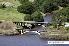
57
146 4700 RJ
Rail road bridge little one and Hi-way bridge. Along Columbia River on Washington state side.
| 
58
147 4713 RJ.up copy
Upper and lower Multinomah Falls
| 
59
147 4714 RJ.edited.up copy
I backed up a bit
| 
60
147 4718 RJ
Same different distance
|

61
147 4721 RJ.e.cp
Complete
| 
62
147 4726 RJ Up copy
Lower Multinomah Falls with foot bridge above it.
| 
63
147 4729 RJ.edited.up copy
different angle
| 
64
147 4733 RJ.edited.up copy
Ditto
|
65
147 4771 RJ copy
South Falls 177 Foot drop - Silver Falls State Park - Oregon
| 
66
147 4774 RJ.copy
177 Ft. Drop South Falls - Silver Falls State Park - OR
| 
67
147 4777 RJ copy
South Falls - Silver Falls state park
| 
68
147 4782 RJ copy
Winter Falls with a 137 foot drop - Silver Falls State Pakr - Oregon
|
69
147 4783 RJ copy
More Winter Falls in Silver Park State Park - OR 137 ft drop
| 
70
147 4787 RJ copy
Straight on Winter Falls....it depends on Snow run off so doesn't always run
| 
71
147 4790 RJ copy
North Falls - Silver Falls State Park - OR 136 Ft. Drop
| 
72
147 4792 RJ copy
Silver Falls State Park - Oregon
At a distance North Falls 136 Ft.
|

73
147 4799 RJ copy
Salem Power Canal (Stayton-Jordan) Covered Bridge
County: Marion
Stream: Salem Power Canal
Truss Type: Howe
Bridge Length (ft): 90
Year Built: 1998
| 
74
148 4801 RJ copy
Salem Power Canal (Stayton-Jordan) Covered Bridge
County: Marion
Stream: Salem Power Canal
Truss Type: Howe
Bridge Length (ft): 90
Year Built: 1998
| 
75
148 4802 RJ copy
Foot Bridge in Stayton near the Covered Bridge. If I'm not correct on that someone needs to inform me who knows for sure. Thanks
| 
76
148 4803 RJ copy
Salem Power Canal (Stayton-Jordan) Covered Bridge
County: Marion
Stream: Salem Power Canal
Truss Type: Howe
Bridge Length (ft): 90
Year Built: 1998
|
77
148 4817 RJ.up copy
Thomas Creek (Gilkey) Covered Bridge
County: Linn
Stream: Thomas Creek
Truss Type: Howe
Bridge Length (ft): 120
Year Built: 1939 *1998
| 
78
148 4821 RJ.up copy
Thomas Creek (Gilkey) Covered Bridge
County: Linn
Stream: Thomas Creek
Truss Type: Howe
Bridge Length (ft): 120
Year Built: 1939 *1998
| 
79
148 4825 RJ.up copy
Texas Long Horns in Oregon?
| 
80
148 4827 RJ.up copy
Another one?
|

81
148 4830 RJ copy
Thomas Creek (Shimanek)
Covered Bridge
County: Linn - State: Oregon
Stream: Thomas Creek
Truss Type: Howe
Bridge Length (ft): 130
Year Built: 1966
| 
82
148 4833 RJ.up.copy
Thomas Creek (Shimanek)
Covered Bridge
County: Linn - State: Oregon
Stream: Thomas Creek
Truss Type: Howe
Bridge Length (ft): 130
Year Built: 1966
| 
83
148 4840 RJ.up copy
Thomas Creek (Hannah) Covered Bridge
County: Linn - State: Oregon
Stream: Thomas Creek
Truss Type: Howe
Bridge Length (ft): 105
Year Built: 1936
| 
84
148 4841 RJ.up copy
Thomas Creek (Hannah) Covered Bridge
County: Linn - State: Oregon
Stream: Thomas Creek
Truss Type: Howe
Bridge Length (ft): 105
Year Built: 1936
|
85
148 4844 RJupXcopy
Crabtree Creek (Larwood) Covered Bridge
County: Linn - State Oregon
Stream: Crabtree Creek
Truss Type: Howe
Bridge Length (ft): 105
Year Built: 1939
| 
86
148 4848 RJ.up copy
Crabtree Creek (Larwood) Covered Bridge
County: Linn
Stream: Crabtree Creek
Truss Type: Howe
Bridge Length (ft): 105
Year Built: 1939
| 
87
148 4850 copy
| 
88
148 4852 RJ.up copy
Crabtree Creek (Hoffman) Covered Bridge
County: Linn - State: Oregon
Stream: Crabtree Creek
Truss Type: Howe
Bridge Length (ft): 90
Year Built: 1936
|

89
148 4862 RJ.up copy
Crabtree Creek (Hoffman) Covered Bridge - from inside
County: Linn - State: Oregon
Stream: Crabtree Creek
Truss Type: Howe
Bridge Length (ft): 90
Year Built: 1936
| 
90
148 4863 RJ.up copy
Ames Creek (Weddle) Covered Bridge
County: Linn
Stream: Ames Creek
Truss Type: Howe
Bridge Length (ft): 120
Year Built: 1937 *1990
| 
91
148 4871 RJ.up copy
Ames Creek (Weddle) Covered Bridge
County: Linn
Stream: Ames Creek
Truss Type: Howe
Bridge Length (ft): 120
Year Built: 1937 *1990
| 
92
148 4883 RJ.up copy
South Fork Santiam River (Short) Covered Bridge
County: Linn
Stream: South Santiam River
Truss Type: Howe
Bridge Length (ft): 105
Year Built: 1945
|
93
148 4887 RJ.up copy
South Fork Santiam River (Short) Covered Bridge
County: Linn
Stream: South Santiam River
Truss Type: Howe
Bridge Length (ft): 105
Year Built: 1945
| 
94
148 4894 RJ.up copy
Ritner Creek Covered Bridge
County: Polk
Stream: Ritner Creek
Truss Type: Howe
Bridge Length (ft): 75
Year Built: 1927
| 
95
148 4899 RJ.up copy
Ritner Creek Covered Bridge
County: Polk
Stream: Ritner Creek
Truss Type: Howe
Bridge Length (ft): 75
Year Built: 1927
| 
96
148 4893 RJ.up copy
Mt. Hood - S.E. of Portlane, OR
This photo was shot from South of Molalla, OR
|
