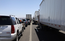
 First day we hit a big snag, multi fatal accident closed I-40 west of Needles for some 16 hours. First day we hit a big snag, multi fatal accident closed I-40 west of Needles for some 16 hours.
| 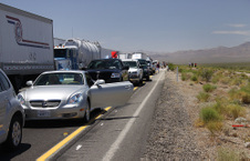 Traffic backup for miles, and it was near 100 degrees. Traffic backup for miles, and it was near 100 degrees.
| 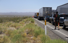 I backed up on the shoulder to place where the median could be crossed, and headed back some 35 miles and took route around the accident. I backed up on the shoulder to place where the median could be crossed, and headed back some 35 miles and took route around the accident.
| 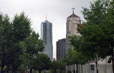 View of Denver from State College campus. View of Denver from State College campus.
|
 Denver skyline from above Invesco Stadium parking lot west of town. Denver skyline from above Invesco Stadium parking lot west of town.
|  Downtown Denver of rainy day with sky beginning to clear. Downtown Denver of rainy day with sky beginning to clear.
| 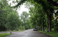 Near city center, we drove through this charming area of classic and beautiful old homes. Near city center, we drove through this charming area of classic and beautiful old homes.
|  Like this one, side view. Like this one, side view.
|
 And front view. And front view.
|  Deer forages in my brother's back yard in Aurora, CO. Deer forages in my brother's back yard in Aurora, CO.
|  |  Leaving Aurora for Grand Junction on I-70, some 163 miles away. Leaving Aurora for Grand Junction on I-70, some 163 miles away.
|
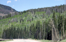 Trees along I-70 suffering from massive beetle attack. Trees along I-70 suffering from massive beetle attack.
| 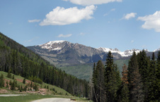 I-70 from Denver to Grand Junction is a beautiful drive. I-70 from Denver to Grand Junction is a beautiful drive.
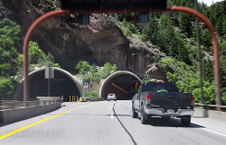
| 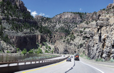 The Glenwood Canyon area, with Colorado River along side is the most dramatic part of I-70 on way to Grand Junction. The Glenwood Canyon area, with Colorado River along side is the most dramatic part of I-70 on way to Grand Junction.
|  |
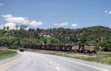 Near Rifle, CO, a train shares the I-70 route. Near Rifle, CO, a train shares the I-70 route.
|  Leaving our motel in Moab morning of June 17th, we head to entrance of Arches National Park. Leaving our motel in Moab morning of June 17th, we head to entrance of Arches National Park.
|  From entrance gate, I could see a tour bus climbing the main road into the park center. From entrance gate, I could see a tour bus climbing the main road into the park center.
|  Images 19 through 69 were shot in Arches National Park. Images 19 through 69 were shot in Arches National Park.
|
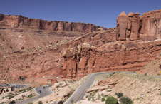
 Lower left is entrance gate, Visitor's Center in middle, and winding road leads us into the park. Rt 191 on left. Lower left is entrance gate, Visitor's Center in middle, and winding road leads us into the park. Rt 191 on left.
|  | 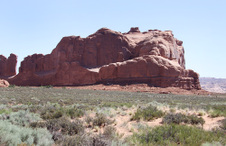 |  |
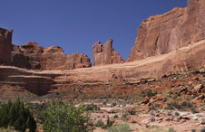
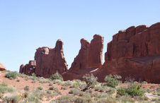 Many of the formations have names,like this one, "Park Avenue." Many of the formations have names,like this one, "Park Avenue."
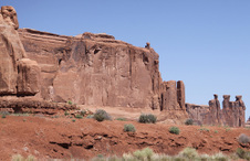
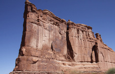
|  |  |  "The Organ" "The Organ"
|
 |  |  |  |
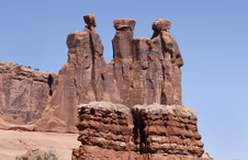 "The Three Gossips" "The Three Gossips"
| 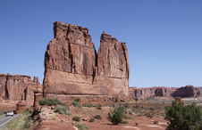 |  |  |
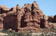
 "The Courthouse" "The Courthouse"
|  |  |  |
