 A pre-dawn, long exposure shot of the North Saint Vrain A pre-dawn, long exposure shot of the North Saint Vrain
| 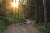 This and shot #9 are my first attempts and experimentation with shooting directly into the sun. Although not perfect, I liked them each well enough to post here in the gallery. This and shot #9 are my first attempts and experimentation with shooting directly into the sun. Although not perfect, I liked them each well enough to post here in the gallery.
| 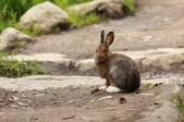 Early morning jackrabbit. Early morning jackrabbit.
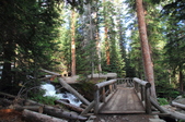
| 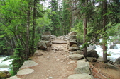 One of many bridges encountered along the way. This one crosses the North Saint Vrain. One of many bridges encountered along the way. This one crosses the North Saint Vrain.
|
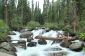 The North Saint Vrain as seen from the previous bridge. The North Saint Vrain as seen from the previous bridge.
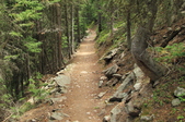
| 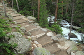 The trail paralleling the North Saint Vrain. The trail paralleling the North Saint Vrain.
|  Bridge number 2 as it crosses Cody Creek and the Calypso Cascade. Bridge number 2 as it crosses Cody Creek and the Calypso Cascade.
| 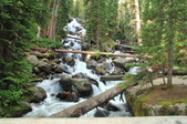 Calypso Cascade. Calypso Cascade.
|
 Sunburst shot looking back at bridge number 2. Sunburst shot looking back at bridge number 2.
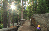
|  Lush trail. Lush trail.
| 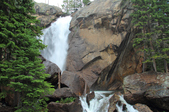 Ouzel Falls. Ouzel Falls.
| 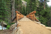 Bridge crossing just below Ouzel Falls and directly over Ouzel Creek. Bridge crossing just below Ouzel Falls and directly over Ouzel Creek.
|
 Morning sun on the trail as I rise above Ouzel falls. Morning sun on the trail as I rise above Ouzel falls.
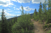
| 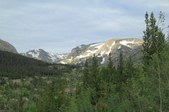 The expansive view looking westward from the trail. The expansive view looking westward from the trail.
| 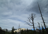 Parts of the area were decimated by fire decades ago in the late 70's, and although many signs of the fire still remain, the area is teaming with life and rebirth and is covered in new green(see next photo). Parts of the area were decimated by fire decades ago in the late 70's, and although many signs of the fire still remain, the area is teaming with life and rebirth and is covered in new green(see next photo).
| 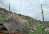 Fire area covered in new green grass, bushes, and young pine trees. Fire area covered in new green grass, bushes, and young pine trees.
|
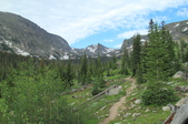 More views from the trail as I hike westward. More views from the trail as I hike westward.
| 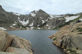 Bluebird Lake, elevation 10,978 feet. Bluebird Lake, elevation 10,978 feet.
| 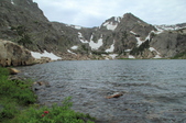 Bluebird Lake. Bluebird Lake.
| 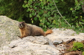 Mr. Marmot. Mr. Marmot.
|
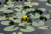
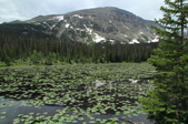 A lily pad covered mountain lake. A lily pad covered mountain lake.
|  | 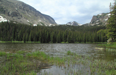 Ouzel Lake. Ouzel Lake.
| |
