 1 1
Tasmania #07 Collage
|  2 2
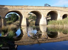
Historic Richmond Bridge
Richmond Bridge (1823). Originally named Bigge's Bridge, Richmond Bridge is Australia's oldest bridge still in use.
|  3 3
Historic Richmond Bridge
Richmond Bridge was built by convicts from sandstone quarried at Butchers Hill and hauled by hand carts to the bridge site. The cutwaters were added in 1884.
|
 4 4
Coal River
Reflections on the Coal River at Richmond Bridge.
|  5 5
Richmond Bridge
Historic Richmond Bridge from further upstream.
|  6 6
Richmond Bridge
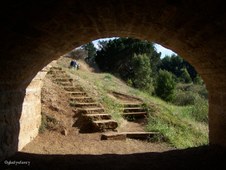
View through the Arch of Richmond Bridge.
|
 7 7
Red Flowering Gum
|  8 8
Richmond Street Scene
|  9 9
Built in Sandstone
|
 10 10
The Stables, Richmond
|  11 11
Iron Lace Verandah, Richmond
|  12 12
Richmond Town Hall
The Town Hall was built in 1908 from recycled stone from derelict and demolished buildings, including the Providence Mill and the Police Barracks. The Police Barracks were built in 1833 on a site roughly in the car park behind the Hall.
|
 13 13
Colonial Cottages, Richmond
|  14 14
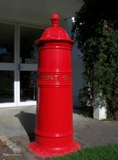
Historic Post Box
|  15 15
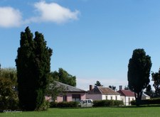
Colonial Cottages, Richmond
|
 16 16
Outer area of Richmond
|  17 17
Richmond Hills
|  18 18
Farmlands
|
 19 19
Distant Vineyards
Vineyards in the distance are covered with bird netting to protect the crops.
|  20 20
Farmlands from moving Bus
Netting covered vineyards on centre left and rose-hips along the fenceline.
|  21 21
The Eastern Tiers
The Eastern Tiers on the horizon beyond Tasmanian Farmlands.
|
 22 22
Sheep on Hillside
The summer colours of Tasmania.
|  23 23
Thistle Infested
Taken from the moving bus, but I tried to capture the spread of introduced Thistles throughout the land.
|  24 24
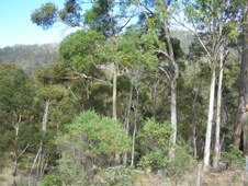
Tree-lined Gully
|
 25 25
Spring Beach
Spring Beach is located just south of Orford on Tasmania’s sunny East Coast about one hour’s drive North East of Hobart, and about one hour south of Swansea.
|  26 26
Spring Beach, Orford
|  27 27
Succulent on Beach
|
 28 28
High and Dry on Spring Beach
|  29 29
Spring Beach, Orford
|  30 30
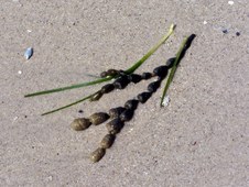
Left by the Tide
|
 31 31
Gum Tree at Spring Beach Car Park
|  32 32
Prosser River
The delightful seaside town of Orford is situated on the Prosser River on Tasmania's East Coast. Established as a shore station to service the convict settlement on Maria Island in 1825, Orford is now a popular holiday resort.
|  33 33
Prosser River
Orford, Tasmania. A large weir separates the lower and upper section of the river. Below the weir the water is under tidal influence. Above the weir the stream is slow and during the summer recedes into pools. In recent years, this situation has been extreme. Trout to 1 kg can be caught with bait fishing being the preferred method.
|
 34 34
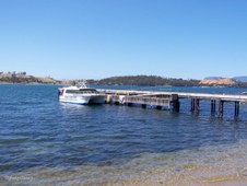
Maria Island Ferry
Jetty at Eastcoaster Resort, Orford.
|  35 35
Maria Island Ferry
This is the Fast Ferry which takes 28 mins for the 7 nautical mile trip from Eastcoaster Resort to Maria Island.
|  36 36
View from Jetty
A Woodchip Factory is located opposite the Eastcoaster Resort.
|
 37 37
Woodchip Pile
Zoomed in on the Pile of Woodchips.
|  38 38
Wooden Row Boat near Jetty
|  39 39
Maria Island
Maria Island is steeped in history. This wild and rugged island which is over 20 km long and 13 km wide is characterised by sheer cliffs tumbling into the sea, jagged rocky outcrops (Mount Maria rises to 710 m and The Bishop and Clerk reaches 915 m), extensive fossil deposits and interesting ruins of the nineteenth century penal settlement.
|
 40 40
Darlington Settlement
Remaining buildings of the Darlington Settlement near the jetty on Maria Island include the Cement Silos, Clinker Storage and Commissariat Store which is now used as a Visitor Information Centre.
|  41 41
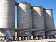
Cement Silos
Portland Cement produced 500 tonnes of Cement each week and it was held in the hoppers of the Cement Silos until being placed in jute bags for shipment. At the height of operations Maria Island population numbered about 500 people.
|  42 42
The Cement Works
The National Portland Cement Works opened on 8 February 1924 after the construction of a 640 ft (195 m) pier and the installation of the machinery giving employment to over 150 men on Maria Island. After heavy financial losses, the company was taken over in 1930 and most of the plant and machinery reinstalled in Port Fairy, Victoria.
|
 43 43
Clinker Storage
Clinker Storage on Maria Island. Clinker was held here until the final grinding process in the Cement Mill.
|  44 44
Commissariat Store
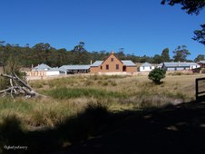
In 1825 a penal colony (the second to be established in Van Diemen's Land)was established on Maria Island by Governor George Arthur to ease the ever-increasing pressure on Hobart Town. Arthur sent 50 convicts, accompanied by a superintendent and a small party of soldiers, to the island. Although their stay was relatively short (the colony closed in 1832 after the larger prison at Port Arthur was established) they built a number of buildings of which only the Commissariat Store and the prisoner's barracks, known as the Penitentiary, still stand. Located at Darlington these historic buildings were built of local stones and bricks.
|  45 45
Penitentiary
Prisoner's Barracks and Penitentiary on Maria Island. These buildings now provide basic accommodation for campers. Each cabin contains bunks with mattresses and a wooden stove for heating, but no electricity or hot water.
|
 46 46
Tasmanian Native Hen
Tasmanian Native Hen (Gallinula mortierii) is a distant relative of the domestic hen. It is found only in Tasmania, being distributed throughout the state except for the west and southwest.
|  47 47
Cape Barren Geese
Cape Barren Goose (Cereopsis novaehollandiae). The Cape Barren goose is a handsome bird about the same size as a domestic goose. Its plumage is pale grey, with black markings near the tips of its wing feathers and tail. It has pink legs and black feet. Its most striking feature is the bright greenish yellow cere on its short black bill.
|  48 48
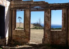
View through Ruins on Maria Island
|
 49 49
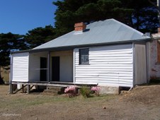
Ranger's Cottage
Belladonna Lilies outside one of the cottages used by Rangers on Maria Island.
|  50 50
Windswept Tree on Maria Island
|  51 51
Hilltop Farmhouse
|
 52 52
BBQ Area
Ocean views towards the mainland from this BBQ Area for use of visitors to Maria Island.
|  53 53
Maria Island viewed from Ranger's Station
|  54 54
Historic Buildings of Maria Island
|
 55 55
Cape Barren Geese
Cape Barren Geese live mostly on small, windswept and generally uninhabited offshore islands, but venture to adjacent mainland farming areas in search of food in summer. Their ability to drink salt or brackish water allows numbers of geese to remain on offshore islands all year round.
|  56 56
Eye to Eye with a Cape Barren Goose
|  57 57
Cape Barren Geese
These geese are grazing birds, and eat predominantly the common island tussock Poa poiformis as well as spear grass and various herbs and succulents they also eat pasture grasses including barley grass and clover. Geese lay eggs in nests in the tussocks found in the open grassland areas in which they live. Each pair of geese establishes a territory in autumn, prepares a nest site and defends it noisily and determinedly against other geese. About five eggs are laid and the eggs take about a month to hatch. The goslings develop rapidly during the winter, and by the end of spring are able to fly. At this time they join the flocks of non-breeding geese which have also spent the winter on the breeding island.
|
 58 58
Terraced Cottages
These Terraced Cottages on Maria Island were erected c1887 by Diego Bernacchi with bricks from the large convict Separate Apartments built in 1842 with additions c1846.
|  59 59
Flowering Eucalyptus Trees found on Maria Island.
|  60 60
Cottage on Maria Island
|
 61 61
Tall Eucalypt Trees
|  62 62
Burnt-out Ruins
The Fireplace and Chimney stand proud and tall after fire on Maria Island.
|  63 63
Vegetation
On 1 June 1971, Maria Island was declared a Wildlife Sanctuary under the control of the Animals and Birds Protection Board. The island was proclaimed a National Park on 14 June 1972 and is now managed by Tasmania's Parks and Wildlife Service.
|
 64 64
Window View
View through the Window of Ruins on Maria Island.
|  65 65
Historic Walls of Ruins
|  66 66
Maria Island hillside through the window of Ruins
|
 67 67
Old Fig Tree
|  68 68
Cape Barren Goose
In 1968, a small number of geese were introduced to Maria Island. Their numbers have increased steadily, and in 1995 there were over 100 birds established there. Since the formation of the Tasmanian National Parks and Wildlife Service in 1970, an ongoing priority has been the study and management of the Cape Barren goose population. The aim has been to keep the goose population at acceptably high levels while not allowing increasing numbers to create problems for farmers.
|  69 69
Bleached Whale Bones
A grim reminder of the early whaling days on Maria Island. The first European Settlers were whalers and sealers who lived a hard and temporary life on the island in the early nineteenth century. They viciously exploited the local Aborigines while plundering the local seal population.
|
 70 70
Bernacchis Creek, Maria Island
|  71 71
Bernacchis Creek flows into Darlington Bay, Maria Island
|  72 72
Hill Climb
Clinker Storage and Cement Silos viewed from path to the cemetery on Maria Island.
|
 73 73
Summer Landscape
|  74 74
Rusted Relic
A rusted relic overlooking Darlington Bay, Maria Island.
|  75 75
Tasmanian Native Hen
Tasmanian Native Hen trying to hide behind a Thistle. Although they cannot fly, they are good swimmers and very fast runners. When a native hen senses danger they often flick their tail to warn others and if chased will seek the shelter of grass or reeds. Using their short wings for balance, they are capable of running at 50 km per hour.
|
 76 76
Maria Island Cemetery
Remains of Historic Graves in Maria Island Cemetery.
|  77 77
Ocean Views
This Historic Cemetery on a sloping hillside of Maria Island has ocean views.
|  78 78
Old Barn on Maria Island
|
 79 79
Rafters of the Old Barn
|  80 80
Ancient Relics inside the Old Barn
|  81 81
Old Engine
|
 82 82
More Relics
|  83 83
Reminders of a past era inside Old Barn
|  84 84
Darlington Bay
Looking towards the mainland from Darlington Bay, Maria Island.
|
 85 85
Maria Island Jetty
|  86 86
Maria Island Jetty
|  87 87
Waterfront Restaurant
Back on the Mainland at Orford with the Maria Island Ferry and the Waterfront Restaurant of the Eastcoaster Resort in view.
|
 88 88
Ocean View
From Eastcoaster Resort, Orford.
|  89 89
Framed by Trees
Near Eastcoaster Resort, Orford.
|  90 90
Small Crab on the Beach
|
 91 91
Left by the Tide
|  92 92
On the Beach
|  93 93
Seagull at Waters Edge
|
 94 94
Awesome Sunrise
See album 'Tasmanian Sunrise' for full sequence of sunrise photos.
|  95 95
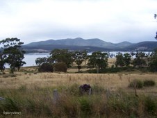
Farewell to Orford
|  96 96
Roadside Pool
|
 97 97
Information about Spiky Bridge
|  98 98
Spiky Bridge
Located 7.5 km south of Swansea, Spiky Bridge is a convict bridge which was built in 1843. It was constructed from fieldstones which were laid without mortar or cement. The parapet features fieldstones laid vertically which gives the bridge a spiky appearance. It has been claimed that the spikes were designed to prevent cattle falling over the sides.
|  99 99
Spiky Bridge
Spiky Bridge was built by convict labour in 1843.
|
 100 100
Spiky Bridge
View through Spiky Bridge to someone at the other end of tunnel.
|  101 101
Spiky Bridge
Loose laid stone walls of Spiky Bridge with the Spikes against the skyline.
|  102 102
Spiky Bridge
The parapet features fieldstones laid vertically which gives the bridge a spiky appearance. It has been claimed that the spikes were designed to prevent cattle falling over the sides.
|
 103 103
Near Spiky Bridge
|  104 104
Colourful Rosehips on fence
|  105 105
Dramatic Clouds
Dramatic Clouds as we left Spiky Bridge to continue the trip to Freycinet National Park.
|
