 1 1
Orientation Tour
The first of many excellent tours with Pinetree Tours.
|  2 2
Norfolk Island School
Students are educated in accordance with the NSW Curriculum and the Teachers are appointed on a 3-year term from NSW. Norfolk Island is a popular posting for teachers.
|  3 3
Leaving the Burnt Pine Township
|
 4 4
Cattle Grid
Most properties have a cattle grid at the entrance to prevent cattle passing through.
|  5 5
Green Hills and Valleys
Along Rooty Hill Road.
|  6 6
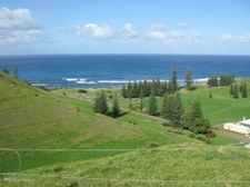
Ocean View from Rooty Hill Road
|
 7 7
Cemetery and Golf Course
Overlooking Kingston, taken from Queen Elizabeth Lookout on Rooty Hill Road.
|  8 8
Cemetery on Emily Bay
Overlooking Kingston, taken from Queen Elizabeth Lookout on Rooty Hill Road.
|  9 9
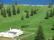
Golf Course and Golf Club House
The Golf Club House was formerly the Stipendiary Magistrate's Quarters. Overlooking Kingston, taken from Queen Elizabeth Lookout on Rooty Hill Road.
|
 10 10
Nepean and Phillip Islands
Overlooking Kingston, taken from Queen Elizabeth Lookout on Rooty Hill Road.
|  11 11
Information and Map
Overlooking Kingston, taken from Queen Elizabeth Lookout on Rooty Hill Road.
|  12 12
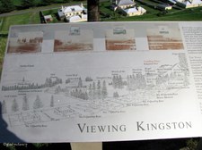
Information and Map
Overlooking Kingston, taken from Queen Elizabeth Lookout on Rooty Hill Road.
|
 13 13
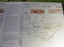
Information and Map
Overlooking Kingston, taken from Queen Elizabeth Lookout on Rooty Hill Road.
|  14 14
Plaque
This plaque was unveiled by Her Majesty the Queen on the occasion of the Royal Visit to Norfolk Island in February 1974, the Bi-Centenary Year of the discovery of the island by Captain James Cook on 10 October 1774.
|  15 15
Historic Houses of Quality Row
The Quality Row houses comprise part of the most extensive remaining pre-1850 settlement street in Australia. Overlooking Kingston, taken from Queen Elizabeth Lookout on Rooty Hill Road.
|
 16 16
Historic Kingston
Overlooking Kingston, taken from Queen Elizabeth Lookout on Rooty Hill Road.
|  17 17
The Islands beyond the Golf Course
Overlooking Kingston, taken from Queen Elizabeth Lookout on Rooty Hill Road.
|  18 18
The Old Military Barracks
Overlooking Kingston, taken from Queen Elizabeth Lookout on Rooty Hill Road.
|
 19 19
Old Military Barracks
The terraced effect on the hillside is created by grazing cattle. Overlooking Kingston, taken from Queen Elizabeth Lookout on Rooty Hill Road.
|  20 20
Rooty Hill Road lined by Norfolk Pine Trees
Overlooking Kingston, taken from Queen Elizabeth Lookout on Rooty Hill Road.
|  21 21
Norfolk Island Pines complete the picture
Overlooking Kingston, taken from Queen Elizabeth Lookout on Rooty Hill Road.
|
 22 22
Another view from the lookout
Overlooking Kingston, taken from Queen Elizabeth Lookout on Rooty Hill Road.
|  23 23
Yet another view of this pretty island
Overlooking Kingston, taken from Queen Elizabeth Lookout on Rooty Hill Road.
|  24 24
Old Military Barracks
A fine example of 1830's British military architecture. Designed by William Buchanan in 1826 as a two-storey building with verandahs to accommodate 100 men. Completed in 1834, the complex was surrounded by a high stone wall, rectangular in plan, with corner turrets.
|
 25 25
Old Military Barracks
This historical building now serves as the chambers and offices of the Norfolk Island Legislative Assembly.
|  26 26
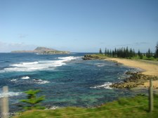
Coastal View
Taken through the window of the bus.
|  27 27
The Lush Green of the Golf Course
|
 28 28
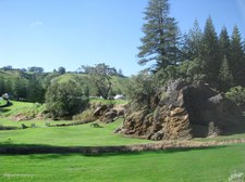
Rocky Outcrop on Reserve
|  29 29
Ocean View
From eastern end of Emily Bay.
|  30 30
View across Emily Bay
|
 31 31
Across the water
Against the sun towards Kingston Pier.
|  32 32
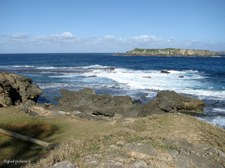
Nepean Island
A limestone islet of about four hectares and 2 km south of Norfolk Island.
|  33 33
Nepean Island and Phillip Island
Phillip Island is an irregularly shaped rugged volcanic island more than 2 kms long and 7 km south of Norfolk Island.
|
 34 34
Rugged Coastline of Volcanic Rock
|  35 35
Near Kingston Pier
Old Lighter near Boatshed, and Nepean Island on the horizon.
|  36 36
Kingston Pier on the south
Note small fishing boat about to be winched ashore.
|
 37 37
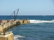
Kingston Pier
Small fishing boat being lifted out of the water. All cargo comes ashore in this manner.
|  38 38
Coastline west of Kingston Pier
|  39 39
Hillside cutting for access road to Cascade Pier
|
 40 40
Cascade Pier on the north
As Norfolk has no harbour, ships stand about a kilometre off shore from Kingston or Cascade, according to where the swell is coming from, and lighters are sent out to pick up passengers or cargo.
|  41 41
Waves crash over Cascade Pier
|  42 42
Wet and Slippery at Cascade Pier
|
 43 43
Afternoon Tea Time
A delightful setting in the spacious grounds of this historic Norfolk Island Home built by Fletcher Quintal, a descendant of 'Bounty' mutineers Fletcher Christian & Matthew Quintal.
|  44 44
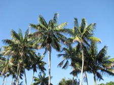
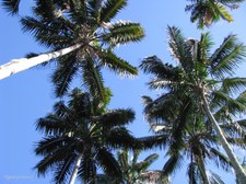
Kentia Palm Trees tower above
|  45 45
Kentia Palms (Howea forsteriana )
|
 46 46
Staghorn Fern growing on trunk of Kentia Palm
|  47 47
Staghorn Fern
|  48 48
Huge Avocado Tree
|
 49 49
Kentia Palms (Howea forsteriana )
|  50 50
Kentia Palms
|  51 51
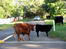
Cattle have 'right of way' on the roads
|
 52 52
Cow crossing the road
|  53 53
Cattle graze on road verges
Owners pay a registration fee of $68 per head to allow the cattle the freedom to graze on road verges.
|  54 54
Cars have to 'give way' to Cattle
The grass is always greener on the other side!
|
 55 55
St Barnabas Chapel
St Barnabas' Chapel, also known as the Melanesian Mission Chapel or the Patteson Memorial Chapel, is loved and valued by both residents of and visitors to Norfolk Island.
|  56 56
St Barnabas Chapel
St Barnabas' Chapel was originally built for the Melanesian Mission, whose school and headquarters were based on Norfolk Island between 1866 and 1920. Established as a memorial to John Patteson, who was ordained as Bishop of Melanesia in 1861, the building which has been used as a place of worship since 1880, has a fascinating history.
|  57 57
St Barnabas Chapel
St Barnabas' Chapel was designed by Sir Thomas Graham Jackson of London. The building work was carried out by the Mission workers and the Melanesian students, with assistance from the Norfolk Island community, who had settled on Norfolk Island from Pitcairn Island in 1856. The Chapel was consecrated on 7th December 1880.
|
 58 58
St Barnabas Chapel
Built as a memorial to Bishop Patteson, the Chapel was dedicated in 1880.
|  59 59
Windows in the Apse
The windows in the Apse dipicting the four evangelists were given by the Dowager Lady Downe.
|  60 60
Stained Glass Windows and Roof Structure
|
 61 61
The Sanctuary
The Organ was presented by Miss Charlotte Yonge, the tapestry hangings were sent by Mrs Goodenough, and Bishop John Selwyn gave the Lamps.
|  62 62
Roof Structure
The roof is designed like the keel of a ship. The large supporting beams are of Norfolk pine, treated with whale oil. The design is a factor in the excellent acoustical qualities of the Chapel, often used as a venue for musical performances. The roof looks like a ship's hull.
|  63 63
Seating either side of the broad Aisle
The seats are carved and inlaid with Christian symbols in mother-of-pearl, done in spare time by missionaries and boys.
|
 64 64
Stained Glass Window
The window, above the entrance, was given by the members of the Mission in memory of the workers who had given their lives in the islands. Beneath the Rose Window, with its many hues, is Philip the Deacon baptising the Ethiopian eunuch. The five stained glass panels commemorate the five workers martyred, one being Bishop Patteson, and two Norfolk Islanders
|  65 65
Melanesian Mission Memorial Garden
1866-1920.
|  66 66
Memorial Garden
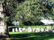
The burial ground for workers and pupils of the Mission used to be a short walk to the north of the Chapel. By the 1970's the site became overgrown, access difficult, and the headstones badly damaged and trampled by cattle. In 1980 the headstones were re-located to a special Memorial Cemetery near the Vestry.
|
 67 67
St Barnabas Chapel from Memorial Garden
|  68 68
Memorial Garden
Some of the Headstones are the work of Melanesian boys and the occasional reversed letters can be found on the stones.
|  69 69
St Barnabas Chapel and Bell Tower
Mission headquarters were moved to Honiara in the Solomons in 1919-20, at this time most of the timber buildings were dismantled. The Chapel was handed over to the Norfolk Islanders and is today still used by the Church of England as one of their places of worship.
|
 70 70
Parish Hall
|  71 71
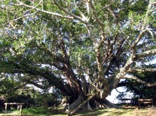
Moreton Bay Fig Tree
This huge exotic tree stands at the rear of the Memorial Gardens.
|  72 72
Strelitzia
St Barnabas Chapel gardens.
|
 73 73
Strelitzia
St Barnabas Chapel gardens.
|  74 74
Strelitzia
St Barnabas Chapel gardens.
|  75 75
Returning to Burnt Pine township
|
 76 76
Evening shadows end this island tour
| |
