Heading out from Fox Camp
Upper North Fork of the Entiat
Pyramid Mountain is on of my favorite hikes. It is located on the ridge that is on the west side of Lake Chelan. The site of an old lookout, this is one of the few 8000+ ft mountain tops in Washington that can be reached by trail. Grand views in all directions are the reward for your effort.
We didn't have a lot of time for a hike because of our Wyoming trip later in the month, so we were limited to a four night/five day trip. Our initial plan was to start at Big Hill and come out at the North Fork of the Entiat. Unfortunately, when we go to the turnoff to
Shady Gap and Big Hill, there was a sheriff's car sitting there enforcing a road closure due to a forest fire.
I figured out that we could do a loop trip from the N. Fork Entiat trailhead by using the little used Butte Creek trail. It would mean a lot more elevation gain for the trip to do it that way, but our options were limited.
In the years since 1998, there have been several forest fires that have burned over some sections of the route described here. These are primarily along the NF Entiat trail and SF Pyramid Cr Trail.
For a longer narrative about this trip [CLICK HERE]
Adults on this trip:
Bill Mooseker,Bill Peckinpaugh
Scouts on this trip:
Andrew Mooseker, Danny Stallings, Austin Peckinpaugh, Eric Walkingshaw, Kyle Meissner,
Roger Shively
The descriptions under the photo thumbnails in the album sometimes contain links to maps or additional information. These are identified by "Blue” text for links. I've also inserted links to Google Maps to show where certain photos in the album were taken or to locate features shown in the photos. Click on the link, close the sidebar, and choose satellite view. Basically, you can then zoom in and out using the mouse wheel or drag the map by clicking and holding.
Troop 24 "The High Adventure Troop" Backpacking Trip
-Cascade Bill Mooseker
Date(s): August 7-11, 1998. Album by Cascade Bill. 1 - 64 of 64 Total. 4247 Visits.
enlarge 335KB, 995x1024 1 picsnvids
To enlarge photos, click on the thumbnail - the photo will pop up enlarged to 1024 pixels max (height or width). To view at Original size, just click on the enlarged photo, which will show the photo enlarged to fit the screen. Click on the screen to enlarge that portion of the photo at original resolution. Click again to reduce.
If you want to save photos to your computer, click the box under the thumbnails of all the photos you want to download. Then click the "Download" button at the top of the album. Pick the size you'd like to download (Original is best)and the photos will be downloaded as a zip file to the folder of your choice.
enlarge 20KB, 791x1024 2 PYRM98.pdf
enlarge 108.39MB, 1024x682 3 1998-pyramid-001.mp4 VIDEO - Click Photo to View
Meeting at the Martha Lake Community Club to get our gear packed up and to get on our way. Usual mayhem ensues.
enlarge 41.39MB, 1024x682 4 1998-pyramid-002.mp4 VIDEO - Click Photo to View
Ramstein in the Gray Ghost - Dissension in the ranks as we didn't stop at the Monroe Mcdonalds for breakfast.
enlarge 28.48MB, 1024x682 5 1998-pyramid-003.mp4 VIDEO - Click Photo to View
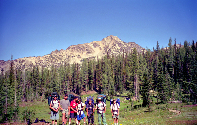
At the trailhead before setting out. Our original plan went out the window as there was a sheriff's car at the junction with the road to the Pyramid Mtn trailhead. He told us the road was closed because of a forest fire.
Forced to redo our route, I opted for starting at the North Fork of the Entiat trail, for a loop trip in the reverse direction.
enlarge 256KB, 662x1024 6 1998 pyramid map 1
enlarge 516KB, 1024x667 7 98-305-013
Taking a break at the trail junction where the South Pyramid Creek Trail meets the North Fork of the Entiat Trail. We would come down the S Pyramid trail at the end of our trip.
Location is at Marker B of the Day 1 Map: Click Here
enlarge 515KB, 1152x712 8 98-305-014 Andrew at our break.
The first day was pretty uneventful with a valley pounder up the N. F. Entiat. We had hoped to get as far as the Fern Lake Trailhead but there was a large group with horses taking off at the same time that had were going to use the camp there as a base camp so we pulled up a little short to camp at Grouse Creek about a mile from the Fern Lake Trail.
enlarge 29.94MB, 1024x682 9 1998-pyramid-004.mp4 VIDEO - Click Photo to View
It didn't take us long to hike the short distance to the Fern Lake Trailhead. Our plan was to day hike to the lake, return and continue up the N.F. trail to Fox Camp.
It is only about 1.6 miles to Fern Lake, but you have to climb 1700 feet in the bargain. In 1982, we did a fifty miler over part of this route, and hauled our packs up this extremely steep and primitive trail. I swore that I would never do that again.
Fern Lake is a beautiful lake that sits in a bowl near the ridgetop. Just when you think that you are never going to get there, you pop over a mound of granite and, boom!, there it is. We had a good time fishing for the cutthroat trout that inhabit the lake.
This video was taken near the lake, where we got our first view of the forest fire that forced us to change our trip plans.
enlarge 71.71MB, 1024x682 10 1998-pyramid-005.mp4 VIDEO - Click Photo to View
Fern Lake is a beautiful alpine lake, but the trail to it is very steep. I was first here in 1982 with Troop 24. We carried our packs up to the lake where there were very few sub standard camping spots.
In 1982, I had no luck with the fishing as I had no strikes. One scout (Corby Miller) caught two or three. We did have fun with a round of "Nugee Blasters" into the lake (I'll leave that to your imagination).
On this trip, the fishing was great. I caught and released about 30 fish. It was so ridiculous that Roger tied a lure onto a line tied to a stick and trolled by swimming in the lake. He actually caught a fish as shown on this video.
enlarge 268KB, 1024x662 11 1998 pyramid map 2
enlarge 483KB, 1024x662 12 98-305-015 Guys at Fern Lake. Location is HERE
enlarge 506KB, 1024x665 13 98-305-016 It was a great day hike.
enlarge 390KB, 1024x642 14 98-305-017
Bill Peckinpaugh - ready to leave Fern Lake. That is Pyramid Mountain in the background, although it looks more like a Gorilla to me.
enlarge 463KB, 1024x664 15 98-305-018 Heading down the Fern Lake Trail - Eric, Danny, and Kyle.
enlarge 507KB, 674x1024 16 98-305-019
Andrew near the upper end of the Fern Lake Trail.
I was pooped when we got back down to the bottom. It was late
afternoon, and we still had another 1500 feet to climb. By the
time we all straggled into Fox camp we were all bushed. We had
only hiked about 6 miles but we had climbed over 3400 feet, no
wonder we were tired.
enlarge 46.68MB, 1024x682 17 1998-pyramid-006.mp4 VIDEO - Click Photo to View
For night 2 we camped at Fox Camp, which was a long climb from the junction with the Fern Lake trail. This is a great campsite, with a wonderful campfire spot up against a big boulder.
enlarge 689KB, 1024x658 18 98-305-020
Morning at Fox Camp. We will have a pretty easy day for our 3rd day on the trail, 3.4mi and 1100' climb, so we're not rushing to get out early.
enlarge 569KB, 1024x658 19 98-305-021 Danny & Roger packing up.
enlarge 42.63MB, 1024x682 20 1998-pyramid-007.mp4 VIDEO - Click Photo to View
Morning action at Fox Camp. Andrew expresses consternation at Eric applying deodorant.
enlarge 572KB, 1024x662 21 98-305-022
Roger, Andrew, and Danny at Fox Camp Campfire pit.
Fox Camp is a good "fair weather" campsite. There are no sheltering trees, but a giant rock forms the backdrop for the firepit and makes for a cozy campfire long into the night. "Sundown Peck" (Bill Peckinpaugh) was in his tent and fast asleep before twilight. We were all tired and I don't think the rest of us stayed up too late.
enlarge 268KB, 1024x662 22 1998 pyramid map 2
enlarge 406KB, 1024x650 23 98-305-023a
Day 3- Ready to head out: Eric, Bill P, Danny, Roger, Kyle, Andrew, and Austin. The picture at left shows the upper N.F. Entiat Valley from near Fox Camp.
The mountain is Saska Peak and Saska Pass is located on the left side of the picture. This had been our usual route on a Pyramid Hike - Hike the Pyramid Mountain trail from Big Hill to Saska Pass and down to Snow Brushy Creek. On this trip we would backtrack about a quarter of a mile and head for Grouse Pass in the reverse direction.
enlarge 439KB, 1024x658 24 98-305-024a
After the junction with the N.F. Entiat trail, the Pyramid Mountain trail makes a long ascending traverse of a ridge. Where the trail crosses the ridge, a viewpoint gives us a view of Pyramid as well as the smoke from the forest fire that had forced our change in departure points. The smoke was billowing out in dark ominous clouds. We couldn't see exactly where it was but it looked a little close for comfort.
enlarge 64.62MB, 1024x682 25 1998-pyramid-008.mp4 VIDEO - Click Photo to View
From Fox camp we retrace our path from the previous day along the Pyramid Mountain trail to the junction with the NF Entiat trail. From there we continue on the Pyramid Mtn trail climbing about 250 feet to the ridge above the Grouse Cr basin, where we took this break. We got a closer view of the forest fire as you can see from the video.
enlarge 521KB, 1024x656 26 98-305-025
Starting off a slight descent into Grouse Basin. That pass at the center is not Grouse Pass, which is actually at the right side of the picture.
enlarge 480KB, 1024x650 27 98-305-026
Grouse Pass in the distance - just below the talus slope of the peak at the middle of the photo.
enlarge 96.05MB, 1024x682 28 1998-pyramid-009.mp4 VIDEO - Click Photo to View
Hiking along from our break at the ridge above Grouse Creek and at our lunch break at Grouse Pass.
From the ridge, the trail drops 400 feet to Devil's Camp and begins to climb again, gradually at first then after a final crossing of Grouse Creek, it becomes very steep. We were all glad when we reached the top of grassy Grouse Pass. From the pass, we had a close up view of Pyramid just across the valley.
From this vantage point, the mountain looks like the head and
shoulders of a Gorilla. We had lunch, and the boys climbed to the
top of a rock outcrop on the south side of the trail. Rested, we
hoisted our packs and began the switchbacks dropping down the east
side of the pass.
enlarge 49.05MB, 1024x682 29 1998-pyramid-010.mp4 VIDEO - Click Photo to View Leaving Grouse Pass to descend to our camp below.
enlarge 466KB, 1024x655 30 98-305-027 View of the switchbacks below Grouse Pass.
enlarge 533KB, 1024x843 31 98-305-028 Our group descending the switchbacks below Grouse Pass.
enlarge 561KB, 763x1024 32 98-305-029 On our way down.
It wasn't long till we arrived that that night's destination: Buck Camp. This is a very nice camp that is very popular with horse parties and has many convienciences, such as a table and a rock that is even bigger than the one at Fox Camp. Greg and I had stayed here in 1987, but there was another party here in 1995 when we had last passed through.
enlarge 42.86MB, 1024x682 33 1998-pyramid-011.mp4 VIDEO - Click Photo to View
Footage from night 3 camp at Buck Camp, another very pleasant camp that featured a rustic table.
A previous camper had left a couple of potatoes at the camp, so we quickly added these to the nightly menu. We had only hiked about 3.5 miles so we were in camp early and took full advantage of our leisure time to relax and soothe our aching muscles. After supper the boys played capture the flag in the meadow below the camp.
enlarge 271KB, 1024x662 34 1998 pyramid map 3
enlarge 604KB, 1152x628 35 98-305-030 Day 4 - Heading out cross country to meet the trail up Pyramid Mountain. Andrew, Kyle, Roger, Bill P. and Austin.
If you take the trail from Buck Camp, you lose quite a bit of elevation which must be made up again. In order to avoid this, I planned to go cross country and link up with an abandoned sheepdrive that would connect us with the Pyramid Mountain trail.
enlarge 536KB, 1024x665 36 98-305-031
In years past, I had followed this route, coming out near Grouse Pass. This time I didn't want to retrace our steps back up to the pass, so we headed NE out of Buck Camp following the stream from the upper meadows. The route is not difficult to follow, although the final ascent into the upper meadows is quite steep.
enlarge 560KB, 1024x662 37 98-305-032 Taking a break on our way up.
When you get to the upper meadows you come around a shoulder that has a sandy pumice slope on the back side. If you climb up this slope back to the shoulder, you will find the vague tread of the old Sheep drive. The tread is vague, so you have to look for it a few times but we had no trouble making our way up another basin.
enlarge 432KB, 1024x658 38 98-305-033
As we climbed we scared up six or seven grouse. It was fun to watch where they landed and then throw rocks to get them going again. Just when we figured that was the last one, another would burst out of the bushes.
At the head of the basin, the tread disappears in high grass, but you make for a steep sand gulley ahead of you. If you climb high, you find a steep path tromped into the sand. Kyle named this the "Sandbuster" which is in the photograph above.
enlarge 529KB, 690x1024 39 98-305-034 This section is very steep.
enlarge 445KB, 761x1024 40 98-305-035
When you get to the top of the "Sandbuster", you go over a lip and find yourself on the west slope of Pyramid Mountain. We took a break, and then climbed a couple of humdred feet to the trail headed for the summit.
enlarge 437KB, 1024x653 41 98-305-036 Danny, Chip, and Kyle.
enlarge 56.44MB, 1024x682 42 1998-pyramid-012.mp4 VIDEO - Click Photo to View
Video from our break. In 1995, we did this portion in reverse, coming down the Sandbuster to camp at Buck Camp.
enlarge 440KB, 1024x664 43 98-305-037
Andrew on the trail up to the summit of Pyramid. Glacier Peak is just to the left of center. When we got to the Pyramid Mtn trail, we grabbed our water bottles and some snacks and set out for the top. The Lookout was destroyed many years ago per the official policy of the forest service, but the remains of the outhouse, and a rock cave used for storage still exist.
enlarge 336KB, 1024x663 44 98-305-038 Looking west to Glacier Peak.
From the top we could see the forest fire, comfortably a few miles to the south. We could make out a chopper dropping water on a hot spot. There was quite a bit less smoke today than there had been on the previous day.
Views of Lake Chelan are spectacular. We could look to the east to the Chelan Summit where we had been the previous summer. And to the west we could see rows and rows of ridges making up the Cascades, with Glacier Peak most prominent among the many peaks. I pointed out Mt. Maude and Seven Fingered Jack, which we had camped near on a trip the previous August.
enlarge 64.80MB, 1024x682 45 1998-pyramid-013.mp4 VIDEO - Click Photo to View Video of our climb to the summit of 8243' Pyramid Mountain.
enlarge 371KB, 676x1024 46 98-305-039
Looking east from the summit, you can see Lake Chelan far below and the peaks of the Chelan Summit in the far distance.
enlarge 427KB, 1024x644 47 98-305-040
Looking more to the NE you can see the Prince Creek Drainage. You can be dropped off the boat at Prince Creek and then have a long, long, climb up to the Chelan Summit Trail, which I've done twice.
enlarge 422KB, 1024x657 48 98-305-041
Guys at the summit. If you view this photo at "Original" size and using the next photo for reference, you can find Fern Lake.
enlarge 154KB, 1024x740 49 pyr7
Low res version of the previous photo, showing the various landmarks off to the west. (I've incorrectly identified Buck Mtn, which is actually the peak just to the left of Glacier Peak. The Mountain labeled as Buck Mtn is actually Clark Mtn.)
enlarge 338KB, 1024x653 50 98-305-042 Roger, Andrew, Eric, Danny, and Bill P.
enlarge 100.65MB, 1024x682 51 1998-pyramid-014.mp4 VIDEO - Click Photo to View
Video of our time at the summit of Pyramid, including a panoramic scan from the top.
enlarge 435KB, 677x1024 52 98-305-043 View from the summit.
enlarge 356KB, 1024x667 53 98-305-044
You can see Fern Lake just to the left of center in this photo. Use Original size for best view.
While we were at the summit, the boys searched for bits of melted glass and rusty hardware left in the ashes of the old lookout. It was a good time to rest and appreciate the wonders of nature.
enlarge 456KB, 1024x660 54 98-305-045 Andrew and Kyle on their way down.
All good things come to an end and it wasn't long before we had to drag ourselves away and head back down the trail to get our packs
and continue our hike out. Down, down, switchback after switchback the trail descends. It sure is a lot easier going down than it is coming up. After a bit the trail drops into a nice basin with possible camps, but we press on climbing about 200 feet out of the basin to meet the Pyramid Mtn trail just before it descends down to meet the South Fork of Pyramid Creek Trail.
After another mile or so of ups and downs, we arrive at Meadow Camp, the usual first night camp if you are coming in from Big Hill.
enlarge 30.81MB, 1024x682 55 1998-pyramid-015.mp4 VIDEO - Click Photo to View
Night 4 - Meadow Camp. This camp is usually our first night camp after starting out at the Pyramid Mtn trailhead. Everyone except me elected to sleep under the stars. I know from experience that no matter how many stars are out when you go to bed, there is still a chance that a front will move in by morning.
We watched the shooting stars from the Perseid Meteor shower and
saw again the owl that had mistaken the ball on Andrew's wool hat
for a small animal in 1993. He flew over our heads a couple of
times but didn't carry anybody off.
enlarge 63.71MB, 1024x682 56 1998-pyramid-016.mp4 VIDEO - Click Photo to View
Day 5 - morning at Meadow Camp, which will hereinafter be known as "No Bastard" camp. When I couldn't find the stove bags, I raised a ruckus, "Where's the stove bags? Who's the bastard that took the stove bags". When I found them in my own pile of stuff, I exclaimed, "No Bastard".
To this day on one of our campouts, whenever someone finds that he made a wrong assumption or finds something he was looking for, he says "No Bastard".
enlarge 253KB, 1024x662 57 1998 pyramid map 4
enlarge 401KB, 1024x663 58 98-305-046
A little ways beyond "No Bastard" camp, we get a peekaboo view of Lake Chelan. We had a long way to go on our last day, so we headed out looking forward for our "porking out" experience at days end. In about about a quarter of a mile form Meadow Camp, the trail comes to this overlook down into Lake Chelan almost a mile below.
Leaving the viewpoint, the trail climbes a couple of hundred feet up
Graham Mountain and then begins a long scenic traverse.
enlarge 396KB, 1024x661 59 98-305-047 Looking at Lake Chelan from viewpoint.
enlarge 79.66MB, 1024x682 60 1998-pyramid-017.mp4 VIDEO - Click Photo to View
Marmot along the way. At a break Bill P talks about the famous "In and Out Burgers" in LA.
enlarge 408KB, 1024x668 61 98-305-048 Farewell to Pyramid Mtn - Danny, Eric, Andrew and Kyle.
enlarge 408KB, 1024x664 62 98-305-049 Bill M and Andrew.
enlarge 453KB, 1024x777 63 98-305-050 Andrew, Eric, Danny, and Kyle.
The trail heads down through meadows and past this viewpoint from which we get a good view of Pyramid. A couple of hundred feet further, the trail goes around the end of the ridge and drops via a series of switchbacks into a small basin with a couple of rustic campsites near a bubbling brook.
After a break in the shade, we cross the creek and push on up a slight grade and then a long traverse of a wooded basin. After the tread levels out and then begins to climb, we come to a sharp switchback and soon to a shoulder of a ridge to the signed junction with the Butte Cr Trail.
Initially the Butte Cr Trail traverses a shoulder of Crow Mountain. At first the tread is visible but it becomes intermittant and vague the further one goes from the junction with the Pyramid trail. Eventually all trace of the tread is lost in the grassy slopes. The map shows the trail going down the crest of the ridge so we make our way down until w...
enlarge 50.11MB, 1024x682 64 1998-pyramid-018.mp4 VIDEO - Click Photo to View
This video is about a mile from the trailhead.
The advantage of a steep trail is that it gets to where its going very quickly, and it wasn't long until we came to the junction with the South Fork of Pyramid Cr. Trail. From here to the cars it was a long valley pound, seemingly neverending and very boring. Eric
and Danny amuse themselves making up verses to "Henry the 8th, I am, I am!" until Bill Peckinpaugh banished them from the front. They were up to their 95th verse when I made them stay at least a hundred yards behind me.
At last we were out, and burger pangs became urgent. Our usual stop when we were near Entiat was Keene's cafe, home of the world famous Tiger Burger. Unfortunately, it had gone out of business since the last time we were here so we had to drive many miles until we
decided to stop at "Rusty's Burgers" in Cashmere. Although not as good as a Tiger Burger, the...