
1
Welcome to Guilderton
Located where the Moore River meets the Indian Ocean about 94 kms north of Perth.
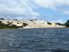
| 
2
Guilderton on the Moore River Estuary
The town of Guilderton was gazetted on 30 November 1951. Originally known as 'Gabbadah' an Aboriginal term meaning "mouthful of water", the area has been used for recreation since the earliest days of white settlement in the Gingin district.
| 
3
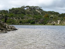
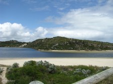
Looking towards the mouth of the Moore River
One of the most pristine, yet fragile estuarine environments in the south west of Western Australia.
|

4
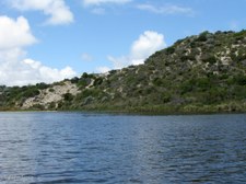
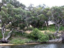
Northerly bank of the Moore River
| 
5
Clean White Sands of Sandbar
| 
6
Launching the Cruise Boat
|

7
Cruise Boat almost afloat
| 
8
Boarding the Cruise Boat
| 
9
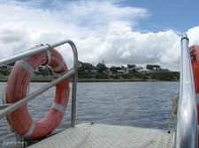
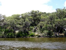
South Bank of the Moore River
View from Cruise Boat.
|

10
Heading towards the Sandbar
| 
11
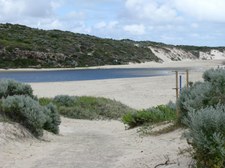
Sandbar at mouth of Moore River
| 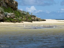
12
Waterbirds enjoying the Shallows
|

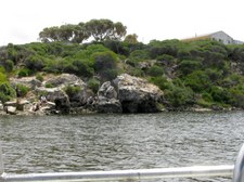
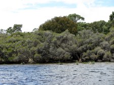
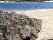
13
Caves in the Limestone Cliffs on North Bank
| 
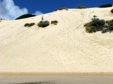
14
Seagulls and Terns in Shallows
| 
15
Boardwalk around base of Cliffs
|

16
Limestone Cliffs
| 
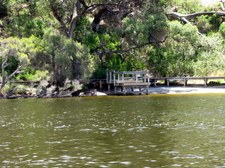
17
The Indian Ocean beyond the Sandbar
The ocean swell builds up the sandbar damming the river mouth in Spring and Summer.
| 
18
The Sandbar
|

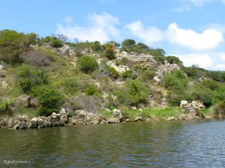
19
Hilltop Lookout on North Bank
| 
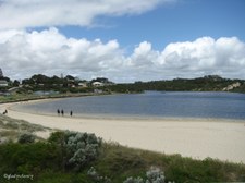
20
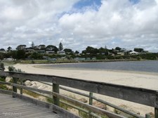
The Town of Guilderton
The strong affection which the population of the area felt for the Gabbadah district was reflected in the very enlightened and 'site-sensitive' design of the settlement with large areas of native vegetation preserved within the townsite.
| 
21
Heading Upstream
|
22
Calm Waters of the Moore River
| 
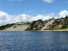
23
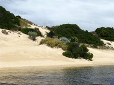
Sand Dunes on the Southern Side
| 
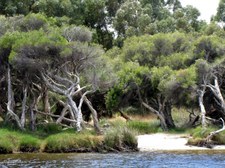
24
Northern Side of Moore River
|

25
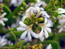
A Splash of Colour
The bright Orange of the West Australian Christmas Tree (Nuytsia floribunda)makes a splash of colour on the hill side.
| 
26
Natural Vegetation on Sand and Limestone
| 
27
Little Pied Cormorants in Tree
(Phalacrocorax melanoleucos)
|

28
Little Pied Cormorants on Rock
(Phalacrocorax melanoleucos)
| 
29
Trio of Little Pied Cormorants
(Phalacrocorax melanoleucos)
| 
30
Birds in the Trees ahead
There have been positive sightings of over 110 species of birds in the Moore River area.
|

31
Australian Pelicans and Little Pied Cormorants
| 
32
Birds enjoying the Sunshine
| 
33
Australian Pelicans
(Pelecanus conspicillatus)
|

34
Birds enjoying the Sunshine
| 
35
Row of Little Black Cormorants on Left
(Phalacrocorax sulcirostris)
| 
36
Little Black Cormorants
(Phalacrocorax sulcirostris)
|
37
Quindalup Dunes
The Quindalup Dunes on the south of the river were too infertile for either pasture or crops, so it is fortunate that their rich bio-diversity has been spared from being cleared for agriculture.
| 
38
Enjoying the Tranquility of the Quindalup Dunes
| 
39
Re-vegetation on the North Bank
All development has taken place on the north side of the estuary and this area has been re-vegetated to provide habitat for native birds and wildlife.
|

40
River Bank Vegetation
Vegetation is of vital importance because it holds the sand together with its roots and reduces wind speed, and therefore erosion, with its branches.
| 
41
Dune Vegetation on South Bank
| 
42
Paperbarks and Riverbank Vegetation
|

43
Quindalup Dunes
Known as "The Desert".
| 
44
Long Hard Climb to Top of Sand Dune
| 
45
Sandboarding
A quick ride down the slope of the sand dune.
|

46
Resting at the Water's Edge
| 
47
Riverbank Vegetation on North
| 
48
Vegetation dotted with White Wildflowers
|

49
South Bank Dune Vegetation on the Right
| 
50
North Bank Vegetation on the Left
| 
51
Closer to North Bank Vegetation
|
52
Boardwalk and Fishing Platform
Anglers have the choice of ocean or river fishing at Guilderton.
| 
53
Fish Sculpture by Nick Compton
Made during an Environmental Art Workshop held at Moore River.
| 
54
Fish Sculpture by Nick Compton
|
55
Looking back to Quindalup Dunes
| 
56
Northern River Bank
| 
57
Further Upstream from Quindalup Dunes
|

58
Travelling Upstream
| 
59
Remnant Tuart Trees (Eucalyptus gomphocephala)
Only 6-7% of the original tuart forests still exist and Moore River is at about the northern limit of their range.
| 
60
Tuart Trees beyond the Paperbarks
|

61
Habitat right to the Water's Edge
| 
62
Re-vegetation with Eucalypts
| 
63
Depleated Understorey Vegetation
Landowners have allowed stock to graze right to water's edge resulting in loss of all understorey vegetation.
|

64
Depleated Understorey Vegetation
Although the land adjoining the river is Crown Land, adjacent landowners have allowed stock to destroy the vegetation in this area.
| 
65
Regrowth of Vegetation in Fenced Area
| 
66
More Loss of Vegetation where Stock Roam
|

67
Unspoilt by Roaming Stock
Compare the difference to previous photo.
| 
68
Tuart Trees with Natural Understorey Vegetation
Only 6-7% of the original Tuart (Eucalyptus gomphocephala) forests still exist and Moore River is at about the northern limit of their range.
| 
69
Healthy Trees further Upstream
|

70
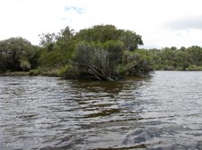
River Island on the Left
This island in the river provides safe nesting habitat for wildlife.
| 
71
Grasstrees beneath the Tuart Trees on the Right
| 
72
Riverbank Unspoilt by Roaming Stock
|
73
Circling around the Island in the Moore River
Commencing the return journey.
| 
74
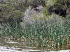
Reeds on the Island give Safety to Waterbirds
| 
75
Reeds and Paperbarks
|
76
Reeds and Paperbarks with tiny White Flowers
| 
77
Natural Vegetation Mix
| 
78
Returning to the Quindalup Dune Area
|

79
More Sandboarders as we return past the Dunes
| 
80
Beach Spinifex and other Dune Vegetation
| 
81
Boardwalk on North Riverbank
|

82
Map of the Moore River
Scanned from travel brochure.
| 
83
Limestone Monument at Guilderton
| 
84
Windswept Tree beside BBQ Shelter
|

85
Mouth of the Moore River from Boardwalk
| 
86
Path around the base of the Cliff
| 
87
Moore River and Indian Ocean
|

88
Formations in the Limestone
| 
89
Limestone Cliffs
| 
90
Limestone Formations
|

91
Vegetation on the Limestone
| 
92
Guilderton from the Boardwalk
| 
93
Sandbar from the Boardwalk
|

94
The Boardwalk protects the Environment
| 
95
Clinging to Life on the Rocks
| 
96
Limestone Formations
|

97
Limestone Formations
| 
98
View of the Sandbar
The Moore River provides a safe swimming area for children while the ocean usually provides good waves for surfers.
| 
99
End of the Boardwalk
Sandy track continues around the Dune.
|

100
Sand Dune Vegetation
| 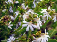
101
Wildflowers on the Sand Dunes
Thick-leaved Fanflower (Scaevola crassifolia).
| 
102
The Indian Ocean
|

103
View of Indian Ocean
| 
104
Mouth of Moore River
| 
105
Thick-leaved Fanflower (Scaevola crassifolia)
|

106
Returning to the Boardwalk
| 
107
Passing Limestone Formations
| 
108
Last Look at the Sandbar
The sandbar at the river mouth is broken by both winter rains, and summer groundwater build-up which comes from Silver Creek (an estuary wetland) and underground flow.
|

109
Guilderton comes into View
| 
110
Limestone on the River Bank
| 
111
Clouds gathering over Guilderton
|

112
The Coach is waiting in the distance
| 
113
Looking back along the Boardwalk
| 
114
The Moore River
|

115
Returning along the Boardwalk
| 
116
Moore River from the Boardwalk
| 
117
Limestone Formations
|

118
Cliff Top Lookout above the Boardwalk
| 
119
Time to leave the beautiful Moore River
We must all fight to preserve this pristine, yet fragile estuarine environment so it does not succumb to the greed of developers and urban sprawl.
| 
120
Goodbye Guilderton Pelicans
|
