
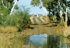
1
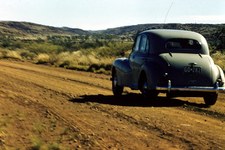
001 RouteTravelled
Departed from Konnongorring and travelled in anti-clockwise direction.
| 
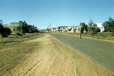
2
002 Flats between Wubin and Paynes Find
| 
3
003 Goldfields Woodlands
|

4
004 Payne's Find Hotel
| 
5
005 Heading North
| 
6
006
|

7
007
| 
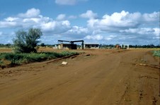
8
008 Wide Open Spaces
| 
9
009
|

10
010
| 
11
011 Northern Goldfields Ghost Town
Possibly Big Bell or Day Dawn.
| 
12
012
|
13
013 Main Street of Cue
| 
14
014
| 
15
015 Town of Meekatharra
|

16
016 Royal Mail Hotel at Meekatharra
| 
17
017 Road Train at Meekatharra
| 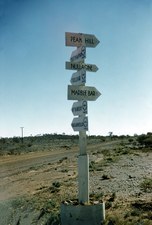
18
018 Road Signpost
This way to Peak Hill, Nullagine and Marble Bar.
|
19
019
| 
20
020 The Road
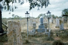
A two-wheel track with protruding stones.
| 
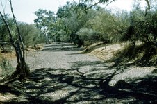
21
021 Dry Creek Bed
|

22
022 Spinifex and Gum Trees
| 
23
023 Stony Ground
| 
24
024 Houses
Possibly at Peak Hill. Note the "Cool Room" at the back made by packing Spinifex between wire netting and cooled by trickling water.
|

25
025 Station Windmill and Tank
| 
26
026
| 
27
027 Kangaroo in the wild
|

28
028 Beside a Petrol Bowser
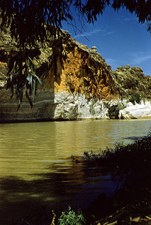
| 
29
029 North West Town
Possibly Nullagine.
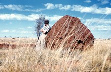
| 
30
030 Cyril at an old Mine Site
|

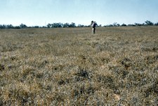
31
031 Coloured Rocks of the Pilbara
| 
32
032 North West Town
Possibly Nullagine.
| 
33
033 Wolseley in Pilbara Landscape
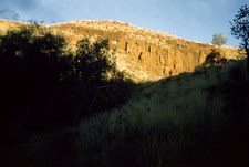
|

34
034 Grading the Road
| 
35
035 Town of Marble Bar
The world record for the longest sequence of days above 100°Fahrenheit (or 37.8° on the Celsius scale) is held by Marble Bar in the inland Pilbara district of Western Australia. The temperature, measured under standard exposure conditions, reached or exceeded the century mark every day from 31 October 1923 to 7 April 1924, a total of 160 days.
| 
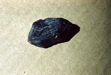
36
036 Marble Bar Government Buildings
In 1894-95 the Government Offices (now a series of National Trust listed buildings) were constructed out of local stone with corrugated iron roofs and elaborate stuccoed window dressings. Located just west of Sandy Creek on General Street they are the most impressive set of buildings in the town.
|

37
037 Marble Bar Landscape
| 
38
038 Marble Bar
Marble Bar was named after a local deposit of mineral first thought to be marble, but which later proved to be jasper (a highly coloured cryptocrystalline variety of quartz) which crosses the Coongan River about 5 km west of the town.
| 
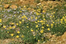
39
039 Marble Bar
The local deposit of mineral first thought to be marble, but which later proved to be jasper (a highly coloured cryptocrystalline variety of quartz).
|

40
040 Marble Bar Pool
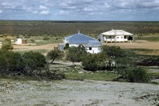
A popular swimming area for locals.
| 
41
041
| 
42
042
|

43
043
| 
44
044 Pilbara Landscape
Spinifex in the foreground, large Termite Mounds and ranges in the background.
| 
45
045
|
46
046
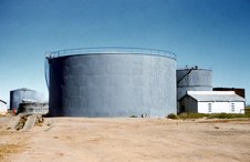
| 
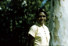
47
047 Aboriginal Girl poses for the Camera
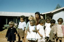
| 
48
048 Port Hedland Post Office
|

49
049 Port Hedland Police Station
| 
50
050 Port Hedland Wharf
| 
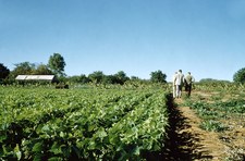
51
051 Near Port Hedland
|

52
052 Heading North to Broome
| 
53
053 Spider Web
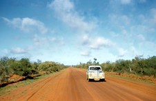
| 
54
054 Campfire
|

55
055 Broome beyond Roebuck Plains
| 
56
056 Broome
| 
57
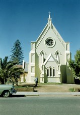
057 Pearling Lugger at Broome
|

58
058 Broome
| 
59
059 Broome
| 
60
060 Broome
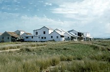
|

61
061 Gantheaume Point at Broome
| 
62
062 Japanese Pearl Divers Cemetery at Broome
| 
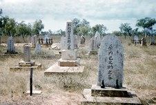
63
063 Japanese Pearl Divers Cemetery at Broome
|

64
064 Long Timber Jetty at Broome
| 
65
065 Broome War Memorial
| 
66
066 Dampiers Chest at Broome
A memorial to explorer William Dampier who first visited the area in 1688.
|

67
067 River Crossing
| 
68
068 Fitzroy River
| 
69
069 Kimberley Cattle
|

70
070 Water Trough for Cattle
| 
71
071 Water Trough
Derby boasts the "Longest Water Trough in the World".
| 
72
072 Artesian Water
|

73
073 Boab Tree near Derby
The Australian boab tree (Adansonia gregorii) is related to the Madagascan and African Adansonia species known as baobabs.
| 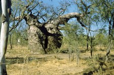
74
074 Boab Tree near Derby
The boab tree, a Kimberley Icon, is found only in the Western Australia Kimberley region, is used as food, medicine, shelter, for art work and even as a prison cell.
| 
75
075 Fisherman at Derby
|

76
076 Cane Grass
| 
77
077 Ivanhoe Research Station
| 
78
078 Ivanhoe Rice Fields
|

79
079 Rice Fields
| 
80
080 Rice Plant
| 
81
081 Fresh Water Crocodiles
|

82
082
| 
83
083 Siloutte of Sphinx-like Head
| 
84
084 Town in the foothills of a Range
Possibly Fitzroy Crossing.
|

85
085
| 
86
086 Rocky Outcrop
| 
87
087
|
88
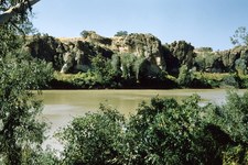
088 Geikie Gorge on the Fitzroy River
| 
89
089 Geikie Gorge
| 
90
090 Geikie Gorge
|

91
091
| 
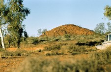
92
092a Large Termite Mound
| 
93
092 Kangaroo on Lookout
|

94
093 Emergency Water
Tony inspects the drum of emergency water placed beside the road to assist travellers.
| 
95
094 Fishing
| 
96
095 Landscape
|

97
096 Boggy Section of Road
| 
98
097 Sturt Desert Pea
| 
99
098 Heavy Haulage
|
100
099
| 
101
100 Whim Creek Hotel
| 
102
101 Cattle Grid
|

103
102 Bogged in the Sand
| 
104
103 Sunlit Hillside
| 
105
104 Gorge in Hamersley Range
|

106
105 Hamersley Range
| 
107
106 Steep Walls of Gorge
| 
108
107 Steep Walls of Gorge
|

109
108 Hamersley Ranges
| 
110
109 Town of Wittenoom
| 
111
110 Wittenoom Hotel
|

112
111 Dining at Wittenoom Hotel
| 
113
112 Blue Asbestos
The deadly Blue Asbestos was mined at Wittenoom.
| 
114
113
|

115
114 Wittenoom Landscape
| 
116
115
| 
117
116 Summit of Mt Herbert
This stone carn has since collapsed.
|

118
117 View from Mt Herbert
| 
119
118 View from Mt Herbert
| 
120
119 Mt Herbert
Truck laden with bags of Blue Asbestos negotiating the winding Chichester Pass Road from Wittenoom for shipment from Point Samson.
|

121
120 Python Pool at the base of Mt Herbert
| 
122
121 Pyramid Hill east of Roebourne
| 
123
122 Creek Crossing
|

124
123 Boiling The Billy
| 
125
124 Wildflowers
| 
126
125
|

127
126 Historic Stone Building
Possibly at Roebourne.
| 
128
127 Overlooking Cossack
| 
129
128 Mud Crab
|

130
129 Minderoo Station
| 
131
130 Vegetable Garden at Minderoo Station
| 
132
131 On Minderoo Station
|

133
132 On Minderoo Station
| 
134
133 On Minderoo Station
| 
135
134 Wildflowers
Millstream Swainsona (Swainsona pterostylis).
|

136
135 Carpet of Everlastings
| 
137
136 Minderoo Station
Grassed area around Homestead.
| 
138
137 Minderoo Station Homestead
|

139
138 Main Street of Onslow
| 
140
139 Onslow
| 
141
140 Fresh Bream
|

142
141 Ashburton River Bridge
| 
143
142 Ashburton River Bridge
| 
144
143 Aproaching Carnarvon
|

145
144 Carnarvon Whaling Station
Carnarvon, like many coastal towns at the turn of the 20th century, began commercial whale hunting. As early as 1912, whaling ships were operating in the waters off Carnarvon.
| 
146
145 Whale On Slipway
In the 1950's the Federal Government helped fund a whaling station at Babbage Island.
| 
147
146 Whale On Slipway
This station became one of the most modern whaling shore stations in the world. It was believed that over 600 whales were killed per season.
|

148
147 Carnarvon Whaling Station
Fortunately by the 1960's whaling ceased. The station was sold to the Nor-West Whaling Company (later to be renamed the Nor-West Seafoods).
| 
149
148 Harpoons
The 'Nor-West Seafoods' converted the whaling station into a factory for processing prawns, Shark Bay banana prawns to be exact.
| 
150
149 Whale Oil Tanks
The company is still processing prawns and even running seasonal whale and dolphin watching tours.
|

151
150 Production Tally
Date: 11 July 1956.
| 
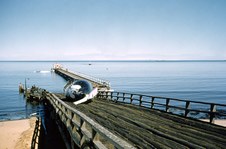
152
151 Carnarvon One-Mile Jetty
| 
153
152 School Children at Carnarvon
|
154
153 School Children with Teacher
| 
155
154 Dry Bed of Gascoyne River
| 
156
155 Bales of Wool for Shipment
|

157
156 Steam Engine
| 
158
157 Carnarvon Hospital
| 
159
158 Carnarvon War Memorial
|

160
159 Gascoyne Hotel at Carnarvon
| 
161
160 Main Street of Carnarvon
| 
162
161 Gascoyne River
|

163
162 Plantation at Carnarvon
| 
164
163 Banana Flower
| 
165
164 Bananas
|

166
165 Paw Paws
| 
167
166 Beans
| 
168
167
|

169
168
| 
170
169
| 
171
170 The Long Road Ahead
|
172
171
| 
173
172 Fuel Depot
Note the 44-gallon drums of fuel.
| 
174
173 Cyril watching Artesian Water
|
175
174 Artesian Water
| 
176
175 Hamelin Pool
| 
177
176 Hamelin Pool
|

178
177 Shell Blocks at Hamelin Bay
| 
179
178 Station Entrance
| 
180
179 Galena Lead Mine
|

181
180 Murchison River
| 
182
181 Our Lady in Ara Coeli Church at Northampton
Our Lady in Ara Coeli Church (c.1936). This fascinating building was designed by the legendary Monsignor Hawes with some influence from the Parish Priest of the time Father Irwin.
| 
183
182 Church at Northampton
|

184
183 Near Northampton
| 
185
184 Stone Ruins
Possibly Convict Prison Ruins at Port Gregory.
| 
186
185 Overlooking Geraldton
|

187
186 St Francis Xavier Cathedral at Geraldton
Famed architect Monsignor Hawes designed this magnificent building in the heart of Geraldton. The parish priest arrived in Geraldton in 1915 to work on the cathedral – regarded as one of his finest works. The cathedral’s foundation stone was laid in 1916 and the building was completed in 1938.
| 
188
187 Overlooking Geraldton
| 
189
188 Church at Geraldton
|

190
189 Geraldton Wharf
| 
191
190 Leaning Trees of Greenough
Buffeted by prevailing southerly winds, the trees' horizontal trunks have become something of an icon for the region of Greenough.
| 
192
191 Historic Buildings at Greenough
Greenough Historical Settlement where character stone buildings are remnants of a once thriving community of pioneers who developed the area at the turn of the 19th century.
|

193
192 Rainbow at Dongara
| 
194
193 Dramatic Sky at Dongara
| 
195
194 Approaching New Norcia
|

196
195 Welcome Home
Tony watches as Cyril is welcomed by his family.
| 
197
196 The End
| |
