
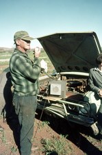
1
001 My Father's Land Rover at Coolgardie
| 
2
002 Ben Prior's Museum at Coolgardie
| 
3
003 Ben Prior's Museum at Coolgardie
|
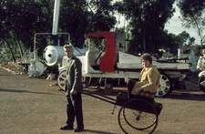
4
004 Ben Prior's Museum at Coolgardie
| 
5
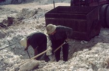
005 Tourist Mine at Kalgoorlie
| 
6
006 Tourist Mine at Kalgoorlie
|

7
007 Tourist Mine at Kalgoorlie
| 
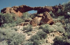
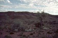
8
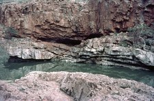
008 Overlooking a Salt Lake
| 
9
009 Paddy Hannan's Statue at Kalgoorlie
|

10
010 Menzies Town Hall
Town Hall & Shire Office: First section (left hand front) built in 1896. In 1900/01 the building was extended at a cost of 3,000 pounds to include Council Chambers, administration offices, public library & reading room with a town hall located at the rear of the building. The front section was completely renovated / restored from 1985 to 1988 and the rear hall was rebuilt in 1991. Further renovations were carried out on the offices in 1999.
Clock: Folklore suggests a clock for the clock tower was sent out from England via S.S. "Orizaba" in 1905. Unfortunately Orizaba sank off the coast of Rottnest Island. Eventually a clock was installed in the tower and unveiled on 1st January 2000.
| 
11
011 Menzies Street Scene
Menzies is a mining and pastoral town in the Eastern Goldfields, 730kms east of Perth.
| 
12
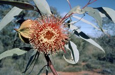
012 Flowering Gum (Eucalypt)
|

13
013 Goldfields Town
Leonora or Laverton?
| 
14
014 Goldfields Town
Leonora or Laverton?
| 
15
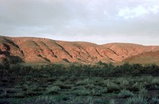
015 Convoy at Dusk
|

16
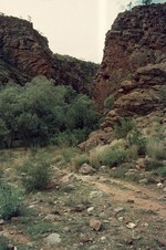
016 Rock Formations
| 
17
017 Red Pokers (Hakea bucculenta)
| 
18
018 Convoy in the Spinifex
|
19
019 Flowering Gum (Eucalypt)
| 
20
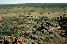
020 Flowering Gum (Eucalypt)
| 
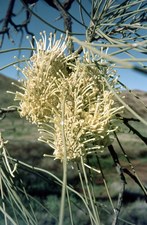
21
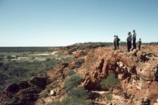
021 View from Granite Outcrop
East of Laverton.
|
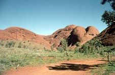
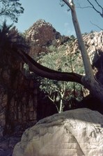
22
022 Rock Bridge Formation
| 
23
023 Rock Bridge Formation
| 
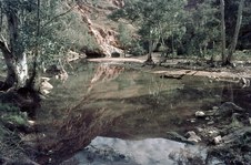
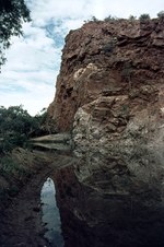
24
024 Pool at Base of Granite Rocks
|

25
025 Hann, Talbot & Giles were Explorers and Prospectors
Cosmo Newberry area.
| 
26
026 Lonely Grave of William Rutter, died 9 July 1894
Charles Hall, one of the original Heffernan exploration party, with William Rutter and others, made a trip to the east of Cue in search of Gold. Rutter died on this trip and his grave is somewhere east of Cosmo Newberry.
| 
27
027 Writing on the Rock
Photo was taken in 1968, so writing must refer to 15 June 1895.
|
28
028 The Convoy on the Track
| 
29
029 Aboriginal Rock Painting
| 
30
030 Local Residents of Aboriginal Community
|

31
031 Red Sand and Spinifex
| 
32
032 Exploring the Desert
| 
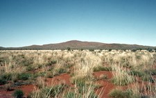
33
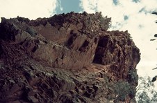
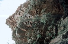
033 Granite Outcrop
|
34
034 Spinifex in foreground
| 
35
035 Perched on the Rock
| 
36
036 Rock Climbers
|

37
037 View from the Rocks
| 
38
038 Golden Glow on the Rocks
| 
39
039 Landscape
|
40
040 Corkwood Hakea
| 
41
041 Rocky Peaks on the Horizon
| 
42
042 Rocky Peak beside the Road
|

43
043 Desert Oak (Casuarina)
| 
44
044 Surveyor's Peg
Appears to be one of Len Beadell's Plaques.
| 
45
045 Communication by CB Radio
|

46
046 Distant Ranges
| 
47
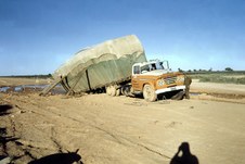
047 Using Manpower to get out of Bog
| 
48
048 Stopped on the Track
|

49
049 Rawlinson Ranges
| 
50
050 Rawlinson Ranges
| 
51
051 Spinifex
|

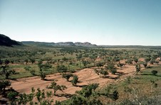
52
052 Landscape
| 
53
053 Crossing Dry Sandy Creekbed
| 
54
054 Proclaimed Native Reserve
|

55
055 Sunset on the Ranges
| 
56
056 Ghost Gum (Eucalypt)
| 
57
057 Windmill
|

58
058 Desert Community
| 
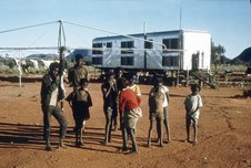
59
059 Aboriginal Community
| 
60
060 Aboriginal Children
|

61
061 Interior School Room
| 
62
062 Aboriginal Women and Children
| 
63
063 Dry Sandy Creekbed
|

64
064 Landscape
| 
65
065 Bird's Egg
| 
66
066 Wickham's Grevillea (Grevillea Wickhamii)
|

67
067 The Convoy at Dusk
| 
68
068 The Olgas / Kata Tjuta
Known as 'The Olgas' when this photo was taken, but now known by the Aboriginal name of 'Kata Tjuta' meaning 'Many Heads'.
| 
69
069 Green Birdflower (Crotalaria cunninghamii)
|

70
070 The Olgas / Kata Tjuta
| 
71
071 Closer to the Olgas / Kata Tjuta
| 
72
072 Land Rover towing Bus out of Bog
|

73
073 Ayers Rock / Uluru
Known as Ayers Rock when this photo was taken and renamed Uluru on 15 December 1993..
| 
74
074 Ayers Rock / Uluru at Sunset
| 
75
075 Ayers Rock / Uluru
Taken from the base of the rock.
|

76
076 Rock Pool
| 
77
077 Group beside Rock Pool
| 
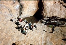
78
078 Rock Cave at Uluru
|

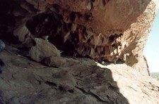
79
079 Inside Rock Cave
| 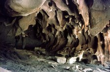
80
080 Rock Cave at Uluru
| 
81
081 View from top of Ayers Rock / Uluru
|

82
082 Signing Visitor's Book on top of Ayers Rock / Uluru
| 
83
083 Top of Ayers Rock / Uluru
The Olgas / Kata Tjuta on the horizon.
| 
84
084 Mt Conner
Mount Conner is a flat-topped and horseshoe-shaped inselberg rising 300 m above ground level.
|

85
085 Eremophila species
| 
86
086 Dry Sandy River Bed
Possibly Finke River.
| 
87
087 Mesa Landscape
|

88
088 Mesa Landscape
| 
89
089 Mesa Landscape
| 
90
090 Yellow Cassia
|

91
091 Alice Springs from Anzac Hill
Anzac Hill is the ideal spot for an overview of the town. The lookout offers a panoramic view of Alice Springs and the beautiful East and West MacDonnell Ranges. Anzac Hill has significance for the local Aboriginal people.
| 
92
092 Alice Springs from Anzac Hill
| 
93
093 War Memorial on Anzac Hill
The Anzac Hill Memorial was unveiled on 25 April 1934 (Anzac Day) and was originally dedicated to all those members of the armed services who had paid the supreme sacrifice during World War I. It has now become a memorial to all those who have served in the defence of their country during all wars in which Australia has participated.
|

94
094 Cloud Formation
| 
95
095 Road from Alice Springs
| 
96
096 Standley Chasm
West MacDonnell Ranges, Alice Springs.
|

97
097 Standley Chasm
West MacDonnell Ranges, Alice Springs.
| 
98
098 Standley Chasm
West MacDonnell Ranges, Alice Springs.
| 
99
099 West MacDonnell Ranges
Northern Territory.
|
100
100 West MacDonnell Ranges
Northern Territory.
| 
101
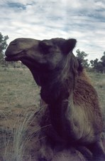
101 Camel Farm near Alice Springs
| 
102
102 Camel Farm near Alice Springs
|

103
103 Camel Farm near Alice Springs
| 
104
104 Camel Farm near Alice Springs
| 
105
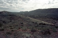
105 Landscape
|
106
106 Unsealed Road between the Ranges
| 
107
107 Natural Vegetation
| 
108
108 Glen Helen Gorge
|
109
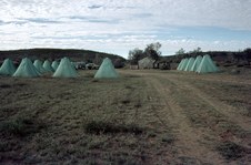
109 Tents in the Desert
| 
110
110 Glen Helen Gorge
| 
111
111 Settlement beneath the Scarp
Possibly Hermannsburg Mission, not sure.
|
112
112 Albert Namatjira Country
| 
113
113 Albert Namatjira Country
Albert Namatjira is one of Australia's great artists, and perhaps the best known Aboriginal painter and his western style landscapes - so different to traditional Aboriginal art, made him famous.
| 
114
114 Albert Namatjira Country
|

115
115 Albert Namatjira Country
| 
116
116 West MacDonnell Ranges
Reflections in Pool at Ormiston Gorge.
| 
117
117 West MacDonnell Ranges
Ormiston Gorge.
|

118
118 West MacDonnell Ranges
Ormiston Gorge.
| 
119
119 West MacDonnell Ranges
Ormiston Gorge.
| 
120
120 West MacDonnell Ranges
Ormiston Gorge.
|

121
121 West MacDonnell Ranges
Ormiston Gorge.
| 
122
122 West MacDonnell Ranges
Ormiston Gorge.
| 
123
123 West MacDonnell Ranges
Ormiston Gorge.
|

124
124 West MacDonnell Ranges
Ormiston Gorge.
| 
125
125 West MacDonnell Ranges
Ormiston Gorge.
| 
126
126 West MacDonnell Ranges
Ormiston Gorge.
|
127
127 West MacDonnell Ranges
Ormiston Gorge.
| 
128
128 West MacDonnell Ranges
Ormiston Gorge.
| 
129
129 West MacDonnell Ranges
Ormiston Gorge.
|

130
130 West MacDonnell Ranges
Ormiston Gorge.
| 
131
131 West MacDonnell Ranges
Ormiston Gorge.
| 
132
132 Flynn of the Inland
The Rev John Flynn died on 5 May 1951 and his ashes together with those of his wife Jean are buried at this site in Alice Springs.
|

133
133 Flynn of the Inland Memorial
In 1952 a large eight ton boulder, from the Devils Marbles area, was put on a low loader and driven 480 kilometres south to Alice Springs by George Nicholls and placed here as a marker for his grave.
Unfortunately the stone had been taken from the highly sacred women's site of Karlu Karlu at the Devils Marbles. It took more than 45 years of negotiations between the Arrernte Aborigines and the White custodians before this original stone was returned to its sacred site and replaced by a local stone on 4 September 1999.
While the new grave stone was dedicated and blessed with a Christian service at Alice Springs, the Warumungu and Kaytej women celebrated the return of their granite boulder at Karlu Karlu.
| 
134
134 Flynn of the Inland
Beneath this stone rest the ashes of 'Flynn of the Inland'. 1880 - 1951.
'Flynn of the Inland', the founder of the Flying Doctor service, is one of outback Australia's most loved characters. "His vision encompassed the continent. He established the Australian Inland Mission and founded the Flying Doctor Service. He brought to lonely places a spiritual ministry and spread a mantle of safety over them by medicine and radio" aptly sums up his life.
| 
135
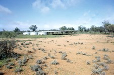
135 The United Church in North Australia
Flynn dreamed of an Inland cathedral where people of all faiths could worship. After his death, his friends across Australia built one in his memory.
|

136
136 The United Church
The Church was opened by the Prime Minister in 1956, and its design was a result of a national architectural competition incorporating passive cooling, local and national symbolism in its design.
| 
137
137 The United Church
| 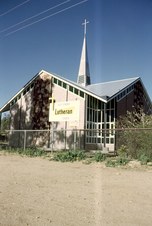
138
138 Alice Springs Lutheran Church
|
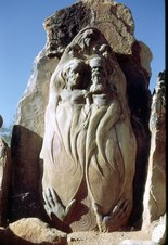
139
139 Pichi Ritchi Historic Sanctuary
Carvings by the famous artist William Ricketts, commemorating his passion for the local indigenous people of Central Australia. Unfortunately the Pichi Ritchi Sanctuary at Alice Springs has now been closed due to vandalism.
| 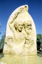
140
140 Pichi Ritchi Historic Sanctuary
Carvings by the famous artist William Ricketts, commemorating his passion for the local indigenous people of Central Australia. Unfortunately the Pichi Ritchi Sanctuary at Alice Springs has now been closed due to vandalism.
| 
141
141 Pichi Ritchi Historic Sanctuary
Carvings by the famous artist William Ricketts, commemorating his passion for the local indigenous people of Central Australia. Unfortunately the Pichi Ritchi Sanctuary at Alice Springs has now been closed due to vandalism.
|

142
142 Pichi Ritchi Historic Sanctuary
Carvings by the famous artist William Ricketts, commemorating his passion for the local indigenous people of Central Australia. Unfortunately the Pichi Ritchi Sanctuary at Alice Springs has now been closed due to vandalism.
| 
143
143 Unsealed Stuart Highway
Travelling south to Coober Pedy.
| 
144
144 Near Coober Pedy
Coober Pedy is recognised as the largest producer of opal in the world with an estimated 70% of the world's precious opal being mined in the opal fields of the area. The Coober Pedy Precious Stones Field, from which the opal is mined, covers an area of 4,954 square kilometres.
|

145
145 Coober Pedy
Coober Pedy is an opal mining town located in the harsh Outback of South Australia, some 850 kilometres north of Adelaide and 680 kilometres south of Alice Springs. Coober Pedy is recognised as the largest producer of opal in the world with an estimated 70% of the world's precious opal being mined in the opal fields of the area.
| 
146
146 Entrance to Underground Dwelling
Coober Pedy is probably best known for its unique style of underground living. There is a range of underground accommodation (as well as above ground if you prefer). There are authentic underground homes to explore as well as underground museums, potteries, opal shops, an art gallery and, of course, opal mines.
| 
147
147 Rain Water Tanks and Catchment Roof
|

148
148 Grain Silos
| 
149
149 Truckin' Problems
| 
150
150 Cattle Grid on the Long Straight Road
Heading Home after an interesting journey through Central Australia.
|
