
1
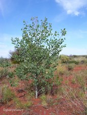
Desert Kurrajong
Desert Kurrajong growing north of Payne's Find.
| 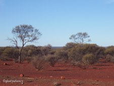
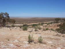
2
Roadside vegetation north of Payne's Find
| 
3
The Granites near Mt Magnet
|

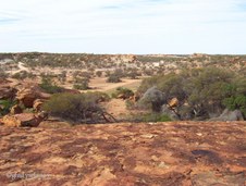
4
Granite Rock formations
| 
5
Mt Magnet from The Granites
| 
6
Historic Buildings at Cue
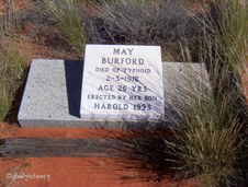
Post Office and Police Station at Cue
|

7
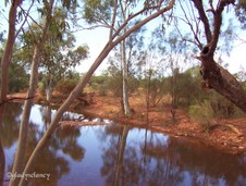
Historic Bank Of New South Wales
| 
8
Bandstand in Main Street of Cue
| 
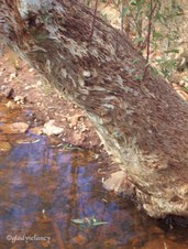
9
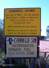
Local Boys at Cue
|

10
Nallan Dam
Nallan Dam was made to supply water to the steam engines when the railway used to run to Meekatharra
| 
11
Camping Ground at Nallan Dam
| 
12
View from Lake Annean Lookout
|

13
Lake Annean from Hilltop Lookout
| 
14
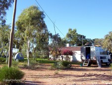
Dunna Dunna at Lake Annean
Dunna Dunna, a member of the Hibiscus Family, growing on the banks of Lake Annean
| 
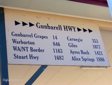
15
View to Lake Annean
|
16
Dry Bed of Lake Annean
| 
17
4WD Vehicle at Lake Annean
| 
18
Historic Nannine Cemetery
|
19
Historic Nannine Cemetery
| 
20
Meekatharra Open-Cut Mine
| 
21
Creek Crossing on road to Wiluna
|

22
Reflections at Creek Crossing
| 
23
Still Water at Creek Crossing
| 
24
Creek Crossing east of Meekatharra
|

25
Two Ringneck Parrots in the branches
| 
26
Patterned Bark of River Red Gum Tree Trunk
| 
27
Wiluna, main street looking up the hill
Wiluna is at the western end of the Gunbarrel Highway
|

28
General Store at Wiluna
Wiluna is on the western end of the Gunbarrel Highway
| 
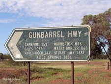
29
Gunbarrel Highway Sign above Petrol Bowsers
Sign at Wiluna showing distances yet to be travelled on this trip
| 
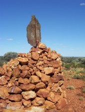
30
Wiluna, main street at turn-off to Gunbarrel Highway
|
31
Gunbarrel Highway Signpost
| 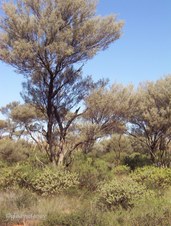
32
Vegetation, Mulga Shrubland
| 
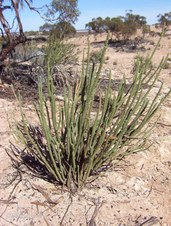
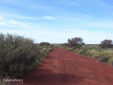
33
Wildflowers, Eremophila
|
34
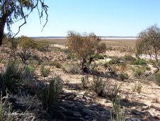
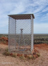
Wongawol Creek Crossing
| 
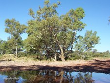
35
River Red Gums by Creek
| 
36
Harry Johnstone Water
Harry Johnstone Water is commonly called Mingal Pool
|

37
Mingal Pool on Wongawol Station
| 
38
River Red Gums at Mingal Pool
| 
39
Picnic Area at Mingal Pool
|

40
A Dying River Gum
| 
41
River Red Gums on Wongawol Station
| 
42
Dead River Gum
|

43
Carnegie Station Homestead
| 
44
Carnegie Station, Sheds and Vehicles
| 
45
Carnegie Station Camping Ground
|

46
Carnegie Station Roadsign
| 
47
Carnegie Station, Roadsign for Gunbarrel Highway
| 
48
Carnegie Station, looking back
|

49
Wildflowers, Flannel Bush on Carnegie Station
| 
50
Wildflowers, Flannel Bush on Carnegie Station
| 
51
Gunbarrel Highway
Heading East from Carnegie Station
|

52
Roadside Vegetation
| 
53
Wild Camels on the Road ahead
| 
54
Wild Camels a little closer
|

55
Vegetation
Gum Trees are sparse now
| 
56
Spinifex on Red Sand
Young re-growth after bushfire
| 
57
Gunbarrel Highway
The long straight road ahead to the horizon
|

58
Gunbarrel Highway
Mulga Scrub on Roadside
| 
59
Mt William Lambert, parking area
| 
60
View from Mt William Lambert
|

61
Mt William Lambert, plaque
| 
62
Cairn on Mt William Lambert - 514m
| 
63
Mangkili Claypan Nature Reserve
Reserved in 1977 to protect a unique area of ephemeral wetland within the Gibson Desert
|

64
Mangkili Claypan Nature Reserve
| 
65
Mangkili Claypan Nature Reserve
| 
66
Entering Gibson Desert Nature Reserve
|

67
Gunbarrel Highway
Camel Tracks across the Corrugated Road
| 
68
Wildflowers, Dicrastylis
Verbenaceae. Dicrastylis (Dicrastylis exsuccosa)
| 
69
Late Afternoon Shadows on the Gunbarrel Highway
|

70
Approaching Mt Everard before Sundown
| 
71
Hill beside Mt Everard at Sunset
| 
72
Sunset on Mt Everard
|

73
Sun's Rays on Hill beside Mt Everard
| 
74
Sun's Rays on Mt Everard
| 
75
Changing Colours of Hill beside Mt Everard
|

76
Changing Colours of Mt Everard
| 
77
Sunrise at Mt Everard
| 
78
Early Morning View from Mt Everard
|

79
On Top of Mt Everard
| 
80
Cairn on Mt Everard
| 
81
Mt Everard from Base
|
82
Gunbarrel Highway
Mt Beadell on the Horizon
| 
83
Washed-out section of Gunbarrel Highway
It took 2.5 hours to travel 48 kms
| 
84
Wildflowers, Eremophila
Wilcox Bush (Eremophila forrestii)
|

85
Wildflowers, Wild Tomato
Solanaceae. Solanum quadiloculatum
| 
86
Desert Poplar (Codonocarpus cotinifolius)
| 
87
Desert Poplar Flowers
|

88
Gunbarrel Highway
Typical Section of Washed-out Road. It took 2.5 hours to travel 48 kms that morning
| 
89
Mt Beadell from Parking Area
| 
90
Mt Beadell
Named after Australian explorer and surveyor, Len Beadell
|

91
Len Beadell Information Kiosk
| 
92
Len Beadell Information Kiosk
| 
93
View of Parking Area from Mt Beadell
|

94
Stone Cairn on Mt Beadell
The name of Mt Beadell was formally approved in 1958 and survey mark and stone cairn built on-site in 1959
| 
95
Memorial to Len Beadell
| 
96
Plaque beside Cairn on Mt Beadell
|

97
Plaque at base of the Replica Theodolite
| 
98
Replica Theodolite
A stainless-steel replica of a surveyor's theodolite was unveiled as a memorial to Len Beadell on the first anniversary of his death
| 
99
View from Mt Beadell
|

100
Plaque at Lynette's Bore
| 
101
Remains of cemented Camp Fire Place used by Len Beadell
| 
102
Wildflowers, Pussytail Mulla Mulla
Amaranthaceae. Large Green Pussytail (Ptilotus macrocephalus)
|

103
Gunbarrel Highway
The road ahead
| 
104
Gunbarrel Highway
Another rough section of road
| 
105
Spinifex Ring
|

106
Spinifex Ring
| 
107
Mulga Shrublands
| 
108
Bore with Hand Pump
Good drinking water
|