jim thompson 01
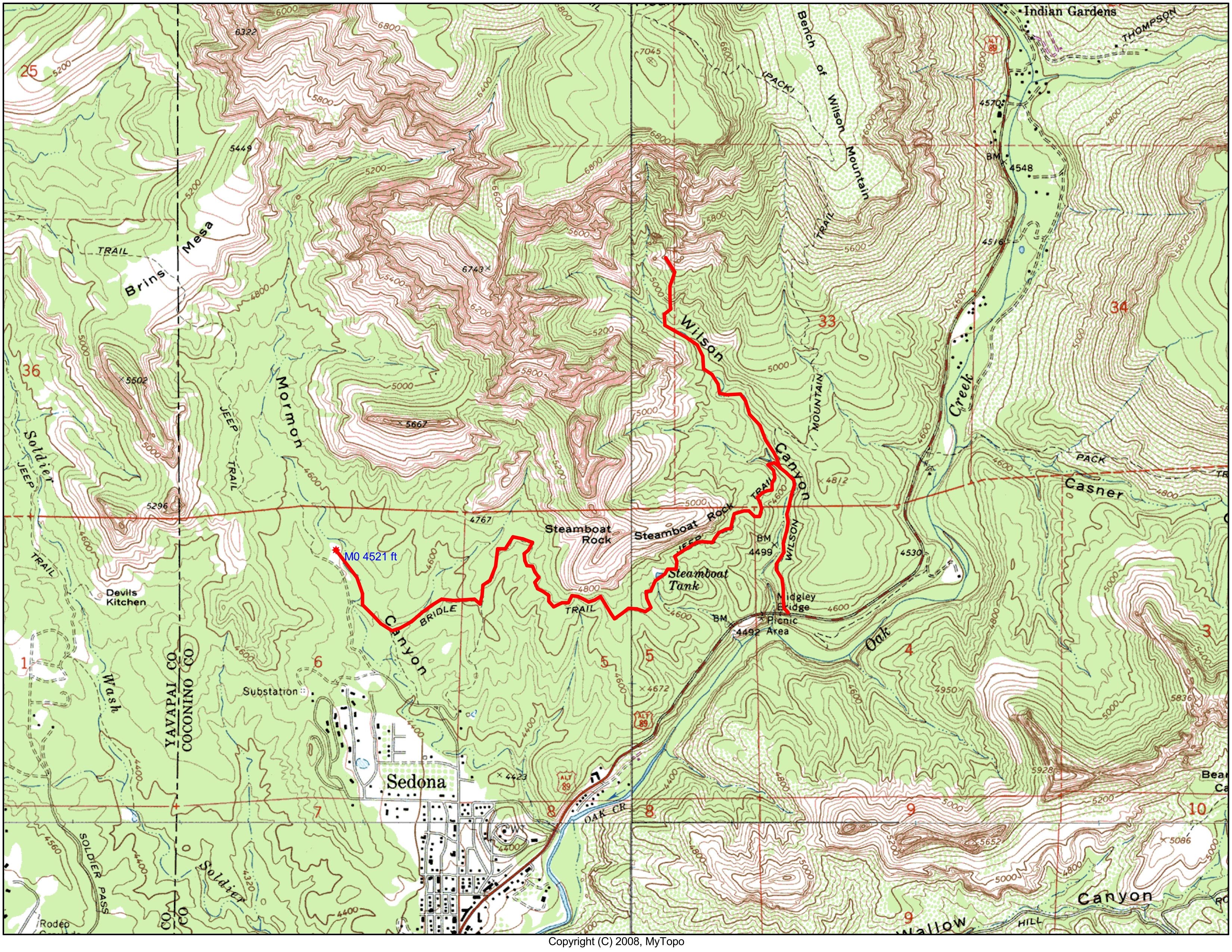
This map shows a shuttle hike that I did with Steve Maschue. We started at the Jim Thompson/Brins Mesa trailhead. The Jim Thompson trail follows a scenic traverse of Steamboat Rock before descending to the Wilson Canyon Trail. At the junction, we headed up Wilson Canyon as far as we could go before going back down Wilson Canyon and exiting at the Midgely Bridge.
Click on map to enlarge it, and then click on "original" size at the bottom. Map generated by MyTopo (Maptech) Terrain Navigator.
Photo 1 of 30, jim thompson_01.jpg, 286KB, 800x618, 24 Hits
Other Sizes: Small Medium Large X-Large XX-Large Original