Day 1: North Lake to Piute Lake
Loch Leven/Piute Lake
Day 2: Piute Lake to Upper Golden Trout Lake
Piute Pass
Desolation Lake / Humphries Basin/Muriel Lake
Golden Trout Lakes
Day 3: Golden Trout Lakes to San Joaquin Canyon
Piute Canyon
Day 4: San Joaquin Canyon to Sally Keyes Lakes
Climb out of San J. Canyon
Sally Keyes Lakes
Day 5: Sally Keyes Lakes to Sandpiper Lake
Heart Lake/Selden Pass/Marie Lake
Sandpiper Lake
Day 6: Sandpiper Lake Rest Day
Day trip to Seven Gables Ridge
Day 7: Sandpiper Lake to Vee Lake
Bear Creek/Vee Lake
Day 8: Vee Lake to Upper Pine Lake
Vee Lake/White Bear Lake
Italy Pass/Granite Park
Day 9: Upper Pine Lake to Pine Cr Trailhead
Tungsten Mine
Entering Seven Gables Basin
My first experiences in backpacking was in California's Sierra Nevada mountains in the 1960's and they have always exerted a strong pull on me. I had last been there in 1969, so it didn't take much to decide that our second out of state backpacking trip would be a trip back to California.
The Sierra's were a completely different type of terrain than we had been used to. Much of the trip was over 10000 feet elevation and above timberline. The trip also featured a lot of scrambling where trails were vague or non existent.
Troop 24 Adults: Bill Mooseker,Bill Peckinpaugh
Troop 24 Scouts: Brian "Buckwheat" Sisk, Jason Smith, Danny Stallings, Peter Goodwin, Roger Shively, Andrew Mooseker, Kyle Meissner, Austin Peckinpaugh
The descriptions under the photo thumbnails in the album sometimes contain links to maps or additional information. These are identified by "Blue” text for links.
I've revised this album recently. When I first uploaded this album back in late 1999, high speed internet was unheard of, so photo resolutions were pretty low in order to allow uploading at dial-up speeds. I've rescanned my photo negatives of this trip at the highest resolution available to me and replaced the old low resolution ones. I don't have access to the photos taken by Jason and Brian, so they remain at the low resolution, although I've run them through a noise filter so they look better when enlarged. I've also digitized the Hi-8 videos that I took on the trip and have added them to the album.
Troop 24 "The High Adventure Troop" Backpacking Trip
-Cascade Bill Mooseker
From Guestbook:
nice pics bill - its good to know someone's out there - cascade bill - taking it easy for all us sinners
- Danny Stallings, Wed, 25 Sep 2002 10:15PM
Date(s): August 1999. Album by Cascade Bill. Photos by BM,Jason,Brian. 1 - 305 of 305 Total. 3760 Visits.
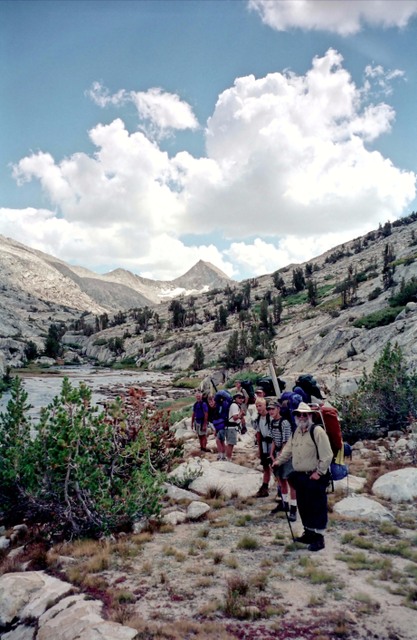
enlarge 335KB, 995x1024 1 picsnvids
To enlarge photos, click on the thumbnail - the photo will pop up enlarged. To view at Original size, just click on the enlarged photo, which will show the photo enlarged to fit the screen. Click on the screen to enlarge that portion of the photo at original resolution. Click again to reduce.
If you want to save photos to your computer, click the box under the thumbnails of all the photos you want to download. Then click the "Download" button at the top of the album. Pick the size you'd like to download (Original is best)and the photos will be downloaded as a zip file to the folder of your choice.
enlarge 313.56MB, 1024x682 Download MPEG4 2 1999 sierra d0 p1 roadtrip 1a.mp4 VIDEO - Click Photo to View.
It's a long boring two day drive from the Martha Lake Community Club to the start of our hike. Here is a sample of the first day on the way to Susanville, California in Jason's under-powered minivan.
enlarge 73.71MB, 1024x682 Download MPEG4 3 1999 sierra d0 p2 roadtrip 2.mp4 VIDEO - Click Photo to View.
On a long drive, what better way to pass the time than a reading from Shakespeare that morfs into the Big Lebowski!
enlarge 175.34MB, 1024x682 Download MPEG4 4 1999 sierra d0 p3 overheating blues 1.mp4 VIDEO - Click Photo to View.
Day 2 of the drive: we started our day in Susanville by having breakfast at the Black Bear Cafe (which has since gone out of business and is now the "Lumberjack" Cafe). I was about halfway through breakfast when I realized that a lot of the guys had bleached their hair overnight. Jason's minivan had a hard time with the climb up to our camp and they had to stop many times because of overheating, and they were mightily pissed off that we didn't stop for them.
enlarge 232KB, 1024x737 5 cal001 This coke's for you - Overheatin Blues Danny, Buckwheat, Andrew, and Peter.
enlarge 424KB, 1152x580 6 ca99d103 Route: Day 1 North Lake to Loch Leven, Including Brian's extra miles.
After the car shuttle, Brian was supposed to park the car in the North Lake Hikers lot (below "Borrow Pit" on the map) close to the trailhead, but instead he parked it at the bottom of the hill near the main road and had a lot of extra miles and climbing to do.
enlarge 451KB, 1152x580 7 ca99d110 Route: Day 1 & 2 Loch Leven to Piute Pass. Camp 1 at Piute Lake
enlarge 29.75MB, 1024x682 Download MPEG4 8 1999 sierra d1 p1.mp4 VIDEO - Click Photo to View. Taking a break on our way up the Piute Pass trail.
enlarge 353KB, 1024x667 9 99-324-017 Bill Peckinpaugh & Jason - Trail below Loch Leven
enlarge 273KB, 1024x721 10 cal003 Jason - Trail near Loch Leven
enlarge 314KB, 1024x670 11 99-324-018 Looking Back down valley towards North Lake
enlarge 126KB, 744x1024 12 ca99d107 Climbing up out of the forest, we get expansive views down Bishop Cr
Taking a break on trail below Loch Leven - Peter, Andrew, & Austin. Bill coming up the trail, last as usual.
enlarge 207KB, 1024x681 15 1999 pr001
Roger, Andrew, Peter, Kyle, & Danny at high point at outlet of Loch Leven.
enlarge 39.67MB, 1024x682 Download MPEG4 16 1999 sierra d1 p2 loch leven 1.mp4 VIDEO - Click Photo to View. Arriving at Loch Leven Lake
enlarge 392KB, 1024x668 17 99-324-019 Andrew, Peter & Danny - Loch Leven
enlarge 294KB, 1024x668 18 99-324-020 Gang at Loch Leven
enlarge 342KB, 1024x656 19 ca99d113.jpg Benchmark at Loch Leven 10743'
enlarge 243KB, 734x1024 20 cal005 Brian - Loch Leven
enlarge 35.45MB, 1024x682 Download MPEG4 21 1999 sierra d1 p3 loch leven 2.mp4 VIDEO - Click Photo to View. Bill Peckinpaugh tries his luck in Loch Leven - no strikes!
enlarge 19.30MB, 1024x682 Download MPEG4 22 1999 sierra d1 p4 loch leven 3.mp4 VIDEO - Click Photo to View. The card players who could be fishing.
enlarge 326KB, 1024x668 23 99-324-021 Piute Pass from Loch Leven
enlarge 324KB, 1024x683 24 99-324-022 Trail at Upper End of Loch Leven- Andrew going thru the trees.
enlarge 284KB, 1024x669 25 1999 pr002 Andrew, Kyle, Roger, Jason, and Austin at falls below Piute Lake
enlarge 246KB, 1024x739 26 ca99d118 1 View of falls below Piute Lake
enlarge 40.76MB, 1024x682 Download MPEG4 27 1999 sierra d1 p5 waterfalls.mp4 VIDEO - Click Photo to View.
Just before the last climb up to our campsite at Piute Lake, there was a bunch of waterfalls. Peter & Danny went over to check them out.
enlarge 231KB, 1024x752 28 ca99d121 Danny & Peter at falls above Loch Leven
enlarge 200KB, 1024x739 29 ca99d123 1
Looking Back towards Loch Leven & unnamed lake above it from climb up to Piute Lake.
enlarge 314KB, 685x1024 30 99-324-024
Card Players at camp at Piute Lake - Peak 12891 -Emerson Lake Basin above. Bill M., Bill P., and Jason hiked up to Emerson lake but had no luck fishing there. Day 1 hiking: 3.4 miles and 1690' of climb. A pretty easy day with the heaviest packs.
enlarge 152KB, 1024x742 31 ca99d125 1 Card Players go on into the night - its cold at 10960 feet.
enlarge 20.79MB, 1024x682 Download MPEG4 32 1999 sierra d2 p1 camp.mp4 VIDEO - Click Photo to View. Morning at our camp at Piute Lake
enlarge 243KB, 1024x753 34 ca99d201 1 Marten getting his breakfast (granola) at Piute Lake (Camp 1)
enlarge 451KB, 1152x580 35 ca99d110 Route: Day 1 & 2 Loch Leven to Piute Pass.
enlarge 248KB, 1024x748 36 ca99d205 View down Bishop Cr to Piute Lake and Loch Leven below
enlarge 342KB, 1024x801 37 ca99d204 1 Andrew arriving at Piute Pass -Piute Lake & Loch Leven down valley.
enlarge 198KB, 1024x645 38 1999 pr003
Looking down Bishop Cr Valley - Piute Lake and Loch Leven in the distance.
enlarge 27.36MB, 1024x682 Download MPEG4 39 1999 sierra d2 p2 piute pass.mp4 VIDEO - Click Photo to View. Bill M. arriving at Piute Pass
enlarge 169KB, 1024x662 40 1999 pr005 Break at Piute Pass: Peter, Bill P., Danny, Roger, and Jason.
enlarge 332KB, 1024x764 41 cal008 Benchmark at Piute Pass. 11409'
enlarge 366KB, 1024x771 42 ca99d207 1 Break at Piute Pass
enlarge 321KB, 761x1024 43 ca99d208 1 Looking south- start of Muriel Lake scramble trail.
enlarge 178KB, 1024x762 44 ca99d209 1 The two Bills at Piute Pass.
enlarge 272KB, 1024x770 45 ca99d210 1 Guys at Piute Pass: Peter, Kyle, Danny, Jason, Austin, Andrew Seated: Roger & Brian
enlarge 252KB, 1024x664 46 1999 pr004 Another view
enlarge 203KB, 1024x765 47 ca99d211 View from Piute Pass to the west - Summit Lake below
enlarge 420KB, 1152x652 48 ca99d203
Piute Lake to Upper Golden Trout Lake. Also shows Muriel Lake sidetrip (purple line) and start of Desolation Lake sidetrip (green line). Day 2 hiking for Muriel Lake Sidetrip: 4.3 miles and 2393' of climbing.
enlarge 502KB, 1024x768 49 ca99d212
Day 2: Sidetrip to Desolation Basin: Bill Peckinpaugh, Austin Peckinpaugh, Kyle Meissner, Roger Shively, Jason Smith, and Brian Sisk. Day 2 hiking: 8.7 miles and 3289' of climbing.
enlarge 204KB, 1024x759 50 cal011 Bill Fishing in Desolation Lake. (No Luck)
enlarge 174KB, 1024x772 51 ca99d214 1 Brian at Desolation Lake
enlarge 185KB, 1024x756 52 cal009 Jason at Desolation Lake
enlarge 186KB, 744x1024 53 ca99d216 1 Brian & Jason Below Mt Humphreys
enlarge 240KB, 1024x758 54 cal012 Jason and Brian - Mt. Humphries in background
enlarge 258KB, 769x1024 55 ca99d220 Marmot in Desolation Basin
enlarge 301KB, 1024x759 56 cal014 California Marmot
enlarge 182KB, 1024x773 57 ca99d221 1 Marmot
enlarge 267KB, 1024x782 58 ca99d219 I'm out a here!
enlarge 388KB, 1024x754 59 cal013 Jason catching some rays - Golden Trout Lakes in background
enlarge 260KB, 1024x760 60 ca99d222 I think this is Lower Desolation Lake
enlarge 253KB, 1024x767 61 ca99d224 Tents near Desolation Lake
enlarge 357KB, 1024x670 62 99-324-025 Andrew at Muriel Lake - Muriel Peak (12937) beyond.
enlarge 369KB, 1024x682 63 99-324-026 Nugee Blaster Rock - Muriel Lake
enlarge 512KB, 1024x670 64 99-324-027 Bill's Golden Trout from Muriel Lake.
enlarge 310KB, 1024x665 65 99-324-028 Leaving Muriel Lake -Andrew, Danny & Peter
enlarge 296KB, 1024x668 66 99-324-029
Pack Train Leaving Golden Trout Lakes area - Piute Pass at upper right. We were waiting for the guys to return from the Desolation Lake sidetrip. Peter, Andrew, and Danny.
enlarge 281KB, 1024x739 67 cal015
Our camp at Upper Golden Lake - note all the bear cannisters (1 per person)
enlarge 38.83MB, 1024x682 Download MPEG4 68 1999 sierra d2 p3 upper golden camp.mp4 VIDEO - Click Photo to View. Our camp at Upper Golden Trout Lake
enlarge 228KB, 1024x691 69 99-324-030 Sunset on Humphreys Peak- Camp 1 at Upper Golden Trout Lake
enlarge 255KB, 656x1024 70 99-324-031 Sunset - Upper Golden Trout Lake
enlarge 278KB, 1024x768 71 99-324-031a Close up of previous photo
enlarge 210KB, 1024x760 72 cal016 Alpenglow on Humphreys Peak
enlarge 318KB, 1024x662 73 99-324-032 Piute Canyon Trail near Golden Trout Lake
enlarge 249KB, 1024x756 74 cal018
Bill, Andrew, Bill P.,Kyle, Roger, Austin, Peter Danny (standing) Brian & Jason
enlarge 272KB, 1024x756 75 cal017 Another view
enlarge 41.45MB, 1024x682 Download MPEG4 76 1999 sierra d3 p1 hutchinson mdw.mp4 VIDEO - Click Photo to View.
Fishing in Puite Creek: We took a lunch break at Hutchinson Meadow about 4.5 miles from our camp at Upper Golden.
enlarge 227KB, 1024x766 82 ca99d305 Brian at Piute Cr Falls
enlarge 341KB, 1024x780 83 ca99d308 1 Roger & Kyle at Piute Cr Falls
enlarge 212KB, 745x1024 84 ca99d309 1 Peter - Break at Piute Cr. Falls
enlarge 301KB, 1152x674 85 1999 pr006 Austin, Bill P., Brian at Piute Cr Falls
enlarge 306KB, 1024x762 86 ca99d310 1 Austin, Bill, Brian
enlarge 323KB, 1024x772 87 cal021 Jason - view down Piute Canyon
enlarge 278KB, 1152x658 88 1999 pr007 Looking down at Piute Cr from falls
enlarge 251KB, 1024x659 89 99-324-033
The trail climbs over a shoulder to avoid a deep gorge at a bend in the creek. Note bluff at left as see in previous photo.
enlarge 361KB, 1024x669 90 99-324-034
Andrew- Looking back up Piute Canyon towards Hutchinson Meadow. Piute Cr Falls to Right.
enlarge 341KB, 1024x665 91 99-324-036 Bill at Overlook at Big Bend in Piute Canyon
enlarge 328KB, 673x1024 92 99-324-035 Another view
enlarge 336KB, 1024x764 93 ca99d319 Jason
enlarge 284KB, 1024x756 94 cal022 Jason in huge evergreen along trail
enlarge 258KB, 764x1024 95 cal023 Another view
enlarge 343KB, 1024x774 96 ca99d320
We hiked all the way down Piute Canyon to the junction with the John Muir Trail and the San Joaquin River shown here.
enlarge 309KB, 1024x754 97 cal026
San Joaquin River: We found a second rate campsite and doffed our packs to rest and look for a possible camp. While were were resting, two male campers came up from a camp directly below and rudely asked if we were staying there. If he had asked nicely, we would have told him that we were going to look for a camp but we replied that "we didn't know yet." We heard crashing and banging in their camp, and they soon passed by looking for another camp. I guess we threw cold water on their planned romantic interlude.
enlarge 355KB, 1024x729 98 99-324-037
Andrew and Roger going down the Big Water Slide at our camp on the San Joaquin R.
enlarge 245KB, 1024x687 99 1999 pr009 Peter going down Big Water Slide
enlarge 224.77MB, 1024x682 Download MPEG4 100 1999 sierra d3 p3 san joaquin water slide.mp4 VIDEO - Click Photo to View. Most fun ever on a backpacking trip: The Big Water Slide.
enlarge 274KB, 1024x756 101 cal025
Card game continues - note inventive use of bear canisters and Thermarest to make table.
enlarge 348KB, 1024x737 102 cal024
Camp 3 - Bill and Kyle getting supper ready (working on my one year old Dragonfly stove - due to a design flaw, deposits build up and the stove wouldn't work requiring a nightly clean up ritual.
enlarge 75.69MB, 1024x682 Download MPEG4 103 1999 sierra d3 p4 san joaquin camp.mp4 VIDEO - Click Photo to View.
Preparing supper at Camp 3. It was a long (9.9 miles) but not a hard day as our climb was only about 550' but the 3800' descent was hard on the feet.
enlarge 24.78MB, 1024x682 Download MPEG4 104 1999 sierra d3 p5 brian flyfishing.mp4 VIDEO - Click Photo to View. Brian trying his luck flyfishing in the San Joaquin river.
enlarge 292KB, 656x1024 106 ca99d401 Day 4
(best viewed at original size)
It was going to be another long but much harder day as we hiked about 8 miles and climbed about 2700'.
enlarge 271KB, 1024x763 107 cal027 Cascade Bill - Long hot climb out of San Joaquin Canyon
enlarge 4.74MB, 1024x682 Download MPEG4 108 1999 sierra d4 p1 breaktime.mp4 VIDEO - Click Photo to View. Very short video of Brian and Jason at overlook of San Joaquin valley.
enlarge 157KB, 1024x757 109 ca99d406 1 Bill Austin, & Brian - Overlook over San Joaquin Canyon
enlarge 258KB, 712x1024 110 1999 pr010 Austin at San Joaquin Canyon overlook
enlarge 237KB, 1024x739 111 cal029 Jason at overlook
enlarge 270KB, 1024x762 112 cal030 Break along trail near Sally Keyes Lakes - Climb out of San J. done
enlarge 284KB, 1024x764 113 cal031
Taking a break in the shade. It was along this stretch before the Sally Keyes Lakes that we met an unusual hiker that Bill Peckinpaugh dubbed, "Forest Gump". He looked and sounded like he had been on the trail much too long, but Hey!, this is California!
enlarge 246KB, 1024x760 114 cal033 View of the eastern Sally Keyes Lake from our camp
enlarge 345KB, 1024x670 115 99-325-002 Swimming at Sally Keyes Lakes - Camping here was very crowded.
enlarge 237KB, 1024x759 116 cal032
Camp at Sally Keyes Lakes. This was an "interesting" camp. One of the groups camped at the lake was a Sierra Club Singles group. I was headed out fishing behind Brian, when he suddenly came hurrying back. I continued on and found a couple of "singles" making out by the lake.
enlarge 268KB, 762x1024 117 cal034
Gang at S.K. Lake - Our sleep was interrupted by a donkey that had gotten loose, and was serenading us most of the night: HEEE HAWWW, HEEE HAWW! We kidded Roger that his "girl friend" was looking for him.
enlarge 324KB, 1024x687 118 1999 pr011 Another view
enlarge 355KB, 730x1024 119 ca99d517 Day 5
Another short day although about half of the day was a cross country scramble - 4 miles and about 1200' of climbing.
enlarge 237KB, 1024x730 120 cal035
Looking back towards S.K. Lakes from trail to Heart Lake. San J. Canyon in background
enlarge 241KB, 764x1024 121 cal036 Heart Lake looking towards Selden Pass.
enlarge 67.57MB, 1024x682 Download MPEG4 122 1999 sierra d5 p1 heart lake.mp4 VIDEO - Click Photo to View.
Taking a break at Heart Lake - "We're the Sequoia Club, a whole new outfit!"
enlarge 214KB, 699x1024 138 cal041 Jason - Selden Pass
enlarge 214KB, 1024x761 139 ca99d515 1 Austin, Bill, Brian
enlarge 280KB, 666x1024 140 99-325-005
Marie Lake from Selden Pass - while we were taking our break, two Hippie Hikers met up at the pass - "Superfly" and "The Green Lantern" (no, I'm not making that up). They exchanged an elaborate fist bump handshake and went on their way.
enlarge 70.94MB, 1024x682 Download MPEG4 141 1999 sierra d5 p4 marie lake from Selden pass.mp4 VIDEO - Click Photo to View. Looking north from Selden Pass towards Marie Lake
enlarge 195KB, 1024x752 142 ca99d514 Marie Lake - looking north from Selden Pass
enlarge 197KB, 793x1024 143 ca99d512 Brian's pack at Selden Pass
enlarge 310KB, 1024x661 144 99-325-003 Bill & Andrew - Marie Lake
enlarge 240KB, 1024x730 145 cal039 Jason - Marie Lake (looking north)
enlarge 273KB, 1024x666 146 99-325-004 Andrew - Marie Lake
enlarge 375KB, 1024x668 147 99-325-008 Going down switchbacks to Marie Lake
enlarge 502KB, 1024x676 148 99-325-010 Brian's brook trout - Marie Lake
enlarge 523KB, 1024x672 149 99-325-011 Bill's brook trout - Marie Lake
enlarge 281KB, 1024x665 150 99-325-012 Heading out from Marie Lake (hidden behind rock outcropping)
enlarge 296KB, 1024x687 151 99-325-014
Working our way around Marie Lake. Peaks west of Marie Lake - Mt Hooper at right. Note gathering storm clouds.
enlarge 238KB, 1024x757 152 ca99d529 1
Thunderstorm break above Marie Lake - we hunkered down and let the storm pass over us.
enlarge 315KB, 1024x669 153 99-325-013
While we were sitting there waiting out the storm, we saw a lightening strike across the way and a little later some smoke from a forest Fire- Marie Lake is to the left
enlarge 197KB, 1024x764 154 ca99d532.jpg Closeup of Forest Fire
enlarge 204KB, 1024x778 155 ca99d533
Another view of fire from our break point - now we are in sun as the storm has passed over us
enlarge 54.72MB, 1024x682 Download MPEG4 156 1999 sierra d5 p5 forest fire.mp4 VIDEO - Click Photo to View.
Showing the fire that was ignited by lightening as we were hunkered down.
enlarge 43.38MB, 1024x682 Download MPEG4 157 1999 sierra d5 p6 hailstorm.mp4 VIDEO - Click Photo to View.
Although it was sunny when we got to our camp at Sandpiper Lake, we had to scurry for cover as we were hit with a hailstorm.
enlarge 175.14MB, 1024x682 Download MPEG4 158 1999 sierra d5 p7 sandpiper lake.mp4 VIDEO - Click Photo to View.
Gumbo night - preparing dinner between thunderstorms. At about the 2 min mark you can see where Andrew and Kyle had pitched their tent. It was right in a drainage path where it flooded in a cloudburst and they had to move to a new spot.
enlarge 322KB, 1024x669 159 99-325-015 Camp at Sandpiper Lake
enlarge 304KB, 1024x667 160 99-325-016 Danny,Jason, Bill P., & Kyle at Sandpiper Lake camp
enlarge 289KB, 1024x731 161 cal043 Bill & Kyle - Sandpiper Lake Camp
enlarge 260KB, 1024x762 162 cal044
It was sunny when we set up our camp, but before long another thunderstorm passed by with a cloudburst.
enlarge 187KB, 1024x761 163 cal042
It was Gumbo and cheesecake night - Brian is porking out on the crust mix!
enlarge 113.81MB, 1024x682 Download MPEG4 164 1999 sierra d5 p8 sandpiper lake card game.mp4 VIDEO - Click Photo to View.
Evening in camp, dinner and dishes done. The card game continues - Danny, Bill P, Peter, and Jason with Brian kibitzing. Very peaceful and scenic camp. Note: at about 1:05 you can see Andrew & Kyle's tent at its new location.
enlarge 157KB, 762x1024 165 ca99d541 View of Sandpiper Lake from hill above our camp
enlarge 112KB, 1024x747 166 ca99d542
Sunset on Lou Beverly Lake from ridge above Sandpiper Lake. We would head out past this lake on our way out after our rest day.
enlarge 256KB, 750x1024 167 ca99d536 1
Peter - catching some rays at Sandpiper Lake rest day. The Sierra Club Singles group had also camped out at Sandpiper Lake, and before they left they came over and gave us a bag of crappy granola as a "reward" for being "good" boy scouts and not making too much noise.
enlarge 213KB, 1024x763 168 cal046
Jason - on eastern shore of Sandpiper Lake -camp is on far shore at right
enlarge 473KB, 1024x716 169 ca99d607
Bill P., Jason, and Brian's Dayhike to Seven Gables Ridge - following the green line around the eastern side of Sandpiper Lake and then up to the ridge following the red dashed line. The solid red line is my path as I fished the various lakes then followed the solid green line to Three Island lake and then returned the way I came except following the green line back to Sandpiper Lake.
enlarge 311KB, 1024x751 170 cal047 View of Medley Lakes Basin from day hike to 7 Gables Ridge
enlarge 225KB, 738x1024 171 cal048 Jason on Boulder - Day hike to Seven Gables Ridge
enlarge 347KB, 1024x764 172 cal050 Can you see it?
enlarge 244KB, 1024x765 173 ca99d606 ptarmigans along the way
enlarge 298KB, 753x1024 174 cal051 A typical Sierra Nevada tarn
enlarge 324KB, 1024x750 175 cal052
Break - looking toward 7 Gables Ridge - route follows canyon around to right
enlarge 243KB, 1024x741 176 cal053 Ice covered tarn near top of 7 Gables ridge
enlarge 284KB, 1024x750 177 cal056
View to east over 7 Gables basin to Feather Peak from top of 7 Gables ridge (El 12150)
enlarge 270KB, 1024x757 178 cal055
Brian, Bill, & Jason - view to south along 7 Gables ridge of knife edged massif.
enlarge 210KB, 1024x742 179 cal057 Jason - view of peaks at head of 7 Gables basin ( Peak 12441 at left)
enlarge 201KB, 1024x766 180 ca99d613 1 Brian and Bill - on top of Seven Gables ridge
enlarge 151KB, 1024x760 181 ca99d614 Brian & Bill P. - Feather Peak behind
enlarge 270KB, 761x1024 182 cal054 Peak 12441 to the right and Mt. Humphreys in the far distance
enlarge 182KB, 769x1024 183 ca99d616 1 Back down from day hike - view to west from small ice ringed tarn
enlarge 220KB, 1024x766 184 ca99d617 Close up of tarn
enlarge 317KB, 764x1024 185 cal058
Descending to two small lakes - you can see Mt Hooper to the left of center.
enlarge 202KB, 1024x767 186 ca99d620 1
Mt Hooper to left - Jason and Bill working their way down to the lower of the small lakes shown in the previous photo.
enlarge 202KB, 1024x758 187 ca99d621 1 Further down from ridge.
enlarge 305KB, 728x1024 188 cal059 Closer to Lakes in previous photos
enlarge 302KB, 1024x752 189 ca99d622 Small Pond along way.
enlarge 270KB, 1024x751 190 ca99d623 Small tarns on way down - Mt. Hooper peering above ridge at right
enlarge 456KB, 1024x704 191 ca99d705
Day 7: Sandpiper Lake to SF Bear Creek - the red dashed line shows our cross country route from Lou Beverly Lake to the E Fork Bear Cr trail.
enlarge 296KB, 1024x734 192 99-325-017 Day 7 - Trail below Sandpiper Lake looking north west
enlarge 277KB, 1024x764 193 ca99d702.jpg Blowup of previous picture
enlarge 300KB, 665x1024 194 99-325-018 Scrambling on "trail" up E. Fork Bear Creek Valley - Day 7
enlarge 303KB, 1024x876 195 ca99d704.jpg
enlarge 316KB, 1024x665 196 99-325-020 Pool in E.F. Bear Creek from our break spot
enlarge 291KB, 1024x753 197 ca99d709 1 View down E.F. Bear Cr. from break spot - about Elev 10300 ' +/- 100'
enlarge 311KB, 1024x666 198 1999 pr015 Looking down slide at E.F. Bear Cr - Andrew at left.
enlarge 236KB, 685x1024 199 1999 pr016
Big Slide above our break point - if you enlarge the photo you can barely make out Andrew at the top right side.
enlarge 376KB, 1024x663 200 99-325-019 Andrew - trying the big "slide" in East Fork Bear Cr
enlarge 353KB, 1024x665 201 99-325-021 Andrew terrorizing small golden trout in E.F. Bear Cr.
enlarge 192KB, 1024x755 202 ca99d711 Tired Feet
enlarge 245KB, 1024x765 203 ca99d710 Looking up E. Fork Bear Creek from above the "slide".
enlarge 313KB, 670x1024 204 99-325-023 Andrew on "trail" near break spot.
enlarge 280KB, 1024x662 205 99-325-024
Typical granite outcroppings traversed by "trail" - there were some cairns here to help
enlarge 240KB, 1024x768 206 99-325-024a Close up of previous photo
enlarge 257KB, 665x1024 207 99-325-025
View of minor Peak of 7 Gables at head of E.F. Bear Cr Valley - Danny, the Invisible Man.
enlarge 238KB, 1024x741 208 ca99d715 1
Andrew, Peter, Invisible Man Danny, & Kyle - Lunch break near "Big Bend" in E.F. Bear Cr canyon.
enlarge 178KB, 1024x756 210 ca99d717 Another view of the striking peak at the end of the Seven Gables ridge
enlarge 85.34MB, 1024x682 Download MPEG4 211 1999 sierra d6 p1 seven gables basin break.mp4 VIDEO - Click Photo to View. Taking a break along the E.F. Bear Cr trail.
enlarge 323KB, 682x1024 212 99-325-026 Lunch Break - at Big Bend in canyon - entrance to 7 Gables Basin
enlarge 290KB, 670x1024 213 99-325-028
The point group - Bill P. , Brian, & Jason . Vee Lake lies over ridge in center.
enlarge 476KB, 1024x715 214 ca99d719 Day 7: Upper SF Bear Cr to Vee Lake.
The trail peters out and we have to scramble up the ridge to Vee lake. The solid blue line is Brian's route up to a high point at sunset. Totals for day 7: 5.5 miles and 1700' of climb.
enlarge 276KB, 668x1024 215 99-325-027 Heading up into 7 Gables Basin - Looking south.
enlarge 360KB, 1024x791 216 99-325-027a Close up of previous photo
enlarge 300KB, 1152x714 217 1999 pr017 Seven Gables Valley
enlarge 246KB, 673x1024 218 99-325-029 Austin - Break climbing ridge near Vee Lake
enlarge 308KB, 667x1024 219 99-325-030 Bill
enlarge 180KB, 768x1024 220 ca99d728 Brian's pack & Bill M. at break below Seven Gables
enlarge 289KB, 1024x662 221 99-325-031
Looking back towards Big Bend in EF Bear Cr. - about 11100 ft elev. Kyle, Austin, Danny the Invisible Man, Roger & Peter
enlarge 49.10MB, 1024x682 Download MPEG4 222 1999 sierra d6 p2 on the way to Vee Lake.mp4 VIDEO - Click Photo to View. Taking a break about halfway up the ridge to Vee Lake.
enlarge 318KB, 667x1024 223 99-325-032
Andrew - northernmost peak in 7 Gables ridge in background. Stub Lake is at right side of photo.
enlarge 139KB, 1024x742 224 ca99d729 1 You got me! (Brian)
enlarge 221KB, 747x1024 225 ca99d731 1 View of 7 Gables Ridge from ridge below Vee lake
enlarge 149KB, 766x1024 226 ca99d732 1 Brian - near Vee Lake
enlarge 221KB, 691x1024 227 99-325-033 Jason and Brian climb to ridge above Vee Lake
enlarge 160KB, 1024x768 228 99-325-033a Close up of previous photo
enlarge 302KB, 1024x764 229 ca99d735 1
View of upper 7 Gables Basin and 7 Gables lakes from ridge above Vee Lake. Twin Peaks at right are the Gemini Peaks and the one to the left is our old friend, Peak 12441 from Jason, Bill, and Brian's day hike the previous day.
enlarge 124KB, 749x1024 230 ca99d736 1 Brian - view to west from ridge above Vee Lake
enlarge 117.96MB, 1024x682 Download MPEG4 231 1999 sierra d6 p3 Vee Lake.mp4 VIDEO - Click Photo to View.
Hiking up to Vee Lake. The video shows us hiking up along the lake, but we didn't find any suitable campsites so we had to return to the outlet.
enlarge 291KB, 1024x761 232 ca99d737 1
Appoaching Vee Lake along outlet stream - As Usual Bill M. is far in rear.
enlarge 249KB, 761x1024 233 ca99d733 1
View of 7 Gables Ridge - Dayhike from Sandpiper ended up near snowfield at upper right.
enlarge 224KB, 1024x746 234 ca99d734
Seven Gables Ridge - Close up of spot on Day 7 day hike where Bill P., Jason, and Brian ended up on the ridge.
enlarge 273KB, 700x1024 235 99-325-034
Thunder cloud beyond Feather Peak - Vee Lake in the foreground - dark shadows from the clouds above. A fisherman that was camped down in the Seven Gables basin came by after fishing some of the upper lakes. Talking with him was the first time I ever heard the expression, "It's all good".
enlarge 366KB, 677x1024 236 99-325-035 Danny & Peter take a chilly dip in Vee Lake
enlarge 307KB, 680x1024 237 99-326-002 Bill P. at Vee Lake
enlarge 242KB, 1024x721 238 99-325-037 Feather Peak - Vee Lake
enlarge 234KB, 1024x664 239 99-325-036 Sun on Feather Peak - Vee Lake
enlarge 257KB, 1024x670 240 99-326-003 Alpenglow on peaks east of Vee Lake
enlarge 244KB, 723x1024 241 99-326-004 Spectacular sunset views at Vee Lake
enlarge 184KB, 1024x718 242 99-326-006 Sunset - Vee Lake. Feather Peak at Center
enlarge 58.81MB, 1024x682 Download MPEG4 243 1999 sierra d6 p4 Vee Lake sunset.mp4 VIDEO - Click Photo to View.
Enjoying the sunset at Vee Lake. We see Brian climbing (or should I say running) up to the top of the ridge by the lake.
enlarge 162KB, 1024x764 244 ca99d745 1
Brian - self portrait at top of knob south of Vee Lake (Feather Peak in background) He did have his camera (see previous video)
enlarge 83KB, 1024x776 245 ca99d746 1 Sunset - nothernmost peak of 7 Gables ridge is at left.
enlarge 170KB, 714x1024 246 99-326-005 Sun is gone!
enlarge 223KB, 1024x677 247 1999 pr019 Danny & Roger
enlarge 284KB, 1024x767 248 99-326-007 The Card Game goes on - Vee lake (Austin, Danny, & Roger)
enlarge 198KB, 1024x796 249 ca99d752 1
No Tents Tonight - Peter at Vee Lake (Brrrr!) Danny starting his almost 5 year long string of tentless nights camped under the stars. The string ended in March 2004 after a cloudburst in Slickhorn Canyon, Utah
enlarge 372KB, 1152x693 250 ca99d801 Route Day 8: Vee Lake to Upper Pine Lake. (best viewed at original size)
A very long and hard day most above 11000'. It wasn't so much the miles (about 8) or the climb (about 1700') but most of it was a cross country scramble, some across snowfields and talus. When we did get to the trail (at 12400' Italy Pass) it was in bad shape and hard on the feet.
enlarge 337KB, 767x1024 251 99-326-008 Day 8: Cascade Bill - Scramble above Vee Lake
enlarge 317KB, 767x1024 252 99-326-009 Seven Gables Peak - ridge above Vee lake
enlarge 320KB, 1024x791 253 99-326-010a
Small tarn between Vee Lake and Little Bear Lake. Seven Gables peak in background
enlarge 273KB, 674x1024 254 99-326-011 Jason & Bill - Break between Big Bear and White Bear
enlarge 227KB, 1024x791 255 99-326-011a Close up of previous photo
enlarge 42.96MB, 1024x682 Download MPEG4 256 1999 sierra d7 p1 above Vee Lake.mp4 VIDEO - Click Photo to View. Taking a break above Vee Lake
enlarge 301KB, 750x1024 257 cal060 Jason's Pack
enlarge 70.94MB, 1024x682 Download MPEG4 258 1999 sierra d7 p2 break.mp4 VIDEO - Click Photo to View. Another break further up above Big Bear Lake
enlarge 194KB, 1024x683 259 1999 pr020 Gemini Peak at center
enlarge 266KB, 1024x665 260 99-326-013
Bill & Andrew -view of Gemini Peaks to Seven Gables Peak. Highpoint of Day 6 dayhike is on ridge between Andrew & Bill
enlarge 285KB, 1024x768 261 99-326-012a Andrew - Taking a break below White Bear Lake.
enlarge 65.68MB, 1024x682 Download MPEG4 262 1999 sierra d7 p3 white bear lake.mp4 VIDEO - Click Photo to View. Hiking up to and past White Bear Lake
enlarge 327KB, 671x1024 263 99-326-014
Break at White Bear Lake - Hell Hill in backgound. Yes we have to climb over it to Dancing Bear Pass.
enlarge 370KB, 1024x791 264 99-326-014a Close up of previous photo - note snowfields near top of pass.
enlarge 196KB, 1024x683 265 1999 pr021
White Bear Lake - our route is over the pass to the left between the two snowfields.
enlarge 271KB, 665x1024 266 99-326-015 Small tarn near White Bear Lake
enlarge 271KB, 675x1024 267 99-326-016 Climbing Hell Hill
enlarge 299KB, 1024x768 268 99-326-016a
Close up of previous photo - getting close to the snowfields from the previous photos
enlarge 280KB, 669x1024 269 99-326-019 Looking down on White Bear Lake
enlarge 294KB, 670x1024 270 99-326-017
The old man nearly dies on Hell Hill - White Bear Lk and Seven Gables in backgound
enlarge 302KB, 666x1024 271 99-326-018
Almost to the top of Hell Hill - Bill is above the snowfield noted previously.
enlarge 268KB, 669x1024 272 99-326-021 Andrew & Bill - top of Hell Hill
enlarge 328KB, 1024x791 273 99-326-021a
Andrew & Bill- White Bear Lake below and Seven Gables Peak to the right.
enlarge 309KB, 1024x663 274 99-326-020 Andrew from viewpoint on top of Hell Hill
enlarge 463KB, 1024x714 276 ca99d822 Scramble route from White Bear to Italy Pass to Granite Park
enlarge 46.28MB, 1024x682 Download MPEG4 277 1999 sierra d7 p4 on to Italy pass.mp4 VIDEO - Click Photo to View. On the way to Italy Pass via Dancing Bear Pass
enlarge 295KB, 1024x664 278 99-326-024
Route over Dancing Bear Pass is directly in line with 7 Gables peak over 1st snowfield then skirting 2nd snowfield on the right.
enlarge 311KB, 665x1024 279 99-326-023
View of route over snowfields between top of Dancing Bear Pass (the low point at left) & Italy Pass(looking west)
enlarge 253KB, 667x1024 280 99-326-022
Bill - Italy lake to right as storm clouds gather. (Jumble Lake is obscured by Bill)
enlarge 292KB, 764x1024 281 cal062 Jumble Lake from traverse to Italy pass
enlarge 275KB, 1024x741 282 cal063 1 View of Italy Pass (12400 ft elev) from scramble route
enlarge 341KB, 737x1024 283 cal064 Kyle and Bill- just below Italy Pass
enlarge 334KB, 1024x674 284 99-326-026 Bill (lower right) is almost to Italy Pass - Jumble lake in center
enlarge 194KB, 667x1024 285 99-326-027 Brian at Italy Pass
enlarge 149KB, 785x1024 286 ca99d828 1
Austin & Andrew -view down to Granite Park and Humphreys Peak far to southeast
enlarge 122KB, 1024x759 287 ca99d827 1 Roger - looking east from Italy Pass
enlarge 330KB, 1024x663 288 99-326-025 Another view of Granite Park from Italy Pass
enlarge 288KB, 1024x742 289 cal065 Granite Park
enlarge 510KB, 1024x715 290 ca99d831 End of Day 8 route - Lower Granite Park to our camp at Upper Pine Lake.
enlarge 257KB, 1024x760 291 ca99d834.jpg Another view of unusual banded rock formation near Honey Moon Lake
enlarge 293KB, 1024x764 292 cal066 Striking bands on peak along the way
enlarge 309KB, 670x1024 293 99-326-028 Honey Moon Lake
enlarge 488KB, 1152x622 294 ca99d901 Day 9 - Upper Pine Lake to Pine Cr. Trailhead.
Our last day on the trail - 4.7 miles and dropping 2900' on a miserable (as most of the Sierra trails) trail that had you walking over fist sized rocks all the way down. Roger and Peter volunteered to hike down with me, while the rest went hell bent for leather down the trail to get the long car shuttle done as quickly as possible.
enlarge 368KB, 663x1024 295 99-326-029 Falls on Pine Creek
Looking down Pine Cr Canyon - you can see the tailing ponds from the Pine Creek Tungsten Mine far below. California trails are different in many respects - at the end of the trail there was a sign, "Showers, 5 bucks". Peter took advantage.
enlarge 160KB, 1024x678 298 1999 pr023
Danny & Kyle and a bunch of packs were off loaded to the side of the road so that the car shuttle back up to North Lake could proceed without having Jason's van becoming overheated.
enlarge 175KB, 1024x651 299 1999 pr024
Familiar with this area from his youth, Bill Peckinpaugh took us to an irrigation ditch for the rest of us to wash up. Jason was a little unsure of this but he did go in at the end. We made it to Susanville for another motel night at the River Inn and breakfast at the Black Bear Diner before the long drive home.
enlarge 28KB, 791x1024 300 TRIP1 Roger austin kyle.pdf
PDF file showing mileages and elevations for Roger, Austin, and Kyle with daily summary for the miles hiked and elevation climbed and lost. Click on thumbnail and click on "Open this PDF" to view.
enlarge 27KB, 791x1024 301 TRIP2 andrew peter danny.pdf
PDF file showing mileages and elevations for Andrew, Peter, and Danny with daily summary for the miles hiked and elevation climbed and lost. Click on thumbnail and click on "Open this PDF" to view.
enlarge 29KB, 791x1024 302 TRIP3 Bill M.pdf
PDF file showing mileages and elevations for Bill M. with daily summary for the miles hiked and elevation climbed and lost. Click on thumbnail and click on "Open this PDF" to view.
enlarge 30KB, 791x1024 303 TRIP4 bill P.pdf
PDF file showing mileages and elevations for Bill P. with daily summary for the miles hiked and elevation climbed and lost. Click on thumbnail and click on "Open this PDF" to view.
enlarge 30KB, 791x1024 304 TRIP5 jason.pdf
PDF file showing mileages and elevations for Jason with daily summary for the miles hiked and elevation climbed and lost. Click on thumbnail and click on "Open this PDF" to view.
enlarge 32KB, 791x1024 305 TRIP6 brian.pdf
PDF file showing mileages and elevations for Brian with daily summary for the miles hiked and elevation climbed and lost. Click on thumbnail and click on "Open this PDF" to view.