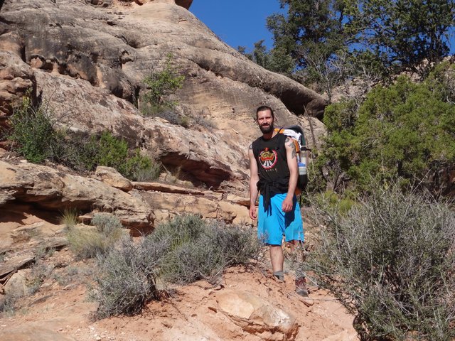
Nick M. Carrying the Old Man's Pack Up The Last Leg
Of Collins Canyon
On our last day, we broke camp very early and headed back up the Gulch a short ways to begin our climb out via Collins Canyon. The hike up Collins is very pleasant and scenic. Even though I was the first one out of camp the Nicks and the Stongs soon overtook me and left me in the dust. It didn't help that I made the wrong turn not once but twice as I mistakenly headed up a side canyon and then missed the trail around a pouroff.
Along with the scenery, the trip is memorable for an old (early 20th century) Cowboy camp above a massive pouroff that provides an interesting glimpse of the modern history of the canyon. The pouroff is skirted by a constructed cattle trail and signals that we are not far from the trailhead. At the top of the pouroff, the canyon walls no longer tower over you and you realize that your hike will soon be over.
It's a relief to change clothes and wash up at the trailhead. I even had a fairly cold diet coke in the cooler. After packing up all the gear we headed out for our long trip home. Our last scenic stop was to climb the "Salvation Knoll" which played a significant role in the historic Hole in the Rock pioneer expedition. Then it was on to Blanding, for our first non freeze dried food in 5 days.
Note photo takers are given in the titles under the thumbnails: Bill (bm), Mike (ms), Nick M. (nm), Nick T. (nt)
Kickass Trekkers on this trip were: Bill Mooseker, Will Stong, Mike Stong, Nick McMahan, Nick Tuggle
The descriptions under the photo thumbnails in the album sometimes contain links to maps or additional information. These are identified by "Blue” text for links. I've also inserted links to Google Maps to show where certain photos in the album were taken or to locate features shown in the photos. Click on the link, close the sidebar, and choose satellite view. Basically, you can then zoom in and out using the mouse wheel or drag the map by clicking and holding.
For panoramic photos, I would recommend clicking on the thumbnail photo to enlarge. View at original size for most detail. The thumbnails do not do justice to petroglyphs and pictographs, so I would recommend enlarging them as well. Please take the time to view the many videos to better experience what it was like to be there.
Troop 24 Kickass Trekkers Backpacking Trip
-Cascade Bill Mooseker
Date(s): May 26, 2017. Album by Cascade Bill. 1 - 69 of 69 Total. 291 Visits.
enlarge 335KB, 995x1024 1 picsnvids
To get the plugin just Google "videolan" or CLICK HERE FOR DOWNLOAD for Windows. There is a MAC version as well. Disable the Quicktime plugin if you use Videolan. To view fullscreen videos click the icon on the top right of the video when it starts playing.
If you want to save photos to your computer, click the box under the thumbnails of the photos you want to download. Then click the "Download" button at the top of the album. Pick the size you'd like to download (Original is best)and the photos will be downloaded to a folder of your choice.
enlarge 53.83MB, 1152x648 Download MPEG4 2 05-26 05-13 ms.mp4 VIDEO - Click Photo to View. We were up early before the sun hit our campsite. You can hear the Dragonfly stove as water is heating for our oatmeal and cocoa. The Nicks did not bother setting up their tent as you can see.
enlarge 64.03MB, 1152x648 Download MPEG4 3 05-26 05-52 bm.mp4 VIDEO - Click Photo to View. Breaking down camp for our hike out to the car. Nick M is pumping water - our good Pur Scout filter had clogged up so Nick is using the Pur/Katadyn Hiker backup filter.
enlarge 111KB, 1024x768 5 05-26 06-33-18 - bm DSC02023 Packs on - Sun is hitting the canyon rim above us.
enlarge 89KB, 768x1024 6 05-26 06-33-58 - bm DSC02024 A farewell look at the Narrow as we head out.
enlarge 140KB, 1024x768 7 05-26 06-50-50 - bm DSC02027 Heading up Collins Canyon - the guys had passed me by and were going full speed.
enlarge 155KB, 1024x768 8 05-26 07-00-14 - bm DSC02028 Looking back down canyon: Pretty section of slickrock in lower Collins Canyon.
enlarge 150KB, 1024x768 9 05-26 07-00-21 - bm DSC02030 Looking up canyon from previous spot - just before I went off track. Collins Canyon goes off to the left, but I went up the side canyon shown here to the right, missing a big cairn showing the right way.
enlarge 143KB, 1024x768 10 05-26 07-03-10 - bm DSC02031 Looking up the side canyon - this pool drew me in. I made it up to the base of the headland at center and was going to keep going, when I saw a tent that was occupied by a couple we had seen the previous day. The woman from Telluride told me that I was going the wrong way. I'm glad that she did as I would have continued on.
enlarge 125KB, 1024x768 11 05-26 07-04-20 - bm DSC02034 Looking back down the side canyon to Collins Canyon proper.
enlarge 209KB, 768x1024 13 05-26 07-05-53 - nt IMG 0182 Yucca about ready to bloom
enlarge 184KB, 1024x768 14 05-26 07-15-40 - bm DSC02035 About to go on my second wild goose chase of the day, I missed the trail that takes you around a big impassible pouroff which is just ahead.
enlarge 218KB, 1024x768 15 05-26 07-23-22 - bm DSC02036 After I hit the pouroff, I backtracked and found the bypass trail. This photo looks down into the pool below the pouroff. I was kicking myself as I had been up this canyon twice before and down it once as well. (the pouroff is located HERE)
enlarge 116KB, 1152x326 16 05-26 07-15-41 - nt IMG 0184 Meanwhile, the guys have reached the historic "Cowboy" camp shown in this panoramic photo. (view at xx-large or original size)
enlarge 67KB, 1152x213 17 05-26 07-16-05 - nt IMG 0189 Another panoramic view
enlarge 226KB, 1024x768 18 05-26 07-16-40 - nt IMG 0185 Collection of leftover cowboy trash.
enlarge 232KB, 1024x768 19 05-26 07-16-46 - nt IMG 0186 Another view.
enlarge 243KB, 1024x768 20 05-26 07-16-57 - nt IMG 0187 Close up.
enlarge 129KB, 1024x768 21 05-26 07-17-05 - bm DSC02052 Rock with cowboy signatures.
enlarge 204KB, 1024x768 28 05-26 07-20-34 - nt IMG 0195 Utensils and bones strung up on rack.
enlarge 219KB, 1024x768 29 05-26 07-20-57 - nt IMG 0196 Cowboy larder dug into ground.
enlarge 152KB, 1024x768 30 05-26 07-21-02 - bm DSC02055 Inside view of larder showing a can of Columbine evaporated milk which was produced in the 1940's and 1950's.
enlarge 113KB, 1024x768 31 05-26 07-21-40 - bm DSC02054 Other side of larder showing a SEGO evaporated milk carton which was produced until the plant closed in 1957.
enlarge 137KB, 1024x768 35 05-26 07-44-39 - bm DSC02041 Flower along the way quite possibly or closely related to the Sonoran Beardtongue (aptly named).
enlarge 107KB, 1024x768 36 05-26 07-45-50 - bm DSC02042 Very nice hiking - I think that this was taken looking up canyon from HERE.
enlarge 292KB, 1024x768 38 05-26 07-59-05 - bm DSC02045 Nick M came back to carry my pack the rest of the way. This is the start of the constructed cattle trail that goes around the huge pouroff near the end of Collins Canyon.
enlarge 168KB, 1024x768 39 05-26 07-59-22 - bm DSC02046 Looking down canyon from start of cattle trail located HERE
enlarge 155KB, 1024x768 40 05-26 08-01-01 - bm DSC02047 Heading up the trail - the pouroff is to the right. If you enlarge the photo to original size you can see Nick M sprinting ahead with my pack.
enlarge 214KB, 1024x768 42 05-26 08-08-06 - nm Image1 Bill at the cowboy camp.
enlarge 138KB, 1024x768 43 05-26 08-22-23 - bm DSC02056 Almost to the top - this gate prevents cattle on free range atop the mesa from going down into the Gulch as they did in the past.
enlarge 102KB, 1152x284 44 05-26 08-09-36 - nt IMG 0198 Panoramic view of Collins Canyon from the canyon rim (best viewed enlarged or original size)
enlarge 93.46MB, 1152x648 Download MPEG4 45 05-26 08-37a ms.mp4 VIDEO - Click Photo to View. Bill tells about his wild goose chase up the wrong canyon.
enlarge 175.20MB, 1152x648 Download MPEG4 46 05-26 08-45 ms.mp4 VIDEO - Click Photo to View. Packing up for our return to the NW. Mike looks at the map and points out the route of our hike, and a last look at Collins Canyon.
enlarge 157KB, 1024x768 47 05-26 08-56-10 - ms DSCF5014 Getting the gear ready to go back into the Subaru.
enlarge 122KB, 1024x768 48 05-26 08-58-19 - ms DSCF5016 What are the odds that the only two cars at the trailhead are both red Subarus.
enlarge 163KB, 1024x768 49 05-26 08-58-46 - ms DSCF5017 Separating out the troop gear from the personal gear.
enlarge 220KB, 1024x768 50 05-26 08-59-16 - ms DSCF5022 Collins Canyon - you can see the trail in the foreground.
enlarge 195KB, 1024x768 51 05-26 08-59-52 - ms DSCF5018 Trailhead map and registration box.
enlarge 103KB, 1024x768 52 05-26 09-01-29 - ms DSCF5025 Mike pointing to the Gov't Trailhead where we entered. We had a much shorter trip this time due to the water and heat condtions.
enlarge 102KB, 1024x768 53 05-26 09-01-33 - ms DSCF5026 Mike pointing out Collins Canyon trailhead.
enlarge 135KB, 1024x768 54 05-26 09-19-23 - ms DSCF5028 Most of the gear is in.
enlarge 134KB, 1024x768 55 05-26 09-21-03 - ms DSCF5029 Nick M, Nick T, Bill, and Will -ready to roll.
enlarge 132KB, 1024x768 56 05-26 09-30-11 - ms DSCF5032 Fab 4 plus Mike this time.
enlarge 135KB, 1152x648 57 05-26 09-42-44 - nt IMG 0200 Heading out on the Collins Canyon access road.
enlarge 128KB, 1152x648 58 05-26 09-42-51 - nt IMG 0202 Another shot on the way out.
enlarge 128KB, 1152x648 59 05-26 09-43-55 - nt IMG 0203 Over some slickrock - In 2006, I had to have all my passengers get out and walk through here as the Corolla was dragging bottom.
enlarge 121KB, 1152x648 61 05-26 09-49-09 - nt IMG 0206 Smooth sailing again
enlarge 177KB, 1024x768 62 05-26 10-26-38 - ms DSCF5033 On the way back, we stopped off to hike up to Salvation Knoll, a historic moment in the epic pioneer trek of the Hole in the Rock Expedition when all hope was gone.
enlarge 174KB, 1024x768 63 05-26 10-26-50 - ms DSCF5035 Enlarge photo to read the story of Salvation Knoll. On our drive from Collins Trailhead to the Gov't Trail, Mike had discussed with the driver about the Hole In the Rock expedition. Our shuttle driver had told us about the trail to the top of Salvation Knoll and where to find the TURNOUT on Hwy 95.
enlarge 49KB, 1152x183 64 05-26 10-31-32 - nt IMG 0210 Panoramic view from the top of Salvation Knoll. Hwy 95 eastbound is at the left and westbound at the right. (best viewed at original size)
enlarge 53KB, 1152x190 65 05-26 10-32-31 - nt IMG 0208 Panoramic view from the top of Salvation Knoll. (best viewed at original size)
enlarge 145KB, 1024x768 66 05-26 10-32-58 - ms DSCF5036 Informational sign at top of Salvation Knoll.
enlarge 122KB, 1024x768 67 05-26 10-33-02 - ms DSCF5037 View from top of Salvation Knoll - after this side trip, we said our goodbyes to Cedar Mesa and started our long journey back to Washington. We stopped at the Homestead Steakhouse in Blanding for a meal that wasn't freeze dried. The restaurant was crowed with Native American families, who had apparently just attended an elementary/middle school graduation as the kids were all dressed in full ceremonial regalia (quite impressive). We spent our first night in Logan, UT where we stopped and had supper with Mike's daughter, Madison. The next day we rode with Mike to Kennewick, where the Nicks and I transferred to the Gray Ghost and continued on to Lynnwood.
enlarge 93KB, 1024x768 68 06-02 15-47-46 - bm DSC02058 After the trip home I took the filter out of the Pur Scout. This is what it looked like compared to a brand new filter. Makes you wonder what your insides look like after spending a week there.
enlarge 189KB, 1152x643 69 the end-2400px.png CLICK HERE for Previous Album(Day 4) CLICK HERE Back to Grand Gulch 2017 Folder