Pyramid Mountain
Glacier Peak Wilderness
Labor Day Weekend - 2013
Danny, Shelby, & Meghan
Sandblaster High Route
This was my sixth trip to Pyramid Mountain. It is one of my favorite trails, starting high with views as you traverse high ridges. We had good weather and as usual, Shelby came up with something new for this trip (See photos).
I had originally planned to do a somewhat reverse trip of what we did in 1998 (CLICK HERE) but we opted to not follow the trail over to the North Fork of the Entiat valley, but instead come out via the South Pyramid Creek Trail.
The descriptions under the photo thumbnails in the album sometimes contain links to maps or additional information. These are identified by "Blue” text.
Troop 24 "Kickass Trekkers" Backpacking Trip
-Cascade Bill Mooseker
Date(s): 08/31/13-09/02/13. Album by Cascade Bill. 1 - 32 of 32 Total. 937 Visits.
To get the plugin just Google "videolan" or CLICK HERE FOR DOWNLOAD for Windows. There is a MAC version as well. Disable the Quicktime plugin if you use Videolan.
If you want to save photos to your computer, click the box under the thumbnails of the photos you want to download. Then click the "Download" button at the top of the album. Pick the size you'd like to download (Original is best)and the photos will be downloaded to a folder of your choice.
enlarge 245KB, 800x600 2 pyr2013-001
Shelby passed me just a little ways from the trailhead. This view is looking northerly with Silver Ridge to the left. If you look closely you can see the trail as it traverses the slope to cross Silver Ridge.
enlarge 192KB, 800x600 3 pyr2013-002
Photo from the point that the trail crosses to the other side of Silver Ridge looking back towards the the trailhead parking area. Big Hill is the bump in the middle of the photo. If you enlarge the photo you can see Shelby's red truck parked in the trailhead.
I was surprised that there was only one other car parked at the trailhead (a couple of day hikers) on Labor Day Weekend. We left the Gray Ghost at the N. Fork of the Entiat trailhead where we would end our trip. The NF trailhead parking lot was pretty full.
enlarge 187KB, 800x600 4 pyr2013-003
Zoomed view looking back. This part of the trail was hit by a big forest fire in 1970. The area past the trailhead below Big Hill shows evidence of another fire several years ago. On my first trip along this trail (1982) the fire damage from the 1970 fire was very apparent.
enlarge 255KB, 800x600 5 pyr2013-004
On the west side of Silver Ridge we get our first view of Glacier Peak.
enlarge 182KB, 800x600 6 pyr2013-005
The trail traverses from Silver Ridge to Pope Ridge below peak 7035and then descends to a saddle overlooking Corral Creek to the east. Lake Chelan is not visible from the saddle.
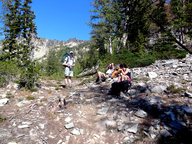
enlarge 155KB, 800x600 7 pyr2013-006 The trail at the saddle between Pope Ridge and Crow Hill (shown here).
enlarge 169KB, 800x600 8 pyr2013-007
As the trail traverses Crow Hill, the views are spectacular. Here we see Pyramid Mountain to the right and Cardinal Peak to the left.
enlarge 209KB, 800x600 9 pyr2013-008
A view of the trail along Crow Hill, looking towards Pyramid Mtn. Unfortunately, it isn't long until the trail drops down steeply about 600 feet to the junction with the Butte Cr Trail (you have to look for it as it is not obvious) on a saddle between the Butte Cr and Sheep Cr drainages.
As we took our break at the saddle we encountered a bow hunter coming in for the weekend. This would make a total of 3 people we saw on Saturday of the Labor Day weekend.
The trail takes a more easterly turn and drops another 200 feet or so as we circle around the Butte Cr Basin. It then climbs slowly to a small creek and small meadows (the first water and possible camp - the bow hunter was going to camp here).
enlarge 147KB, 800x600 10 pyr2013-009 Another view from Crow Hill, looking across the valley to Duncan Hill.
enlarge 220KB, 800x600 11 pyr2013-010
The trail climbs steeply out of Butte Cr Basin and onto the western slopes of Graham Mountain, then becomes less steep as it traverses.
After regaining the 800 feet we dropped from the high point on Crow Hill, the trail drops gradually to this saddle where you get a peekaboo view of Lake Chelan.
enlarge 162KB, 800x600 12 pyr2013-011
As you can see, the shadows are lengthening as the sun is sinking. Fortunately, "No Bastard" camp is less than half a mile away.
enlarge 180KB, 800x600 13 pyr2013-012
Shelby roasting 5 game hens on a battery (4 D cells) powered rotisserie he brought along (as well as the game hens).
enlarge 74.47MB, 900x506 Download MPEG4 14 pyr13-01a.mp4 VIDEO - Click Photo to View. Shelby roasting his game hens.
enlarge 312KB, 800x600 15 pyr2013-014 Danny and Shelby leaving "No Bastard" Camp.
enlarge 328KB, 800x600 16 pyr2013-015 Click this Link to see how "No Bastard" camp got its name.
enlarge 331KB, 800x600 17 pyr2013-016
After leaving camp the trail gradually climbs through alternating stretches of forest and meadows.
enlarge 304KB, 800x600 18 pyr2013-019
A little over a half a mile from camp we come to the junction with the Pyramid Lookout trail.
enlarge 356KB, 800x600 19 pyr2013-017
Danny and Meghan at the beginning of the Lookout trail.
enlarge 313KB, 800x600 20 pyr2013-018
Shelby at the Lookout trail junction. From here the lookout trail contours through forest and passes a meadow with camping (Elev 6750) before beginning the long climb to the summit of Pyramid (Elev 8243).
enlarge 207KB, 800x600 21 pyr2013-020
Since I had been to the top of Pyramid 5 times ('82, '87, '93, '95, & '98), I decided that I would call take a break at the first big switchback (Elev 7700) and wait for the others to make their way back down. As I waited I was passed by 3 mountain bikers and a pair of hikers on their way up. When Shelby, Danny, and Meghan were back, we took a break for lunch.
After lunch we backtracked down the trail and headed out on an abandoned sheepherder's trail to the meadows below Grouse Pass. The start of the vague tread is the "Sandblaster". If you enlarge this photo to "Original Size", you will see Shelby at the top of the "Sandblaster" with Danny and Meghan just behind. As usual, I'm way in the rear.
enlarge 255KB, 800x600 22 pyr2013-021
The top of the Sandblaster. If you enlarge the photo, you can make out the vague tread. The others had already made their way down past the borders of the photo.
enlarge 309KB, 800x600 23 pyr2013-022
The old tread heads down through forest and is pretty easy to follow, except for one stretch among a bunch of big boulders.
You think you should go down but actually you go up a ways and pick up the tread again.
The tread leads to a shoulder above one of the meadows under peak 8189. If you look close there are cairns that lead you to the meadow and then up over a small ridge that bisects the two meadows.
enlarge 327KB, 800x600 24 pyr2013-023
Taking a break at the ridge. Peak 8189 beyond.
enlarge 296KB, 800x600 25 pyr2013-024
From the previous spot, a photo looking back towards the "Sandblaster". If you enlarge the photo to "Original Size" you can see the tread of the old trail (not the steeper game track cutting down the slope). This is a zoomed view.
enlarge 264KB, 800x600 26 pyr2013-025 A non telephoto view of the "Sandblaster".
enlarge 45.12MB, 900x506 Download MPEG4 27 pyr13-02b.mp4 VIDEO - Click Photo to View. Heading down towards the first meadow below peak 8189.
enlarge 209KB, 800x600 28 pyr2013-026
Our original plan was to bushwack our way to Grouse Pass and then continue on the Pyramid Trail to Fox Camp (Click Here for Link).
However, when we went over the saddle between the two meadows, we found a nice camp with water nearby. We decided to camp there instead of humping over Grouse Pass (the section of trail between Grouse Pass and Fox Camp being my least favorite section of the Pyramid Mtn trail).
enlarge 190KB, 800x600 29 pyr2013-027
Shadows falling at our camp. Peak 8189 is in the background.
So we had a restful afternoon in a very scenic spot. I did have a little difficulty getting water as the creek was very shallow and you couldn't dip it without getting a lot of dirt and scum. I dredged out a hole and waited for the muddy water to clear before filling our jugs.
enlarge 162.20MB, 900x506 Download MPEG4 30 pyr13-03a.mp4 VIDEO - Click Photo to View.
Shelby set up his rotisserie again to cook a grouse he had shot. It was the toughest bird I had ever tasted, having the consistency (and flavor) of an old boot.
Note: Although the fire danger was extreme in the valley bottoms, campfires were still allowed in the high country as the soil still had a lot of moisture.
enlarge 308KB, 800x600 31 pyr2013-028 Shelby and Danny - Breakfast at camp.
enlarge 223KB, 800x600 32 pyr2013-029
We followed the cairns down until they finally petered out, but we just kept bearing SW through fairly open forest (Here we are coming upon a meadow along the way) till we hit the Pyramid Mtn Trail between Buck Camp and Grouse Pass.
Buck Camp was full with a horse party. From there on we finally saw the Labor Day crowds. We followed the trail down the junction with the SF Pyramid Cr Trail and took it out to the NF Entiat trailhead.
A couple of day hikers came in and parked as we were packing up the Gray Ghost and shared a watermelon with us, which was a great treat after a long dusty valley pound.