mt05-097a-map3
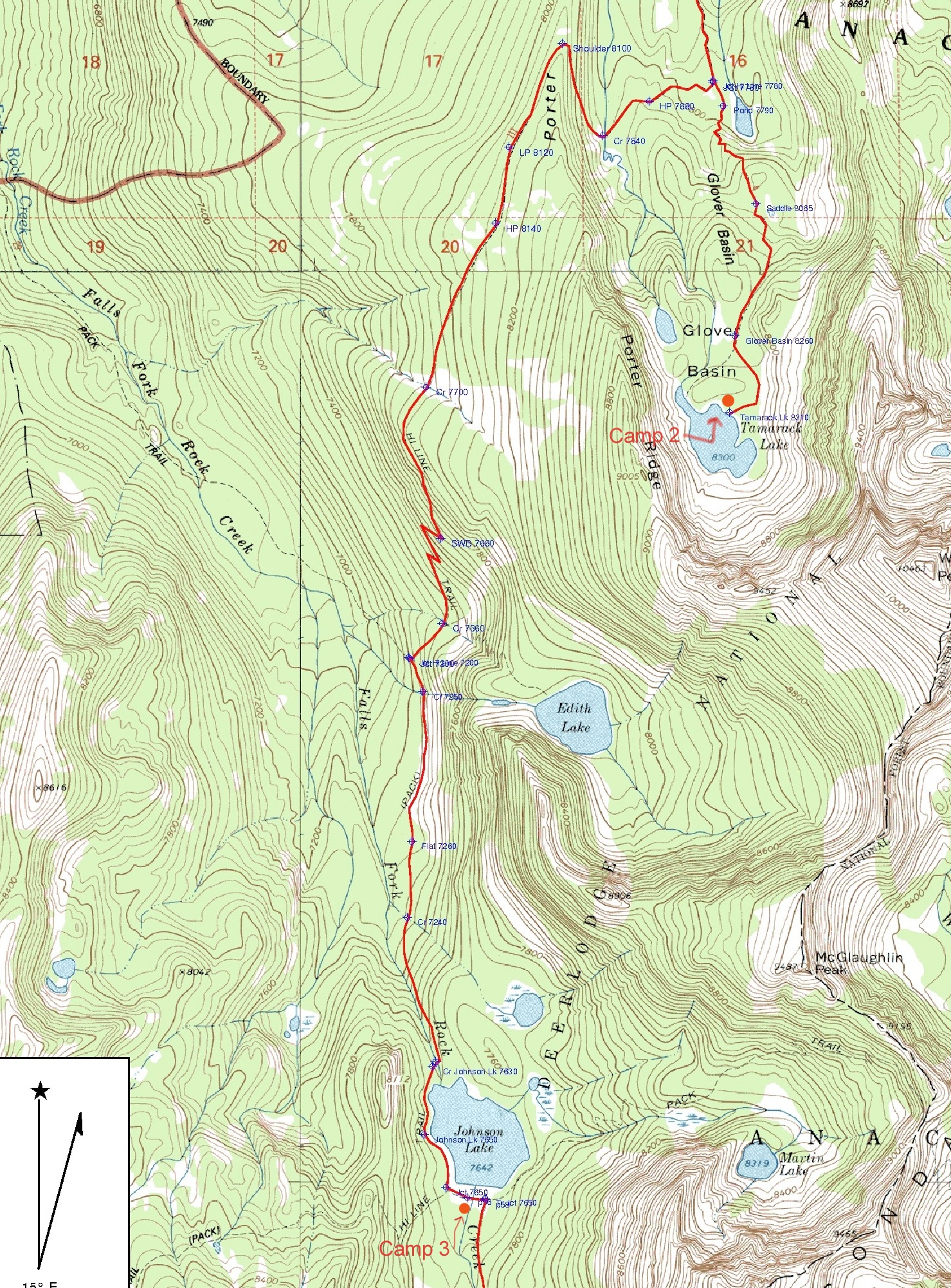
Map for Day 3: Tamarack Lake to Johnson Lake. From Tamarack Lake we retrace our route from Day 2 down to the Hiline Trail where we head west over a small hill and then down to cross the creek coming down from Glover Basin (Tamarack Lake). After crossing the creek, the trail climbs steeply up to cross Porter Ridge (2 mi and 400' elev gain) from Tamarack Lk. After crossing the ridgeline, the trail trends up for a while before trending down for a long traverse through trees, meadows and a talus slope. Reaching another ridge, the trail heads down into the Falls Fork of Rock Creek drainage passing the trail to Edith Lake (not as shown on topo but much higher up) before seriously switchbacking down to meet the Falls Fork Trail to Johnson Lake (4.4 mi from Tamarack Lake). Note map best viewed at "Original Size".
Photo 81 of 113, mt05-097a-map3.jpg, 176KB, 591x800, 55 Hits
Other Sizes: Small Medium Large X-Large XX-Large Original