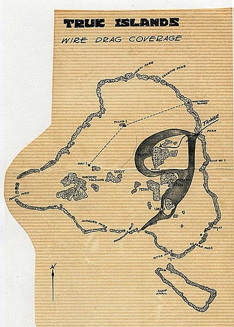
Truk island mapping
A map of the Drag Sweep around Truk Island. We were using metal detectors and precision sonar to detect the remains of sunken Japaneses ships in and around the harbor.. for mapping and salvage purposes.
Full EXIF / IPTC
Photo 37 of 296, Truk isl-w.jpg, 0KB, x0, 0 Hits
Other Sizes: Original Medium